Koulikoro, Ivory Coast
Koulikoro
Kouroukoro | |
|---|---|
Village | |
 Koulikoro Location in Ivory Coast | |
| Coordinates: 7°49′N 7°10′W / 7.817°N 7.167°W | |
| Country | |
| District | Montagnes |
| Region | Tonkpi |
| Department | Biankouma |
| Sub-prefecture | Gbonné |
| Time zone | UTC+0 (GMT) |
Koulikoro (also spelled Kouroukoro) is a village in western Ivory Coast. It is in the sub-prefecture of Gbonné, Biankouma Department, Tonkpi Region, Montagnes District. The area are dominated by rainforest.
History[]
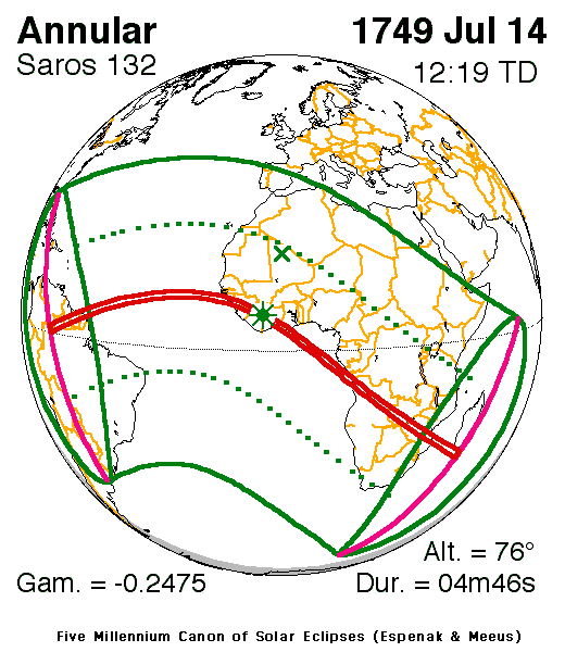
On July 14, 1749, an annular solar eclipse took place, 2 km west, the center of the greatest eclipse took place, it included the area and lasted 4 min 46 sec at 12:19 UTC.[1]
Koulikoro was a commune until March 2012, when it became one of 1126 communes nationwide that were abolished.[2]
Notes[]
- ^ "Solar eclipse of July 14, 1749". NASA. Retrieved March 20, 2017.
- ^ "Le gouvernement ivoirien supprime 1126 communes, et maintient 197 pour renforcer sa politique de décentralisation en cours", news.abidjan.net, 7 March 2012.
| Authority control |
|
|---|
Coordinates: 7°49′N 7°10′W / 7.817°N 7.167°W
This Montagnes District location article is a stub. You can help Wikipedia by . |
Categories:
- Former communes of Ivory Coast
- Populated places in Montagnes District
- Populated places in Tonkpi
- Montagnes District geography stubs