Kraków Voivodeship (1919–1939)
| Kraków Voivodeship Województwo krakowskie | |||||||||||
|---|---|---|---|---|---|---|---|---|---|---|---|
| Voivodeship of Poland | |||||||||||
| 1920–1939 | |||||||||||
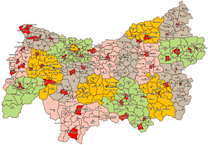
 Location of the Kraków Voivodeship (red) within the Second Polish Republic, 1938. | |||||||||||
| Capital | Kraków | ||||||||||
| Area | |||||||||||
• 1921 | 17,448 km2 (6,737 sq mi) | ||||||||||
• 1939 | 17,560 km2 (6,780 sq mi) | ||||||||||
| Population | |||||||||||
• 1921 | 1992810 | ||||||||||
• 1931 | 2300100 | ||||||||||
| History | |||||||||||
| Government | |||||||||||
| • Type | Voivodeship | ||||||||||
| Voivode | |||||||||||
• 1921–1923 | Kazimierz Junosza-Gałecki | ||||||||||
• 1937–1939 | Józef Tymiński | ||||||||||
| History | |||||||||||
• Established | 23 December 1920 | ||||||||||
| September 1939 | |||||||||||
| Political subdivisions | 18 powiats | ||||||||||
| |||||||||||

Kraków Voivodeship (Polish: województwo krakowskie) was a unit of administrative division and local government in Poland in years 1919–1939. Back then, it covered a big chunk of the southern part of the country, including such cities as Kraków, Jaworzno and Tarnów. Capital city: Kraków.
Location and area[]
In early 1939, Voivodeship's area was 17 560 square kilometers. It was located in southern Poland, bordering Autonomous Silesian Voivodeship to the west, Kielce Voivodeship to the north, Lublin Voivodeship, Lwów Voivodeship to the east and Slovakia to the south. Landscape was hilly in the northern part and mountainous in south, with the Tatra Mountains located in the very south of the area. Forests covered 20.9%, with the national average 22.2% (as for January 1, 1937).
Population[]
According to the 1931 Polish census, the population was 2 300 100, with approximately 25% living in towns and cities. Poles were 91.3% of the population, Jews were 5.6%, and Ukrainians were 2.5%. The Jews preferred to live in the cities and towns; in 1931 they made 19.2% of Voivodeship's city inhabitants. Illiteracy (in 1931) was 13.7%, lower than the national average of 23.1%. In early 1939, population density of the province was 130 people per sq. kilometer, which was much higher than Poland's average of 83.
Industry[]
Kraków Voivodeship was very divided in industrial terms. Its western part, with such cities as Jaworzno, Chrzanów or Trzebinia, was to a large degree industrialized and urbanized, with some coalmines. Also Kraków and Tarnów were big industrial centers. Eastern part, on the other hand, was backward, with little industry and underdeveloped agriculture. In mid-1930s Polish government started a huge public works program, called Centralny Okręg Przemysłowy (COP), which was a great boost to overpopulated and poor central and eastern counties.
The province was unofficially divided into three regions: southern (tourist), western (industrial), and eastern, with its developing industry of the COP. In 1938, the voivodeship was visited by 217,000 tourists. In early 1939, local government began a program of creation of three model tourist villages: Sol in Zywiec County, Tymbark in Limanowa County, and Szymbark in Gorlice County. Furthermore, regulation of the Vistula began in 1938, with levees built along its shores. The road connecting Kraków with Zakopane was to be completed by the end of 1939, after which funds were to be assigned to modernization of the main road from Kraków to Lwow. Due to the outbreak of World War II, none of the projects were finished.
Cities and administrative divisions[]
In 1938, it consisted of 18 powiats (counties). These were as follows:
- Biala Krakowska county (area 635 km², population 139 100),
- Bochnia county (area 877 km², population 113 800),
- Brzesko county (area 849 km², population 102 200),
- Chrzanów county (area 722 km², population 138 100),
- Dąbrowa Tarnowska county (area 650 km², population 66 700),
- Dębica county (area 1 141 km², population 110 900),
- Gorlice county (area 1 082 km², population 104 800),
- Jasło county (area 1 055 km², population 116 100),
- city of Kraków county (powiat krakowski grodzki), (area 48 km², population 219 300),
- Kraków county (area 884 km², population 187 500),
- Limanowa county (area 944 km², population 87 300),
- Mielec county (area 901 km², population 77 500),
- Myślenice county (area 988 km², population 102 700),
- Nowy Sącz county (area 1 572 km², population 183 900),
- Nowy Targ county (area 2 069 km², population 131 800),
- Tarnów county (area 881 km², population 142 400),
- Wadowice county (area 1 109 km², population 145 100),
- Żywiec county (area 1 337 km², population 130 900).
According to the 1931 census, biggest cities within the Voivodeship's boundaries were:
- Kraków (pop. 219 300),
- Tarnów (pop. 44 900),
- Nowy Sącz (pop. 30 300),
- Biala Krakowska (pop. 22 700),
- Jaworzno (pop. 19 100),
- Chrzanów (pop. 17 900),
- Zakopane (pop. 16 300),
- Bochnia (pop. 12 100),
- Oświęcim (pop. 12 000).
Voivodes[]
- 1 September 1921 – 19 December 1923
- 6 November 1923 – 16 November 1923 (acting)
- 16 November 1923 – 7 July 1926 (acting till 19 December 1923 or 8 March 1924 ?)
- 1 July 1926 – 31 December 1928
- 1 January 1929 – 25 June 1935
- Władysław Raczkiewicz 10 August 1935 – 13 October 1935
- Kazimierz Świtalski 3 December 1935 – 20 April 1936
- 22 April 1936 – 8 September 1937
- 9 September 1937 – September 1939
See also[]
- Poland's current Lesser Poland Voivodeship
References[]
- Maly rocznik statystyczny 1939, Nakladem Glownego Urzedu Statystycznego, Warszawa 1939 (Concise Statistical Year-Book of Poland, Warsaw 1939).

Coordinates: 50°03′41″N 19°56′18″E / 50.061389°N 19.938333°E

- States and territories established in 1920
- States and territories disestablished in 1939
- Kraków Voivodeship (1919–1939)
- Former voivodeships of the Second Polish Republic
- History of Lesser Poland Voivodeship
- History of Podkarpackie Voivodeship