Krakolye
Krakolye
Краколье | |
|---|---|
Village (abolished) | |
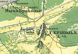 Map. 1860 year | |
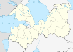
Location of Krakolye  | |
 Krakolye Location of Krakolye | |
| Coordinates: 59°39′N 28°17′E / 59.650°N 28.283°ECoordinates: 59°39′N 28°17′E / 59.650°N 28.283°E | |
| Country | Russia |
| Federal subject | Leningrad Oblast |
| Administrative district | Kingiseppsky District |
| Selsoviet | |
| First mentioned | 1654 |
| Abolished | October 24, 2008[1] |
| Elevation | 13 m (43 ft) |
| Population | |
| • Estimate (2007)[2] | 110 |


A church in Krakolye in 1943
Krakolye (Russian: Кракóлье; Votic: Jõgõperä; Finnish: Joenperä; Ingrian: Joemperä) was a rural locality (a village) in of Kingiseppsky District in Leningrad Oblast, Russia, located just south of Ust-Luga and about 8 kilometers (5.0 mi) southwest of the Ust-Luga Harbour. It is now a part of the settlement of Ust-Luga.[1] Population: 110 (2007 est.).[2]
History[]
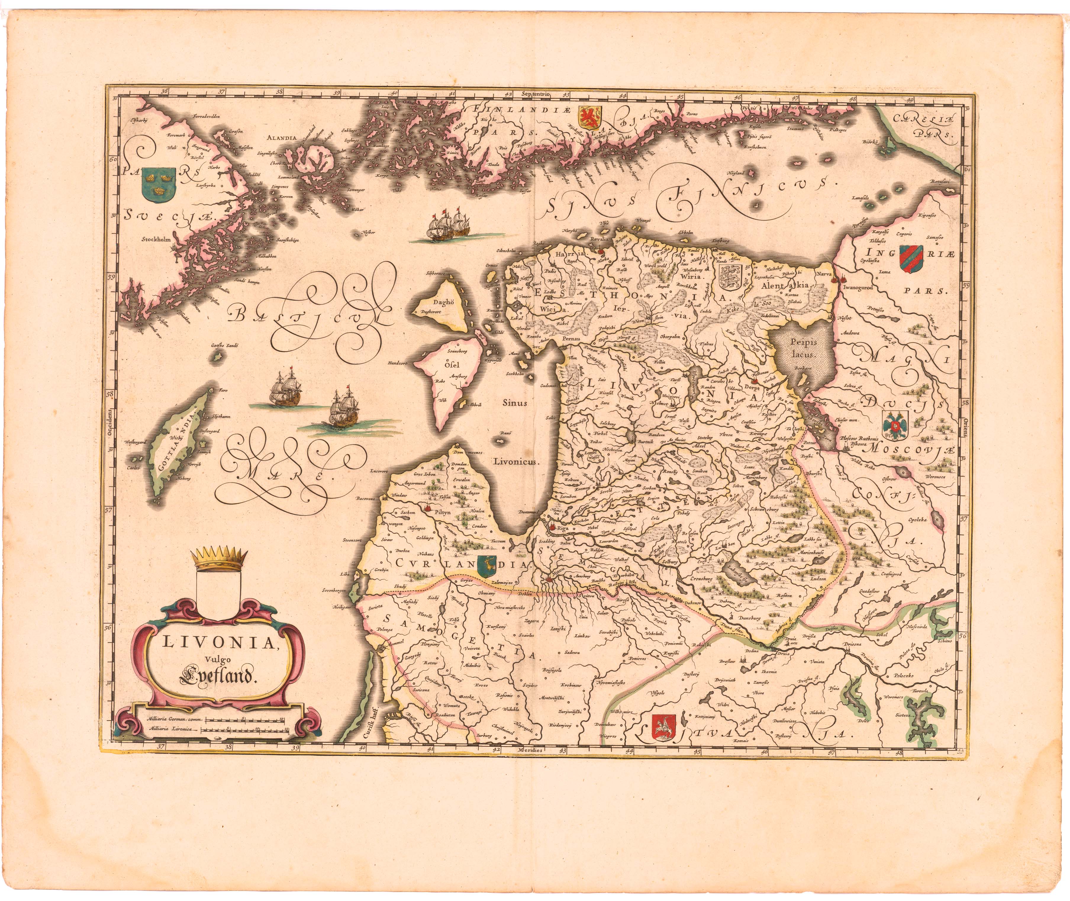
Krakolye was first mentioned in the Joan Blaeu's Livonian Atlas in 1654 as Kargalse.[3] It was one of the two villages where the Votic language was still spoken; the other was Luzhitsy in the Leningrad Oblast.
The village was merged into Ust-Luga effective October 24, 2008.[1]
Notable people[]
Votic teacher and linguist Dmitri Tsvetkov (1890–1930) was born in Krakolye.
References[]
- ^ a b c Законодательное Собрание Ленинградской области. Областной закон №98-оз от 13 октября 2008 г. «Об объединении посёлка Усть-Луга, деревни Краколье и посёлка при железнодорожной станции Усть-Луга Кингисеппского муниципального района Ленинградской области». Вступил в силу со дня официального опубликования. Опубликован: "Вести", №203, 24 октября 2008 г. (Legislative Assembly of Leningrad Oblast. Oblast Law #98-oz of October 13, 2008 On the Merger of the Settlement of Ust-Luga, the Village of Krakolye, and the Settlement at the Railway Station of Ust-Luga in Kingiseppsky Municipal District of Leningrad Oblst. Effective as of the day of the official publication.).
- ^ a b "Административно-территориальное деление Ленинградской области". — СПб., 2007, с. 97.
- ^ Карта Ливонии из большого атласа Блау. 1654 г.
Categories:
- Geography of Leningrad Oblast
- Kingiseppsky District