Krewerd
Krewerd | |
|---|---|
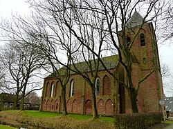 Maria Church in Krewerd | |
 Krewerd Location in the province of Groningen in the Netherlands | |
| Coordinates: 53°21′14″N 6°50′56″E / 53.35389°N 6.84889°ECoordinates: 53°21′14″N 6°50′56″E / 53.35389°N 6.84889°E | |
| Country | Netherlands |
| Province | Groningen |
| Municipality | Eemsdelta |
| Area (2012)[1] | |
| • Total | 37 ha (91 acres) |
| • Land | 36 ha (89 acres) |
| • Water | 0 ha (0 acres) |
| Population (2017)[1] | |
| • Total | 85 |
| • Density | 230/km2 (590/sq mi) |
| Time zone | UTC+1 (CET) |
| • Summer (DST) | UTC+2 (CEST) |
| Postal code | 9904 PA – 9904 PG[2] |
| Area code(s) | 0596[3] |

Krewerd (Dutch pronunciation: [ˈkreːʋərt]; Gronings: Kraiwerd) is a village with a population of around 85[1] in the municipality of Eemsdelta in the province of Groningen in the Netherlands. The medieval village church houses a gothic organ from 1531, which is still largely in its original state.
Geography[]
Krewerd is located at 53°21′14″N 6°50′56″E / 53.35389°N 6.84889°E in the municipality of the Delfzijl in the north of the province of the Groningen in the northeast of the Netherlands.
Krewerd lies directly northwest of Delfzijl and about 24 km northeast of the city of Groningen.
References[]
- ^ Jump up to: a b c (in Dutch) "Kerncijfers wijken en buurten 2017. Retrieved on 2 December 2017.
- ^ (in Dutch) Zoekresultaten, Postcode.nl. Retrieved on 12 April 2015.
- ^ (in Dutch) Netnummer 0596 Krewerd, Netnummer.info. Retrieved on 12 April 2015.
External links[]
 Media related to Krewerd at Wikimedia Commons
| Authority control |
|
|---|
This Groningen location article is a stub. You can help Wikipedia by . |
Categories:
- Populated places in Groningen (province)
- Eemsdelta
- Groningen (province) geography stubs