Krommenie
Krommenie | |
|---|---|
  | |
 Coat of arms | |
 | |
 The statistical district of Krommenie in the municipality of Zaanstad. | |
| Country | Netherlands |
| Province | North Holland |
| Municipality | Zaanstad |
| Area | |
| • Total | 540 ha (1,330 acres) |
| Population | 17,410 |
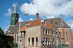
Coordinates: 52°30′N 4°46′E / 52.500°N 4.767°E Krommenie (Dutch pronunciation: [ˌkrɔməˈni]) is a town in the Dutch province of North Holland. It is a part of the municipality of Zaanstad, and lies about 15 km northeast of Haarlem.

Krommenie was a separate municipality until 1974, when the new municipality of Zaanstad was created.[1]
The statistical district "Krommenie", which covers the village and the surrounding countryside, has a population of around 17,410.[2]
Krommenie is the first city in the world to have a solar bikepath (SolaRoad), a path made of a transparent surface over solar cells to generate electricity fed back to the grid. The path, over 70 meters long, was to test engineering feasibility.
Train services[]
The town is served by Krommenie-Assendelft railway station. From here there are 4 trains an hour to Amsterdam in one direction and Uitgeest – Alkmaar in the other, with a journey time of 25 minutes.
See also[]
- SolaRoad
- Smart highways
References[]
- ^ Ad van der Meer and Onno Boonstra, Repertorium van Nederlandse gemeenten, KNAW, 2011.
- ^ Statistics Netherlands (CBS), Statline: Kerncijfers wijken en buurten 2003-2005 "Archived copy". Archived from the original on April 27, 1999. Retrieved July 24, 2006.CS1 maint: archived copy as title (link). As of 1 January 2005.
External links[]
- J. Kuyper, Gemeente Atlas van Nederland, 1865-1870, "Krommenie". Map of the former municipality, around 1868.
| Authority control |
|
|---|
This North Holland location article is a stub. You can help Wikipedia by . |
- Zaanstad
- Former municipalities of North Holland
- Populated places in North Holland
- North Holland geography stubs