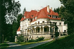
Kunerad
Kunerad | |
|---|---|
Municipality | |
 | |
 Kunerad Location of Kunerad in Slovakia | |
| Coordinates: 49°05′57″N 18°42′38″E / 49.09917°N 18.71056°ECoordinates: 49°05′57″N 18°42′38″E / 49.09917°N 18.71056°E | |
| Country | Slovakia |
| Region | Žilina |
| District | Žilina |
| Area | |
| • Total | 22.94 km2 (8.86 sq mi) |
| Elevation | 494 m (1,621 ft) |
| Population | |
| • Total | 931 |
| • Density | 41/km2 (110/sq mi) |
| Postal code | 013 13 |
| Area code(s) | +421-41 |
| Car plate | ZA |
| Website | www.obeckunerad.sk |

Kunerad is a village and municipality in Žilina District in the Žilina Region of northern Slovakia.
History[]
In historical records the village was first mentioned in 1490.
Geography[]
The municipality lies at an altitude of 494 metres and covers an area of 22.937 km². It has a population of about 931 people.
External links[]
| Authority control: National libraries |
|---|
This Žilina Region geography article is a stub. You can help Wikipedia by . |
Categories:
- Villages and municipalities in Žilina District
- Žilina Region geography stubs