Kuruman
Kuruman | |
|---|---|
 The Eye | |
 Kuruman | |
| Coordinates: 27°27′S 23°26′E / 27.450°S 23.433°ECoordinates: 27°27′S 23°26′E / 27.450°S 23.433°E | |
| Country | South Africa |
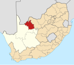
| Province | Northern Cape |
| District | John Taolo Gaetsewe |
| Municipality | Ga-Segonyana |
| Established | 1887[1] |
| Area | |
| • Total | 93.39 km2 (36.06 sq mi) |
| Population (2011)[2] | |
| • Total | 13,057 |
| • Density | 140/km2 (360/sq mi) |
| Racial makeup (2011) | |
| • Black African | 23.5% |
| • Coloured | 43.7% |
| • Indian/Asian | 1.3% |
| • White | 30.3% |
| • Other | 1.2% |
| First languages (2011) | |
| • Afrikaans | 76.9% |
| • Tswana | 14.9% |
| • English | 4.0% |
| • Other | 4.2% |
| Time zone | UTC+2 (SAST) |
| Postal code (street) | 8460 |
| PO box | 8460 |
| Area code | 053 |


Kuruman is a town with just over 13,000 inhabitants in the Northern Cape province of South Africa. It is known for its scenic beauty and the Eye of Kuruman, a geological feature that brings water from deep underground. The abundance of water produces an unexpected swathe of green amidst the barren plains and is known as the Oasis of the Kalahari.[3] It was at first a mission station of the London Missionary Society founded by Robert Moffat in 1821.[4] It was also the place where David Livingstone arrived for his first position as a missionary in 1841. The Kuruman River, which is dry except for flash floods after heavy rain, is named after the town.

Origins[]
Kuruman is regarded as the “Oasis of the Kalahari”. It is set out on the and receives its water source from a spring called “The Eye” which rises in a cave in the semidesert thornveld area in the Kalahari region. Kuruman is the main town in the area and the spring gives about 20 to 30 million litres of water daily to approximately 10 000 inhabitants. It is also known as “Die Oog” or “Gasegonyane” in the Kalahari region.[5]
The name Kuruman is derived from the Chief who lived in the area, named Kudumane. Robert Moffat, a missionary from the London Missionary Society, also lived there from 1820 to 1870. Moffat helped build the famous Moffat Church which was completed in 1838 and is still used for regular church services. While living in Kuruman, Moffat translated the bible into the Tswana language: this was the first bible in an indigenous southern African language.[5][6]
Location and climate[]
Kuruman is situated on the main route between Gauteng and Namibia/Cape Town via Upington. The route is growing in popularity because of its beautiful nature and various tourist attractions.[5] Kuruman lies virtually on the edge of the Kalahari at the foot of a range of low hills. [7] How ever it has relatively mild weather patterns compared to other Northern Cape towns, such as Upington and Springbok, and is surrounded by more vegetation if compared to Upington and Springbok, which are mostly semi-arid to desert environments.
Economy[]
Mining and agriculture (cattle and game) support Kuruman's thriving economy. Minerals mined in Kuruman include Manganese, Iron Ore, Tiger's eye and Crocidolite. The richest deposits of Crocidolite in the world are found in the Kuruman district.[5]
Demographics[]
According to the 2001 census, Kuruman had a population of 9,824, of which 4,267 (43.4%) were Coloured, 3,549 (36.1%) were White and 1,969 (20.0%) were Black. The most spoken language at home was Afrikaans with a percentage of 80.68%, followed by Tswana language with 14.8%. Males make up 50.58% of the population and females, 49.42%.[8]
Attractions[]
The Eye of Kuruman[]
This is a natural fountain delivering approximately 20 to 30 million litres (4,400,000 to 6,600,000 imp gal; 5,300,000 to 7,900,000 US gal) of crystal clear water daily which supplies domestic water, feeds the Kuruman River and spills more water into two irrigation canals which are 7 kilometres (4.3 mi) in length. The Eye was claimed to have been discovered in 1801 and this led to the establishment of the mission station in the early 19th century. The Eye then came to be described as "The fountain of Christianity". It is the biggest natural fountain in the Southern Hemisphere. In the early years, Tswana people called this fountain Gasegonyane which means "small water calabash with bubbling water".[9]
Other attractions[]
- Billy Duvenhage Nature Reserve
- Raptor Route
- Moffat Mission
- Truce Tree which dates back to the 1914 Rebellion
- Tswalu Kalahari Reserve – the country’s largest privately owned game reserve
- Bird Sanctuary – wetland area with grass, reeds and trees. There are about 115 species of birds.
- Northern Cape's only Instrumentation Engineering company, Mdux Instrumentation and Control System
- Wonderwerk Cave
- Kuruman Hiking Trail
- Kgalagadi Transfrontier Park – where one can experience mine excursions[5]
- Boesmansgat/Sinkhole situated at Mount Carmel Farm. This cave is acclaimed the sixth deepest submerged cave in the world – also known as a sinkhole[10]
- The Kalahari Meerkat Project, made famous by the television series Meerkat Manor, is located nearby, in the Kuruman River Reserve.[11]
- Kuruman was home to well-known local author and Sanusi/Zulu traditional healer, Credo Mutwa.
See also[]
- European exploration of Africa
- List of returned Peace Corps Volunteers
References[]
- ^ Raper, R.E. (1987). Dictionary of Southern African Place Names. HSRC. p. 265.
- ^ Jump up to: a b c d "Main Place Kuruman". Census 2011. Archived from the original on 2013-09-27. Retrieved 2019-03-24.
- ^ "South Africa Accommodation | Game Lodges & Parks and National Parks". www.places.co.za. Retrieved 2020-10-28.
- ^ Chisholm, Hugh, ed. (1911). . Encyclopædia Britannica. 15 (11th ed.). Cambridge University Press.
- ^ Jump up to: a b c d e "Kuruman – Oasis of the Kalahari". SA Places. SA Places. Retrieved 6 January 2018.
- ^ South African History Online (16 March 2011). "Kuruman Missionary Robert Moffat is born". South African History Online. SAHO. Retrieved 6 January 2018.
- ^ "South Africa Accommodation, Hotels and Travel". www.sa-venues.com. Retrieved 2020-10-28.
- ^ "Main Place 'Kuruman Part 2'". Census 2001. Retrieved 10 January 2012.
- ^ "The eye of Kuruman". Experience Northern Cape. Retrieved 6 January 2018.
- ^ "Boesmansgat - Sinkhole". SA Venues. SA Venues. Retrieved 6 January 2018.
- ^ "Meerkat Research". kalahariresearchcentre.org.
External links[]
| Wikimedia Commons has media related to Kuruman. |
- Visit Kuruman Travel Guide and Accommodation in Kuruman
- Kuruman on the Northern Cape Tourism Authority website
| hide Municipalities and communities of John Taolo Gaetsewe District Municipality, Northern Cape | ||
|---|---|---|
District seat: Kuruman | ||
| Joe Morolong |
|  |
| Ga-Segonyana |
| |
| Gamagara |
| |
- Populated places in the Ga-Segonyana Local Municipality
- Populated places established in 1887