Kwa Ibo River
| Kwa Ilbo River | |
|---|---|
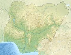 Location of mouth | |
| Location | |
| Country | Nigeria |
| State | Abia State |
| Physical characteristics | |
| Mouth | |
• coordinates | 4°32′27″N 7°59′19″E / 4.54083°N 7.98861°ECoordinates: 4°32′27″N 7°59′19″E / 4.54083°N 7.98861°E |
| Basin features | |
| Progression | Atlantic Ocean |

The Kwa Ibo River (also Quaibo River) is a river that rises near Umuahia in Abia State, Nigeria, and flows in a southeastern direction through Akwa Ibom State to the Atlantic Ocean.
The river feeds a zone of mangrove swamps linked by creeks and lagoons that is separated from the sea by a low and narrow ridge of sand.[1] Ibeno, on the eastern side of the Kwa Ibo River about 3 kilometres (2 mi) from the river mouth, is one of the largest fishing settlements on the Nigerian coast.[2]
References[]
- ^ "KWA IBO RIVER". Marine World Database. Archived from the original on 2011-09-13. Retrieved 2011-09-09.
- ^ "DESCRIPTION OF FISHERIES", Marine fishery resources of Nigeria: A review of exploited fish stocks..., Fisheries and Aquaculture Department, retrieved 2011-09-09
This Abia state, Nigeria location article is a stub. You can help Wikipedia by . |
Categories:
- Abia State
- Rivers of Nigeria
- South East Nigeria geography stubs
- Abia State stubs
- Africa river stubs
- Nigeria geography stubs