La Pouëze
La Pouëze | |
|---|---|
Part of Erdre-en-Anjou | |
 | |
show Location of La Pouëze | |
 La Pouëze | |
| Coordinates: 47°33′13″N 0°48′30″W / 47.5536°N 0.8083°WCoordinates: 47°33′13″N 0°48′30″W / 47.5536°N 0.8083°W | |
| Country | France |
| Region | Pays de la Loire |
| Department | Maine-et-Loire |
| Arrondissement | Segré |
| Canton | Chalonnes-sur-Loire |
| Commune | Erdre-en-Anjou |
| Area 1 | 22.15 km2 (8.55 sq mi) |
| Population (2017)[1] | 1,996 |
| • Density | 90/km2 (230/sq mi) |
| Demonym(s) | Pouëzéen, Pouëzéenne |
| Time zone | UTC+01:00 (CET) |
| • Summer (DST) | UTC+02:00 (CEST) |
| Postal code | 49370 |
| Elevation | 51–97 m (167–318 ft) (avg. 70 m or 230 ft) |
| 1 French Land Register data, which excludes lakes, ponds, glaciers > 1 km2 (0.386 sq mi or 247 acres) and river estuaries. | |


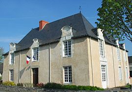
La Pouëze (French pronunciation: [la pwɛz] (![]() listen)) is a former commune in the Maine-et-Loire department in western France. On 28 December 2015, it was merged into the new commune Erdre-en-Anjou.[2]
listen)) is a former commune in the Maine-et-Loire department in western France. On 28 December 2015, it was merged into the new commune Erdre-en-Anjou.[2]
See also[]
- Communes of the Maine-et-Loire department
References[]
- ^ Téléchargement du fichier d'ensemble des populations légales en 2017, INSEE
- ^ Arrêté préfectoral 23 December 2015 (in French)
| Wikimedia Commons has media related to La Pouëze. |
This Maine-et-Loire geographical article is a stub. You can help Wikipedia by . |
Categories:
- Former communes of Maine-et-Loire
- Maine-et-Loire geography stubs