La Trimouille
La Trimouille | |
|---|---|
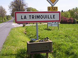 Entering La Trimouille on the D727 road | |
 Coat of arms | |
show Location of La Trimouille | |
 La Trimouille | |
| Coordinates: 46°28′02″N 1°02′29″E / 46.4672°N 1.0414°ECoordinates: 46°28′02″N 1°02′29″E / 46.4672°N 1.0414°E | |
| Country | France |
| Region | Nouvelle-Aquitaine |
| Department | Vienne |
| Arrondissement | Montmorillon |
| Canton | Montmorillon |
| Government | |
| • Mayor (2020–2026) | Brigitte Abaux |
| Area 1 | 41.65 km2 (16.08 sq mi) |
| Population (Jan. 2018)[1] | 874 |
| • Density | 21/km2 (54/sq mi) |
| Time zone | UTC+01:00 (CET) |
| • Summer (DST) | UTC+02:00 (CEST) |
| INSEE/Postal code | 86273 /86290 |
| Elevation | 97–183 m (318–600 ft) (avg. 143 m or 469 ft) |
| 1 French Land Register data, which excludes lakes, ponds, glaciers > 1 km2 (0.386 sq mi or 247 acres) and river estuaries. | |


La Trimouille (French pronunciation: [la tʁimuj]) is a commune in the Vienne department and Nouvelle-Aquitaine region of western France.
Geography[]
La Trimouille lies 13 km east of Montmorillon and 19 km south of Le Blanc. The area's main town, Poitiers, lies 55 km away to the west-north-west, while the principal town to the south is Limoges, 73 km away.
The river Benaize flows through La Trimouille.
Demographics[]
| Year | 1946 | 1954 | 1962 | 1968 | 1975 | 1982 | 1990 | 1999 | 2009 | 2014 |
|---|---|---|---|---|---|---|---|---|---|---|
| Population | 1308 | 1255 | 1255 | 1275 | 1257 | 1243 | 1130 | 1023 | 977 | 901 |
See also[]
References[]
- ^ "Populations légales 2018". INSEE. 28 December 2020.
External links[]
| Wikimedia Commons has media related to La Trimouille. |
- Tourisme La Trimouille (in French)
- Ileaux Serpents
| show Authority control |
|---|
This Vienne geographical article is a stub. You can help Wikipedia by . |
Categories:
- Communes of Vienne
- Vienne geography stubs