Lady's Island (South Carolina)
Lady's Island | |
|---|---|
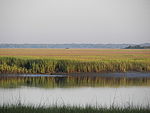
 Pier on Lady's Island, July 2013 | |
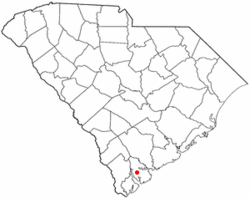 Location of Lady's Island, Beaufort, South Carolina | |
| Coordinates: 32°23′0″N 80°41′44″W / 32.38333°N 80.69556°WCoordinates: 32°23′0″N 80°41′44″W / 32.38333°N 80.69556°W | |
| Country | United States |
| State | South Carolina |
| County | Beaufort |
| Elevation | 17 ft (5 m) |
| Population (2010) | |
| • Total | 12,570 |
| Time zone | UTC-5 (Eastern (EST)) |
| • Summer (DST) | UTC-4 (EDT) |
| ZIP codes | 29907 |
| Area code(s) | 843, 854 |

Ladys Island is a predominantly residential Sea Island located in Beaufort County, South Carolina. Small portions of the island are within the City of Beaufort, while the majority of the island remains unincorporated.[1] The South Carolina Highway 802, also known locally as Sams Point Road, serves as the principal highway for Ladys Island and provides the only access to Coosaw Island.
History[]
The Coosaw band of Native Americans lived in the high ground of Coosaw Point on Ladys Island. Decorative pottery shards and oyster shells are part of the history of where they prepared the oysters gathered from the Coosaw river.[2] Ladys Island was named in 1698, in honor of Lady Elizabeth Axtell Blake, wife of Joseph Blake, governor of colonial South Carolina. She and her mother, Lady Rebecca Axtell, owned Newington Plantation in present-day Summerville, South Carolina. The island is sometimes called Combachee, Combee, or Comber Island for the ACE Basin river that flows along its border.[3][4]
The island was predominantly rural and agricultural in character for much of its history. In the 1920s, the first bridge connected downtown Beaufort with Ladys Island. As development of Beaufort and surrounding areas began in the last half of the 20th century, the island began to develop former plantation and timber tracts into residential subdivisions. A second bridge connected Ladys Island with Port Royal in the 1980s.
The Laurel Hill Plantation, once owned by Girard B. Henderson, was on Sam’s Point Road on Lady’s Island. It consisted of approximately 368 acres of land. Truck Farming for the production of fruits, vegetables and flowers as cash crops was done on the plantation. The land had a small grass air field (once called Laurel Hill Plantation Airport), residences, and an assortment of non-historic buildings and mobile homes.[5] Laurel Hill Plantation was sold in 1997 to Homestake Realty Company and is now called Coosaw Point.
Economy[]
The island is home to four public schools (two elementary, one middle, and one high school), Beaufort Academy, a K-12 private school, and Saint Peter's Catholic School, a K3-6 private Catholic school. Commercial development clustered at the intersection of S.C. Highway 802 and U.S. Highway 21 serves Ladys Island, Beaufort, and the surrounding Sea Islands of northern Beaufort County. The island is also the location of the Beaufort County Airport. Faith Communities located on the island include St. John's Lutheran Church, Sea Island Presbyterian Church, St. Peter's Catholic Church, Meadowbrook Baptist Church, Unitarian Universalist Fellowship of Beaufort, Israelite Baptist Church, Grace Chapel AME Church, Ladys Island Baptist Church, Water's Edge New United Methodist Church, and Tidal Creek Fellowship.
Notable people[]
- , Ladys Island was named in honor of her
- Joseph Blake, governor of colonial South Carolina
- Girard B. Henderson, American business executive and philanthropist; lived on Ladys Island
References[]
- ^ "LADY'S ISLAND". www.beaufortsc.org. Retrieved 2020-04-05.
- ^ "THE HISTORY OF COOSAW POINT". www.coosawpoint.com. 2020-04-08.
- ^ Rowland, Lawrence Sanders (1996). The History of Beaufort County, South Carolina: 1514-1861. South Carolina: University of South Carolina Press. p. 3. ISBN 9781570030901.
- ^ "LADY'S ISLAND". www.scpictureproject.org. Retrieved 2020-04-05.
- ^ Pinckney, Edward (Jul 14, 1997). LAUREL HILL PLANTATION, INC. SAM'S POINT, LADY ISLAND BEAUFORT. COUNTY SOUTH CAROLINA WETLANDS SURVEY (PDF). South Carolina: Homestake Realty Company. p. 1.
External links[]
| Wikimedia Commons has media related to Ladys Island. |
- Ladys Island, Beaufort SC ladys Island SC form the air.
- FaceBook page Ladys Island, SC
| show Municipalities and communities of Beaufort County, South Carolina, United States |
|---|

| show The Lowcountry of South Carolina |
|---|
| show Authority control |
|---|
- Towns in Beaufort County, South Carolina
- Islands of Beaufort County, South Carolina
- Islands of South Carolina
- Hilton Head Island–Beaufort micropolitan area
- South Carolina Sea Islands