Lahstedt
This article does not cite any sources. (February 2020) |
Lahstedt | |
|---|---|
part of Ilsede | |
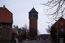 Water tower | |
 Coat of arms | |
show Location of Lahstedt | |
 Lahstedt | |
| Coordinates: 52°15′N 10°13′E / 52.250°N 10.217°ECoordinates: 52°15′N 10°13′E / 52.250°N 10.217°E | |
| Country | Germany |
| State | Lower Saxony |
| District | Peine |
| Municipality | Ilsede |
| Subdivisions | 5 districts |
| Area | |
| • Total | 43.6 km2 (16.8 sq mi) |
| Elevation | 97 m (318 ft) |
| Population (2013-12-31) | |
| • Total | 9,985 |
| • Density | 230/km2 (590/sq mi) |
| Time zone | UTC+01:00 (CET) |
| • Summer (DST) | UTC+02:00 (CEST) |
| Postal codes | 31246 |
| Dialling codes | 05172, 05174 |
| Vehicle registration | PE |
| Website | www.lahstedt.de |


Lahstedt is a former municipality in the district of Peine, in Lower Saxony, Germany. It was situated approximately 11 km south of Peine, and 20 km west of Braunschweig.
Lahstedt was formed in 1971 by merging the five villages of Adenstedt, Gadenstedt, Groß Lafferde, Münstedt and Oberg. "Lahstedt" itself was an artificial name, but not a population centre. Since 1 January 2015 its subdivisions are part of the municipality Ilsede.
Municipal subdivisions[]
- Adenstedt
- Gadenstedt
- Groß Lafferde
- Münstedt
- Oberg
References[]
External links[]
![]() Media related to Lahstedt at Wikimedia Commons
Media related to Lahstedt at Wikimedia Commons
| show Authority control |
|---|
This Peine district location article is a stub. You can help Wikipedia by . |
Categories:
- Peine (district)
- Former municipalities in Lower Saxony
- Braunschweig region geography stubs