Lake Claiborne State Park
| Lake Claiborne State Park | |
|---|---|
 Boardwalk into Lake Claiborne on the park grounds | |
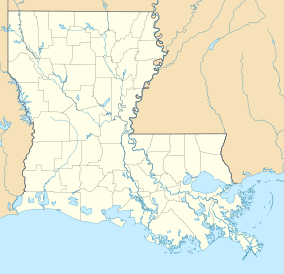
 Map of Louisiana, United States of America | |
| Location | Claiborne Parish, Louisiana, United States of America |
| Coordinates | 32°43′23″N 92°55′13″W / 32.7231°N 92.9203°WCoordinates: 32°43′23″N 92°55′13″W / 32.7231°N 92.9203°W[1] |
| Area | 643 acres (2.60 km2; 1.005 sq mi)[2] |
| Established | May 12, 1974[3] |
| Visitors | 55000[2] |
| Governing body | Louisiana Office of State Parks |
| web | |
Lake Claiborne State Park is a recreation site located in Claiborne Parish, northwestern Louisiana, USA. It was opened in 1974 and is 643 acres (2.60 km2) in size.[2] The park provides access to scenic Lake Claiborne, a 6,400-acre (26 km2)[2][4] man-made water body formed by damming Bayou D'Arbonne. Guests may stay at 10 cabins and 89 campsites (67 improved, 20 premium, 2 unimproved) on the Park grounds. Boats and canoes are available to rent. There is a large swimming beach, boat launch, Nature Center and numerous interpretive programs. The entrance to Lake Claiborne State Park is located 7 miles (11 km) southeast of Homer on Louisiana Highway 146.
The park was designed by the late architect , of Bastrop, Louisiana.[5]
References[]
- ^ "Lake Claiborne State Park - Louisiana Office of State Parks". Archived from the original on 10 January 2011. Retrieved 17 January 2011.
- ^ a b c d "Claiborne Parish Lakes and Recreation Areas". Archived from the original on 11 December 2010. Retrieved 14 February 2011.
- ^ Outdoor Recreation Action. United States. Bureau of Outdoor Recreation. 1974. p. 67.
- ^ Office of State Parks - Teacher's Guide. Louisiana State Parks. 2002.
- ^ Gordon E. Harvey (2007). Historic Ouachita: An Illustrated History. San Antonio, Texas: Historical Publishing Network. pp. 94–95. ISBN 978-1893619708. Retrieved April 18, 2015.
External links[]
Categories:
- Protected areas of Claiborne Parish, Louisiana
- State parks of Louisiana
- Louisiana geography stubs
- Southern United States protected area stubs
