Lantoto National Park
| Lantoto National Park | |
|---|---|
 | |
| Nearest city | Yambio |
| Coordinates | 4°30′N 29°54′E / 4.5°N 29.9°ECoordinates: 4°30′N 29°54′E / 4.5°N 29.9°E |
| Area | 760 km2 (290 sq mi) |

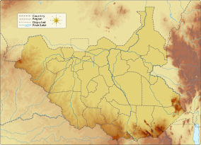
Lantoto National Park is a protected area in southwestern South Sudan on the border with the Democratic Republic of the Congo (DRC).
The park has an area of 760 km2 (290 sq mi) and is predominantly woodland, forest and open glades. The park was named by the Sudan's central government in the Wildlife Act of 1986 and Wildlife Conservation and National Parks Act of 2003. As of 2012 the boundaries of the park have not been demarcated.[1]
The vegetation of the park supports a huge population of elephants, Buffaloes, Baboon, Antelope and Ostrich.[2]
The highest and the most prominent mountain is Jabal Mbang i.[3]
Poaching in the park is increasingly threatening the survival of elephants.[4]
References[]
- ^ Launching Protected Area Network Management and Building Capacity in Post-conflict Southern Sudan (PDF) (Report). UNDP.
- ^ "Lantoto National park". Fortune of Africa South Sudan. 2013-08-03. Retrieved 2020-12-09.
- ^ "Lantoto National Park". PeakVisor. Retrieved 2020-12-09.
- ^ "Poaching on rise at Lantoto National Park; ten elephants dead". Radio Tamazuj. Retrieved 2020-12-09.
This Africa protected areas related article is a stub. You can help Wikipedia by . |
- IUCN Category II
- National parks of South Sudan
- Northern Congolian forest–savanna mosaic
- African protected area stubs