Las Matas de Farfán
This article needs additional citations for verification. (November 2007) |
Las Matas de Farfán | |
|---|---|
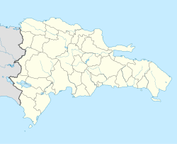 Las Matas de Farfán Las Matas de Farfán in the Dominican Republic | |
| Coordinates: 18°52′12″N 71°31′12″W / 18.87000°N 71.52000°WCoordinates: 18°52′12″N 71°31′12″W / 18.87000°N 71.52000°W | |
| Country | |
| Province | San Juan |
| Area | |
| • Total | 636.64 km2 (245.81 sq mi) |
| Population (2012)[2] | |
| • Total | 70,586 |
| • Density | 110/km2 (290/sq mi) |
| Municipal Districts | 2 |

Las Matas de Farfán is a town in the San Juan Province, Dominican Republic. It is the birthplace of a number of current and former Major League Baseball players including Nelson Cruz, Jean Segura, Juan Encarnación, Roberto Novoa, Odalis Perez, Ramón Santiago, and Valerio de los Santos. During the 1822–44 Haitian occupation, the town was officially designated as Las-Mathas.
Climate[]
Las Matas de Farfán has a tropical monsoon climate (Am) with very hot daytime temperatures year round with milder nighttime temperatures. Diurnal temperature range is very large for somewhere in the Caribbean.
| hideClimate data for Las Matas de Farfán (1961–1990) | |||||||||||||
|---|---|---|---|---|---|---|---|---|---|---|---|---|---|
| Month | Jan | Feb | Mar | Apr | May | Jun | Jul | Aug | Sep | Oct | Nov | Dec | Year |
| Record high °C (°F) | 37.8 (100.0) |
38.8 (101.8) |
38.0 (100.4) |
39.0 (102.2) |
38.5 (101.3) |
38.5 (101.3) |
38.7 (101.7) |
38.5 (101.3) |
38.2 (100.8) |
38.2 (100.8) |
38.0 (100.4) |
38.3 (100.9) |
39.0 (102.2) |
| Average high °C (°F) | 31.1 (88.0) |
31.9 (89.4) |
33.0 (91.4) |
33.6 (92.5) |
33.5 (92.3) |
34.2 (93.6) |
34.5 (94.1) |
34.4 (93.9) |
33.5 (92.3) |
32.4 (90.3) |
31.3 (88.3) |
30.4 (86.7) |
32.8 (91.0) |
| Average low °C (°F) | 15.7 (60.3) |
16.2 (61.2) |
17.3 (63.1) |
18.3 (64.9) |
19.2 (66.6) |
19.6 (67.3) |
19.2 (66.6) |
19.3 (66.7) |
19.2 (66.6) |
19.0 (66.2) |
17.7 (63.9) |
15.9 (60.6) |
18.0 (64.4) |
| Record low °C (°F) | 9.3 (48.7) |
10.3 (50.5) |
10.5 (50.9) |
12.0 (53.6) |
14.0 (57.2) |
13.0 (55.4) |
15.0 (59.0) |
15.5 (59.9) |
15.2 (59.4) |
11.0 (51.8) |
11.8 (53.2) |
9.5 (49.1) |
9.3 (48.7) |
| Average rainfall mm (inches) | 9.1 (0.36) |
10.0 (0.39) |
35.0 (1.38) |
104.3 (4.11) |
164.5 (6.48) |
109.7 (4.32) |
82.8 (3.26) |
125.2 (4.93) |
150.1 (5.91) |
154.1 (6.07) |
53.6 (2.11) |
13.3 (0.52) |
1,011.7 (39.83) |
| Average rainy days (≥ 1.0 mm) | 1.1 | 1.5 | 3.0 | 7.3 | 11.1 | 7.1 | 6.5 | 8.7 | 10.2 | 10.7 | 4.4 | 2.0 | 73.6 |
| Source: NOAA[3] | |||||||||||||
References[]
- ^ Superficies a nivel de municipios, Oficina Nacional de Estadistica Archived 2009-04-17 at the Wayback Machine
- ^ Censo 2012 de Población y Vivienda, Oficina Nacional de Estadistica
- ^ "Las M. Farfan Climate Normals 1961-1990". National Oceanic and Atmospheric Administration. Retrieved September 18, 2016.
| show Authority control |
|---|
This Dominican Republic location article is a stub. You can help Wikipedia by . |
Categories:
- Municipalities of the Dominican Republic
- Populated places in San Juan Province (Dominican Republic)
- Dominican Republic geography stubs