Lelu, Kosrae
Lelu, Kosrae | |
|---|---|
 | |
| Coordinates: 5°19′56″N 163°01′22″E / 5.33222°N 163.02278°ECoordinates: 5°19′56″N 163°01′22″E / 5.33222°N 163.02278°E | |
| Country | Federated States of Micronesia |
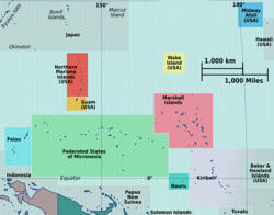

Lelu or Lelu Town is a municipality of the state of Kosrae, in the Federated States of Micronesia.
The municipality of Lelu consists of Lelu Island (a small of Kosrae Island) and a big part of the northeastern portion of Kosrae Island. Its capital is Lelu Village, located on Lelu island. Another village in the municipality, on Kosrae Island, is Tofol, the capital of the state of Kosrae. Established as a Town since Jan. 1989.[1]
Education[]
Kosrae State Department of Education operates public schools in the municipality:[2]
- Kosrae High School (Tofol)
- Lelu Elementary School (Lelu Island)
- Sansrihk Elementary School - Lelu Municipality
Climate[]
Lelu has a tropical rainforest climate (Af) with very heavy rainfall year-round.
| Climate data for Lelu | |||||||||||||
|---|---|---|---|---|---|---|---|---|---|---|---|---|---|
| Month | Jan | Feb | Mar | Apr | May | Jun | Jul | Aug | Sep | Oct | Nov | Dec | Year |
| Average high °C (°F) | 30.2 (86.4) |
30.2 (86.4) |
30.1 (86.2) |
30.0 (86.0) |
30.2 (86.4) |
30.3 (86.5) |
30.3 (86.5) |
30.7 (87.3) |
30.7 (87.3) |
30.8 (87.4) |
30.6 (87.1) |
30.3 (86.5) |
30.4 (86.7) |
| Daily mean °C (°F) | 27.4 (81.3) |
27.4 (81.3) |
27.4 (81.3) |
27.3 (81.1) |
27.3 (81.1) |
27.2 (81.0) |
27.2 (81.0) |
27.5 (81.5) |
27.3 (81.1) |
27.6 (81.7) |
27.4 (81.3) |
27.4 (81.3) |
27.4 (81.3) |
| Average low °C (°F) | 24.8 (76.6) |
24.8 (76.6) |
24.7 (76.5) |
24.5 (76.1) |
24.6 (76.3) |
24.5 (76.1) |
24.2 (75.6) |
24.3 (75.7) |
24.2 (75.6) |
24.3 (75.7) |
24.4 (75.9) |
24.7 (76.5) |
24.5 (76.1) |
| Average rainfall mm (inches) | 399 (15.7) |
485 (19.1) |
500 (19.7) |
583 (23.0) |
491 (19.3) |
453 (17.8) |
446 (17.6) |
415 (16.3) |
383 (15.1) |
344 (13.5) |
414 (16.3) |
510 (20.1) |
5,423 (213.5) |
| Source: Climate-Data.org[3] | |||||||||||||
References[]
- ^ "Pacific Digital Library". pacificdigitallibrary.org.
- ^ "Schools." Kosrae State Department of Education. Retrieved on February 23, 2018.
- ^ "Climate: Lelu". Climate-Data.org. Retrieved 22 October 2020.
This Federated States of Micronesia location article is a stub. You can help Wikipedia by . |
Categories:
- Municipalities of Kosrae
- 1989 establishments in the Federated States of Micronesia
- Federated States of Micronesia geography stubs