Lettstädter Höhe
| Lettstädter Höhe | |
|---|---|
 On the Lettstädter Höhe | |
| Highest point | |
| Elevation | 966 m above sea level (NHN) (3,169 ft) |
| Coordinates | 48°26′03″N 8°15′20″E / 48.43417°N 8.25556°ECoordinates: 48°26′03″N 8°15′20″E / 48.43417°N 8.25556°E |
| Geography | |
 Lettstädter Höhe | |
| Parent range | Black Forest |

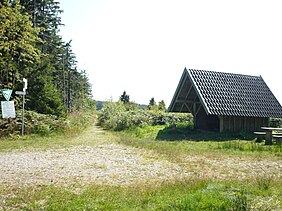
The Lettstädter Höhe is a mountain, 966 metres high, in the Central Black Forest in Germany, southwest of Kniebis.
The Lettstädter Höhe lies in a walking region on the Westweg trail from Pforzheim to Basle on the seventh stage between the and the Bergbauernhof Hark.
This Baden-Württemberg location article is a stub. You can help Wikipedia by . |
Categories:
- Mountains under 1000 metres
- Mountains and hills of Baden-Württemberg
- Mountains and hills of the Black Forest
- Baden-Württemberg geography stubs