Liangshan Yi Autonomous Prefecture
Liangshan Prefecture
凉山州 · ꆃꎭꍏ | |
|---|---|
凉山彝族自治州 · ꆃꎭꆈꌠꊨꏦꏱꅉꍏ Liangshan Yi Autonomous Prefecture | |
 | |
 Location of Liangshan Prefecture in Sichuan | |
| Coordinates (Liangshan Prefecture government): 27°53′N 102°16′E / 27.88°N 102.27°ECoordinates: 27°53′N 102°16′E / 27.88°N 102.27°E | |
| Country | People's Republic of China |
| Province | Sichuan |
| Prefecture seat | Xichang |
| Area | |
| • Total | 60,261 km2 (23,267 sq mi) |
| Population (2009) | |
| • Total | 4,532,809 |
| • Density | 75/km2 (190/sq mi) |
| Time zone | UTC+8 (China Standard) |
| ISO 3166 code | CN-SC-34 |
| Website | www |

| Liangshan Yi Autonomous Prefecture | |||
|---|---|---|---|
| Chinese name | |||
| Simplified Chinese | 凉山彝族自治州 | ||
| Traditional Chinese | 涼山彝族自治州 | ||
| |||
| Commonly abbreviated as "Liangshan Prefecture" | |||
| Simplified Chinese | 凉山州 | ||
| Traditional Chinese | 涼山州 | ||
| |||
| Yi Language name | |||
| Yi Language | ꆃꎭꆈꌠꊨꏦꏱꅉꍏ niep sha nuo su zyt jie jux dde zho | ||
Liangshan (Chinese: 凉山; Yi: ꆃꎭ Niep Sha, pronounced [nɛ̀ʂā]), officially the Liangshan Yi Autonomous Prefecture, is an autonomous prefecture occupying much of the southern extremity of Sichuan province, People's Republic of China; its seat is Xichang. Liangshan has an area of 60,261 km2 (23,267 sq mi) and over 4.5 million inhabitants (2010). It is also has the largest population of ethnic Yi nationally.[clarification needed] Liangshan Li contains a number of isolated villages high up on its cliffs, often known as "cliff villages".[1]
Xichang has the Xichang Qingshan Airport and the Xichang Satellite Launch Center. The prefecture also features a substantial network of railways for both passengers and freight.
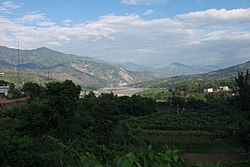
Terrain and climate[]
The Anning River, which runs into the Jinsha River (Yangtze River headwaters), is the main river in the area.
Owing to its low latitude and high elevation, Liangshan has a mild climate. Under the Köppen system, the prefecture belongs to the humid subtropical zone (Köppen Cwa). Winters feature mild days and cool nights, while summers are very warm and humid. Monthly daily mean temperatures range from 9.6 °C (49.3 °F) in January to 22.3 °C (72.1 °F) in July. Unlike much of the province, which lies in the Sichuan Basin, humidity levels in winter are rather low, but like the rest of the province, rainfall is concentrated in the months of June through September, and the prefecture is virtually rainless in winter.
Cliff villages[]
Also see Zhaojue County
Due to the mountainous terrain, many villages that lie among the mountain cliffs of Liangshan Yi are isolated from the rest of Sichuan. They are called cliff villages as they tend to be isolated and lie at vertical heights of about 800 m (2,600 ft).[2] Access to these cliff villages tends to be through vines of trees along the cliffs and steep ladders made of ropes. In 2016, the state run The Beijing News reported one such village called Atulie'er (阿土列尔村) where children climbed up a rope ladder for two hours to reach their home from school, often leading to falls and deaths.[3] In light of this, the local government constructed a special steel ladder (dubbed "Stairway to heaven") in November 2016 for people to climb up and down in a safer manner.[4]
The Atulie'er village is home to 72 families. Access from the outside world to Atulie'er is through 17 vertical vine ladders.[1]
Subdivisions[]
Liangshan directly controls one county-level city, 15 counties, and 1 autonomous county.
| Map | ||||||
|---|---|---|---|---|---|---|
| Name | Hanzi | Hanyu Pinyin | Yi | Population (2010 Census) |
Area (km2) | Density (/km2) |
| Xichang City | 西昌市 | Xīchāng Shì | ꀒꎂꏃ | 712,434 | 2,655 | 268.33 |
| Yanyuan County | 盐源县 | Yányuán Xiàn | ꋂꂿꑤ | 350,176 | 8,388 | 41.74 |
| Dechang County | 德昌县 | Déchāng Xiàn | ꄓꍣꑤ | 214,405 | 2,284 | 93.87 |
| Huili County | 会理县 | Huìlǐ Xiàn | ꑌꄷꑤ | 430,066 | 4,527 | 95.00 |
| Huidong County | 会东县 | Huìdōng Xiàn | ꉼꄏꑤ | 362,944 | 3,227 | 112.47 |
| Ningnan County | 宁南县 | Níngnán Xiàn | ꆀꆆꑤ | 170,673 | 1,667 | 102.38 |
| Puge County | 普格县 | Pǔgé Xiàn | ꁌꐭꑤ | 155,740 | 1,905 | 81.75 |
| Butuo County | 布拖县 | Bùtuō Xiàn | ꀭꄮꑤ | 160,151 | 1,685 | 95.04 |
| Jinyang County | 金阳县 | Jīnyáng Xiàn | ꏁꇉꑤ | 165,121 | 1,587 | 104.04 |
| Zhaojue County | 昭觉县 | Zhāojué Xiàn | ꏪꐦꑤ | 251,836 | 2,699 | 93.30 |
| Xide County | 喜德县 | Xǐdé Xiàn | ꑝꅇꑤ | 165,906 | 2,206 | 75.20 |
| Mianning County | 冕宁县 | Miǎnníng Xiàn | ꍿꆈꑤ | 351,245 | 4,423 | 79.41 |
| Yuexi County | 越西县 | Yuèxī Xiàn | ꃺꄧꑤ | 269,896 | 2,257 | 119.58 |
| Ganluo County | 甘洛县 | Gānluò Xiàn | ꇤꇉꑤ | 195,100 | 2,156 | 90.49 |
| Meigu County | 美姑县 | Měigū Xiàn | ꂿꈬꑤ | 221,505 | 2,573 | 86.08 |
| Leibo County | 雷波县 | Léibō Xiàn | ꃀꁧꑤ | 223,885 | 2,932 | 76.35 |
| Muli Tibetan Autonomous County | 木里藏族自治县 | Mùlǐ Zàngzú Zìzhìxiàn |
ꃆꆹꀒꋤꊨꏦꏱꅉꑤ | 131,726 | 13,252 | 9.94 |

Ethnic groups in Liangshan, 2010 census[]
| Nationality | Population | Percentage |
|---|---|---|
| Yi | 2,226,755 | 49.13% |
| Han | 2,155,357 | 47.55% |
| Tibetan | 60,679 (2000) | 1.49% (2000) |
| Mosuo and Mongol | 27,277 (2000) | 0.67% (2000) |
| Hui | 18,385 (2000) | 0.45% (2000) |
| Miao | 11,912 (2000) | 0.29% |
| Lisu | 9,121 (2000) | 0.22% (2000) |
| Buyei | 5,459 (2000) | 0.13% (2000) |
| Nakhi | 5,199 (2000) | 0.13% (2000) |
| Others | 8,751 | 0.22% |
See also[]
- Asteroid 121001 Liangshanxichang
References[]
- ^ Jump up to: a b Chi, Ma (25 May 2016). "Kids climb vine ladder in 'cliff village' in Sichuan". China People's Daily. Retrieved 22 November 2016.
- ^ Chi, An (21 November 2016). ""Ladders of heaven" gives new path to cliff village in China's Sichuan". Xinhua. Beijing News. Retrieved 22 November 2016.
- ^ "Steel replaces vine ladders in China's "Cliff Village"". Sina News. 21 November 2016. Retrieved 22 November 2016.
- ^ Wang, Serenetie; Hunt, Katie (26 October 2016). "China: Cliff-top village builds steel ladder for children to go to school". CNN News. Retrieved 22 November 2016.
External links[]
| Authority control |
|
|---|
- Liangshan Yi Autonomous Prefecture
- Yi autonomous prefectures