Lindsay Reef
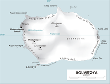
Lindsay Reef (54°26′S 3°29′E / 54.433°S 3.483°ECoordinates: 54°26′S 3°29′E / 54.433°S 3.483°E) is a reef lying close north of Cape Meteor on the east side of the island of Bouvetøya in the South Atlantic Ocean. The reef was first charted in 1898 by a German expedition under Carl Chun. It was recharted in December 1927 by a Norwegian expedition under Captain , and named by the Norwegians after Captain , a British whaler in command of the Swan who, in the company of Captain with the Otter, sighted Bouvetøya in 1808.[1][2]
 WikiMiniAtlas
References[]
- ^ "Lindsay Reef". Geographic Names Information System. United States Geological Survey. Retrieved 2013-06-17.
- ^ "Prof. Dr. phil., Dr. med. h. c. Carl Chun". University of Leipzig. Retrieved October 1, 2016.
Other sources[]
- Simpson-Housley, Paul (2002) Antarctica: Exploration, Perception and Metaphor (Routledge) ISBN 9781134891214
![]() This article incorporates public domain material from the United States Geological Survey document: "Lindsay Reef". (content from the Geographic Names Information System)
This article incorporates public domain material from the United States Geological Survey document: "Lindsay Reef". (content from the Geographic Names Information System)
This Bouvet Island location article is a stub. You can help Wikipedia by . |
- Reefs of Bouvet Island
- Norway geography stubs
- Subantarctic island geography stubs