Linschoten (village)
Linschoten | |
|---|---|
Town | |
 | |
 Flag  Coat of arms | |
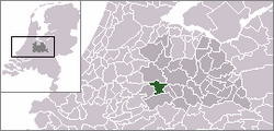 | |
 The town centre (dark green) and the statistical district (light green) of Linschoten in the municipality of Montfoort. | |
| Coordinates: 52°3′46″N 4°54′52″E / 52.06278°N 4.91444°ECoordinates: 52°3′46″N 4°54′52″E / 52.06278°N 4.91444°E | |
| Country | Netherlands |
| Province | Utrecht |
| Municipality | Montfoort |
| Population (2003) | |
| • Total | 5,000 |
| Time zone | UTC+1 (CET) |
| • Summer (DST) | UTC+2 (CEST) |
Linschoten (Dutch pronunciation: [ˈlɪnsxoːtə(n)]) is a village in the Dutch province of Utrecht. It is a part of the municipality of Montfoort, and lies about 3 km southeast of Woerden.
In 2001, the village of Linschoten had 3588 inhabitants. It had a built-up area of 0.65 km² with 1288 residences.[1] The statistical area "Linschoten", which also can include the peripheral parts of the village, as well as the surrounding countryside, has a population of around 3910.[2]

Castle Linschoten
Notable people born in Linschoten[]
- Mat Herben, (born 1952), politician
- Rigard van Klooster, (born 1989) – track cyclist and former speed skater
See also[]
References[]
- ^ Statistics Netherlands (CBS), Bevolkingskernen in Nederland 2001. (Statistics are for the continuous built-up area).
- ^ Statistics Netherlands (CBS), Statline: Kerncijfers wijken en buurten 2003-2005. As of January 1, 2005.
| Wikimedia Commons has media related to Linschoten. |
Authority control | |
|---|---|
| General |
|
| National libraries | |
This Utrecht location article is a stub. You can help Wikipedia by . |
Categories:
- Populated places in Utrecht (province)
- Montfoort
- Utrecht (province) geography stubs