Lipljan
Lipljan | |
|---|---|
Town and municipality | |
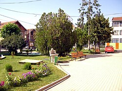 Lipljan town park | |
 Emblem | |
 Location of the municipality of Lipljan within Kosovo | |
| Coordinates: 42°32′N 21°06′E / 42.533°N 21.100°E | |
| Country | Kosovo[a] |
| District | District of Pristina |
| Government | |
| • Mayor | Imri Ahmeti (LDK) |
| • Municipal | 338 km2 (131 sq mi) |
| Elevation | 563 m (1,847 ft) |
| Population (2011) | |
| • Urban | 6,870 |
| • Municipal | 57,605 |
| • Municipal density | 170/km2 (440/sq mi) |
| Time zone | UTC+1 (CET) |
| • Summer (DST) | UTC+2 (CEST) |
| Postal code | 14000 |
| Area code(s) | +383 38 |
| Car plates | 01 |
| Website | kk |

Lipljan (Serbian Cyrillic: Липљан) or Lipjan (definite Albanian form: Lipjani) is a town and municipality located in the Pristina District of Kosovo.[a] According to the 2011 census, the town of Lipljan has 6,870 inhabitants, while the municipality has 57,605 inhabitants.
Name[]
According to one theory proposed by Croatian toponomy expert Petar Skok, the name of the town, Lipljan, is derived from the Serbian lipa, "linden tree", referring to the local foliage.[1] The name lipa is often used in South Slavic toponyms.[1] However, a rival theory holds that the town's name derives from Ulpiana, the Dardanian and Roman era settlement it succeeded, possibly due to either a Ul- to Li- shift seen elsewhere in Roman toponyms, or via folk etymology with Slavic lipa.[2]
The Roman city of Ulpiana was located near Lipljan and it was named in honor of the Roman Emperor Marcus Ulpius Nerva Traianus. In the early Middle Ages in was part of the Bulgarian Empire and a diocese of the Bulgarian Patriarchate. The neo-Latin form Lypenion for the city occurs for the first time in a Byzantine text from 1018 AD that confirmed the town as an episcopal seat of the Bulgarian Archbishopric of Ohrid following the Byzantine conquest of Bulgaria in the same year.[3]
History[]
Roman period[]
Ulpiana played an important role in the development of the most important cities in the Roman province of Dardania.
Middle Ages[]
Lipljan was the seat of medieval Eparchy of Lipljan that existed up to the beginning of 18 century. The Gračanica monastery was built in 1321, on the ruins of two older churches.
The town of Lipljan is located on the banks of the Sitnica River, not far from Priština. During the 1320s or 1330s, a single-nave church of modest dimensions dedicated to the Presentation of the Virgin was built there atop of the remains of an older site. After 1336 it was given to the Pyrgos[disambiguation needed] of the Ascension of Christ in Hilandar as a gift. In the mid-14th century, an unknown ktetor had the church decorated. At the end of the 16th and the beginning of the 17th century, a new layer of frescoes was made.
Lipjan is the birthplace of an Albanian Noble Lekë Dukagjini, who was born here in 1410. He was a close friend of the Albanian military commander and ruler, Gjergj Kastrioti Skanderbeg and a participant in the Albanian League of Lezhë.
Demographics[]
| Year | Pop. | ±% p.a. |
|---|---|---|
| 1948 | 29,700 | — |
| 1953 | 33,132 | +2.21% |
| 1961 | 38,573 | +1.92% |
| 1971 | 47,526 | +2.11% |
| 1981 | 57,705 | +1.96% |
| 1991 | 69,451 | +1.87% |
| 2011 | 57,605 | −0.93% |
| 2016 est. | 56,643 | −0.34% |
| Source: Division of Kosovo | ||
According to the last official census done in 2011, the municipality of Lipljan has 57,605 inhabitants. Based on the population estimates from the Kosovo Agency of Statistics in 2016, the municipality has 57,415 inhabitants.
The ethnic composition of the municipality:
| Ethnic Composition, Including IDPs | |||||||||||||
| Year/Population | Albanians | % | Serbs | % | Croats | % | Others | % | Total | ||||
|---|---|---|---|---|---|---|---|---|---|---|---|---|---|
| 1961 census | 24,433 | 60.98 | 10,902 | 27.21 | 3,304 | 8.25 | 1,431 | 3.57 | 40,070 | ||||
| 1991 census | 53,730 | 77.36 | 9,713 | 13.99 | 2,914 | 4.20 | 3,094 | 4.45 | 69,451 | ||||
| January 1999 (OSCE est.) | 62,706 | 81.3 | 9,985 | 13.0 | N/A | N/A | 5,834 | 7.6 | 77,087 | ||||
| 2000 (OSCE est.) | 63,478 | 83.3 | 9,300 | 12.2 | 363 | 0.5 | 1,890 | 2.6 | 76,143 | ||||
Municipality[]
- Akllap/Oklap
- Babush i Muhaxherëve/Muhadžer Babuš
- Baicë/Banjica
- Banullë/Bandulić
- Breg i Zi/Crni Breg
- Brus
- Bujan/Bujance
- Bukovicë/Bukovica
- Divlakë/Divljaka
- Dobrajë e Madhe/Velika Dobranja
- Dobrajë e Vogël/Mala Dobranja
- Gadime e Epërme/Gornje Gadimlje
- Gadime e Ulët/Donje Gadimlje
- Gllanicë/Glanica
- Gllavicë/Glavica
- Gllogoc/Glogovce
- Grackë e Vjetër/Staro Gracko
- Grackë e Vogël/Malo Gracko
- Gumnasellë/Guvno Selo
- Hallaç i Madh/Veliki Alaš
- Hallaç i Vogël/Mali Alaš
- Hanroc/Androvac
- Janjevo/Janjevë
- Kleçkë/Klečka
- Kojskë/Konjsko
- Konjuh
- Kraishtë/Krajište
- Krojmir/Krajmirovce
- Leletiq/Laletić
- Lipovica
- Livađe/Livagjë
- Llugaxhi/Lugadžija
- Llugë/Lug
- Magura
- Marec/Marevce
- Medvec/Medvece
- Mirenë/Mirena
- Okosnicë/Okosnica
- Plitkoviq/Plitković
- Poturoc/Poturovce
- Qellapek/Čelopek
- Qyqylagë/Čučuljaga
- Resinoc/Rusinovce
- Ribar i Madh/Veliko Ribare
- Ribar i Vogël/Malo Ribare
- Ruboc/Rabovce
- Rufc i Ri/Novo Rujce
- Rufc i Vjetër/Staro Rujce
- Shalë/Sedlare
- Shisharkë/Šišarka
- Sllovi/Slovinje
- Smallushë/Smoluša
- Teqë/Teća
- Topličane
- Torina/Torinë
- Trbovce/Tërbuc
- Varigoc/Varigovce
- Vërshec/Vrševce
- Vogaçicë/Vogačica
- Vrelo
- Vrellë e Goleshit/Goleško Vrelo
- Zlokućane
See also[]
- Municipalities of Kosovo
- Cities and towns in Kosovo
- Populated places in Kosovo
- Staro Gracko massacre
Notes and references[]
- Notes
- ^ Jump up to: a b Kosovo is the subject of a territorial dispute between the Republic of Kosovo and the Republic of Serbia. The Republic of Kosovo unilaterally declared independence on 17 February 2008. Serbia continues to claim it as part of its own sovereign territory. The two governments began to normalise relations in 2013, as part of the 2013 Brussels Agreement. Kosovo is currently recognized as an independent state by 97 out of the 193 United Nations member states. In total, 113 UN member states are said to have recognized Kosovo at some point, of which 15 later withdrew their recognition.
- References
- ^ Jump up to: a b Skok, Petar (1988) [1971]. Etimologijski rječnik hrvatskoga ili srpskoga jezika (in Serbo-Croatian). 2. Zagreb: Jugoslavenska akademija znanosti i umjetnosti. pp. 305–306. ISBN 86-407-0064-8.
- ^ Lafe, Emil (1976). "Toponymes latino-romans sur le territoire de l'albanais". Iliria. Page 116
- ^ Collective (1965). Greek Sources about Bulgarian History (GIBI), volume VI (in Bulgarian and Greek). Sofia: Bulgarian Academy of Sciences Press. p. 44.
External links[]
| Wikimedia Commons has media related to Lipljan. |
Coordinates: 42°31′48″N 21°08′19″E / 42.53000°N 21.13861°E
| hide | ||
|---|---|---|
| District of Ferizaj |  | |
| District of Gjakova | ||
| District of Gjilan | ||
| District of Mitrovica | ||
| District of Peja | ||
| District of Pristina | ||
| District of Prizren | ||
1 Kosovo is the subject of a territorial dispute between the Republic of Kosovo and the Republic of Serbia. The Republic of Kosovo unilaterally declared independence on 17 February 2008. Serbia continues to claim it as part of its own sovereign territory. The two governments began to normalise relations in 2013, as part of the 2013 Brussels Agreement. Kosovo is currently recognized as an independent state by 97 out of the 193 United Nations member states. In total, 113 UN member states are said to have recognized Kosovo at some point, of which 15 later withdrew their recognition. | ||
| Authority control |
|
|---|
- Municipalities of Kosovo
- Cities in Kosovo
- Lipljan