List of crossings of the Raritan River

From Wikipedia, the free encyclopedia
The Raritan river at its mouth at Raritan Bay, an arm of the Upper New York Bay

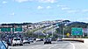
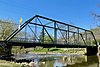
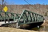
This is a list of road/highway and rail crossings of the Raritan River from the mouth at Raritan Bay upstream. It also includes crossings of its two branches: the North Branch Raritan River and the South Branch Raritan River.


Map all coordinates using: OpenStreetMap 
Download coordinates as: KML

Crossings[]

Crossing Image Carries Location Coordinates

Main stem[]

Raritan Bay Drawbridge Raritan Bay Bridge.jpg NJ Transit North Jersey Coast Line
Norfolk Southern Railway
CSX
40°29′46″N 74°16′52″W / 40.4961°N 74.2810°W / 40.4961; -74.2810 (Raritan Bay Drawbridge)
Victory Bridge Victory Bridge from US 9.JPG Circle sign 35.svg NJ 35 40°30′28″N 74°17′31″W / 40.5077°N 74.2919°W / 40.5077; -74.2919 (Victory Bridge)
Edison Bridge US 9.svg US 9 north 40°30′32″N 74°18′01″W / 40.5090°N 74.3003°W / 40.5090; -74.3003 (Edison Bridge)
Ellis S. Vieser Memorial Bridge US 9.svg US 9 south 40°30′32″N 74°18′02″W / 40.5090°N 74.3006°W / 40.5090; -74.3006 (Ellis S. Vieser Memorial Bridge)
Driscoll Bridge Driscoll-Viesser-Edison Bridges - August 30, 2020.jpg GSPkwy Shield.svg Garden State Parkway 40°30′32″N 74°18′05″W / 40.5090°N 74.3013°W / 40.5090; -74.3013 (Driscoll Bridge)
Basilone Bridge I-95 (NJ).svg I-95
New Jersey Turnpike Shield.svg New Jersey Turnpike
40°29′18″N 74°23′47″W / 40.4884°N 74.3963°W / 40.4884; -74.3963 (Basilone Bridge)
Morris Goodkind Bridge GoodkindBridges.jpg US 1.svg US 1 north 40°29′34″N 74°24′46″W / 40.4927°N 74.4127°W / 40.4927; -74.4127 (Morris Goodkind Bridge)
Donald Goodkind Bridge US 1.svg US 1 south 40°29′33″N 74°24′47″W / 40.4926°N 74.4131°W / 40.4926; -74.4131 (Donald Goodkind Bridge)
Albany Street Bridge Raritan River, New Brunswick, New Jersey (1903).jpeg Circle sign 27.svg NJ 27
County 514.svg County Route 514
40°29′51″N 74°26′16″W / 40.4975°N 74.4377°W / 40.4975; -74.4377 (Albany Street Bridge)
Raritan River Bridge (Northeast Corridor) Raritan River Bridge, Highland Park, NJ.jpg Amtrak Northeast Corridor
NJ Transit Northeast Corridor Line
40°30′04″N 74°26′27″W / 40.5011°N 74.4409°W / 40.5011; -74.4409 (Raritan River Bridge (Northeast Corridor))
John A. Lynch Sr. Memorial Bridge Circle sign 18.svg NJ 18 40°30′30″N 74°27′31″W / 40.5084°N 74.4586°W / 40.5084; -74.4586 (John A. Lynch Sr. Memorial Bridge)
Landing Lane Bridge Landing Lane Bridge 2010.jpg Middlesex County Route 609 NJ.svg County Route 609 40°30′31″N 74°27′50″W / 40.5086°N 74.4638°W / 40.5086; -74.4638 (Landing Lane Bridge)
I-287 Bridge I-287.svg I-287 40°32′23″N 74°30′43″W / 40.5397°N 74.5119°W / 40.5397; -74.5119 (I-287 Bridge)
Rail bridge (abandoned) Rail 40°33′32″N 74°31′26″W / 40.5588°N 74.5240°W / 40.5588; -74.5240 (Rail bridge (abandoned))
Queen's Bridge Queen's Bridge-South Bound Brook, New Jersey.jpg County 527.svg County Route 527 40°33′35″N 74°31′40″W / 40.5596°N 74.5278°W / 40.5596; -74.5278 (Queen's Bridge)
I-287 Bridge I-287.svg I-287 40°33′15″N 74°32′40″W / 40.5542°N 74.5445°W / 40.5542; -74.5445 (I-287 Bridge)
Rail bridges Conrail Shared Assets Operations 40°32′59″N 74°34′07″W / 40.5497°N 74.5687°W / 40.5497; -74.5687 (Rail bridges)
Rail bridge Conrail Shared Assets Operations 40°33′06″N 74°34′19″W / 40.5518°N 74.5720°W / 40.5518; -74.5720 (Rail bridge)
Rail bridge (abandoned) Rail 40°33′10″N 74°34′31″W / 40.5527°N 74.5754°W / 40.5527; -74.5754 (Rail bridge (abandoned))
Van Veghten's Bridge Van Veghten's Bridge, Raritan River, NJ - looking north.jpg County 533.svg County Route 533 40°33′19″N 74°35′00″W / 40.5553°N 74.5832°W / 40.5553; -74.5832 (Van Veghten's Bridge)
U.S. Route 206 Bridge US 206.svg US 206 40°33′22″N 74°36′57″W / 40.5562°N 74.6159°W / 40.5562; -74.6159 (U.S. Route 206 Bridge)
Rail bridge (abandoned) Rail 40°33′27″N 74°37′14″W / 40.5575°N 74.6206°W / 40.5575; -74.6206 (Rail bridge (abandoned))
Nevius Street Bridge Nevius Street Raritan Bridge.jpg Pedestrian Bridge 40°33′53″N 74°38′09″W / 40.5646°N 74.6357°W / 40.5646; -74.6357 (Nevius Street Bridge)
John Basilone Veterans Memorial Bridge John Basilone Veterans Memorial Bridge, Raritan, NJ.jpg Somerset County Route 625 NJ.svg County Route 625 40°33′53″N 74°38′12″W / 40.5647°N 74.6368°W / 40.5647; -74.6368 (John Basilone Veterans Memorial Bridge)

North Branch[]

Old York Road Bridge Old York Road Bridge, North Branch Raritan River, NJ.jpg County 567.svg County Route 567 Branchburg 40°33′24″N 74°41′16″W / 40.5567°N 74.6879°W / 40.5567; -74.6879 (Old York Road Bridge)
North Branch Bridge North Branch Bridge, North Branch, NJ.jpg Circle sign 28.svg NJ 28
Somerset County Route 614 NJ.svg County Route 614
North Branch 40°36′00″N 74°40′25″W / 40.6000°N 74.6737°W / 40.6000; -74.6737 (North Branch Bridge)
U.S. Route 202 and U.S. Route 206 Bridge U.S. Route 202 and U.S. Route 206 Bridge, Bedminster, NJ - North Branch Raritan River.jpg US 202.svg US 202
US 206.svg US 206
Bedminster 40°39′40″N 74°38′44″W / 40.6611°N 74.6456°W / 40.6611; -74.6456 (U.S. Route 202 and U.S. Route 206 Bridge)

South Branch[]

Studdiford Drive Bridge Studdiford Drive Bridge, South Branch, NJ.jpg Studdiford Drive South Branch 40°32′48″N 74°41′47″W / 40.5468°N 74.6963°W / 40.5468; -74.6963 (Studdiford Drive Bridge)
Neshanic Station Lenticular Truss Bridge Lenticular Truss Bridge, Neshanic Station , NJ - area view.jpg Somerset County Route 667 NJ.svg County Route 667 Neshanic Station 40°30′34″N 74°43′37″W / 40.5094°N 74.7269°W / 40.5094; -74.7269 (Neshanic Station Lenticular Truss Bridge)
Rockafellows Mill Bridge Rockafellows Mill Bridge, NJ - looking south.jpg Rockafellows Mill Road Rockefellows Mills 40°31′15″N 74°49′13″W / 40.5207°N 74.8204°W / 40.5207; -74.8204 (Rockafellows Mill Bridge)
Main Street Bridge (Clinton, New Jersey) Main Street Bridge, Clinton, NJ.jpg Main Street Clinton 40°38′10″N 74°54′44″W / 40.6360°N 74.9121°W / 40.6360; -74.9121 (Main Street Bridge (Clinton, New Jersey))
Union Forge Bridge Union Forge Bridge, High Bridge, NJ.jpg Taylor Steelworkers Historic Greenway Trail High Bridge 40°40′09″N 74°53′15″W / 40.6692°N 74.8875°W / 40.6692; -74.8875 (Union Forge Bridge)
Ken Lockwood Gorge Bridge Ken Lockwood Gorge Bridge, NJ - looking northwest.jpg Columbia Trail Ken Lockwood Gorge 40°41′51″N 74°52′21″W / 40.6976°N 74.8724°W / 40.6976; -74.8724 (Ken Lockwood Gorge Bridge)
Hoffman's Crossing Road Bridge Hoffman's Crossing Road Bridge, Hoffmans, NJ.jpg Hoffman's Crossing Road Hoffmans 40°42′26″N 74°51′40″W / 40.7071°N 74.8611°W / 40.7071; -74.8611 (Hoffman's Crossing Road)
Main Street Bridge (Califon, New Jersey) Main Street Bridge, Califon, NJ - looking west.jpg Main Street
County 512.svg County Route 512
Califon 40°43′14″N 74°50′15″W / 40.7206°N 74.8376°W / 40.7206; -74.8376 (Main Street Bridge (Califon, New Jersey))
Vernoy Road Bridge Vernoy Road Bridge, Vernoy, NJ.jpg Vernoy Road Tewksbury Township 40°44′32″N 74°49′26″W / 40.7423°N 74.8239°W / 40.7423; -74.8239 (Vernoy Road Bridge)
Middle Valley Road Bridge Middle Valley Road Bridge, Middle Valley, NJ.jpg Middle Valley Road Middle Valley 40°45′41″N 74°49′17″W / 40.7613°N 74.8213°W / 40.7613; -74.8213 (Middle Valley Road Bridge)

See also[]

  • Nuvola apps ksysv square.svg Transport portal
  • Nuvola apps kcmsystem.svg Engineering portal
  • Flag of New Jersey.svg New Jersey portal
Retrieved from ""