List of highways in Reeves County, Texas
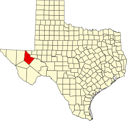
Location of Reeves County
The following is a list of all state highways in Reeves County, Texas maintained by the Texas Department of Transportation. All state highways in Texas are paved.
Interstate highways[]
| Route Name | Direction | Termini | Junctions | Length[1] | Remarks |
|---|---|---|---|---|---|
| W/E | Jeff Davis County Pecos County |
41.3 miles (66.5 km) | Passes by Van Horn | ||
| W/E | 48.2 miles (77.6 km) | Passes by Toyah and Pecos |
Interstate business routes[]
| Route Name | Direction | Termini | Junctions | Length | Remarks |
|---|---|---|---|---|---|
| W/E | 2.0 miles (3.2 km)[4] | Business loop through Balmorhea | |||
| W/E | 5.5 miles (8.9 km)[1] | Business loop through Pecos and Barstow |
U.S. highways[]
| Route Name | Direction | Termini | Junctions | Length[1] | Remarks |
|---|---|---|---|---|---|
| S/N | Pecos County Culberson County |
77.8 miles (125.2 km) | Passes through Pecos and Orla |
State highways[]
| Route Name | Direction | Termini | Junctions | Length[1] | Remarks |
|---|---|---|---|---|---|
| S/N | Jeff Davis County |
44.2 miles (71.1 km) | Passes through Toyahvale, Balmorhea, and Saragosa ending in Pecos | ||
| S/N | 2.3 miles (3.7 km) |
State park roads[]
| Route Name | Direction | Termini | Junctions | Length | Remarks |
|---|---|---|---|---|---|
| S/N | Balmorhea State Park |
0.6 miles (1.0 km)[9] | Balmorhea State Park Road |
Farm and ranch to market roads[]
| Route Name | Direction | Termini | Junctions | Length | Remarks |
|---|---|---|---|---|---|
| W/E | Culberson County |
13.5 miles (21.7 km)[1] | Passes through Orla | ||
| S/N | 2.5 miles (4.0 km)[11] | Entire route within Pecos | |||
| S/N | 13.8 miles (22.2 km)[12] | ||||
| W/E | 4.4 miles (7.1 km)[13] | Passes through Saragosa | |||
| S/N | 10.1 miles (16.3 km)[14] | ||||
| W/E | Pecos County |
23.5 miles (37.8 km)[1] | |||
| W/E | 10.1 miles (16.3 km)[16] | ||||
| S/N | 7.9 miles (12.7 km)[17] | ||||
| W/E | Culberson County |
34.7 miles (55.8 km)[1] | |||
| S/N | 6.0 miles (9.7 km)[19] | ||||
| S/N | 6.0 miles (9.7 km)[20] | Road from Balmorhea to Toyah | |||
| W/E | Jeff Davis County |
5.0 miles (8.0 km)[1] | Road leaves county | ||
| W/E | Jeff Davis County |
4.9 miles (7.9 km)[1] | Road reenters county to Toyahvale | ||
| W/E | 7.7 miles (12.4 km)[22] | ||||
| W/E | 3.5 miles (5.6 km)[23] |
Historic roads[]
| Route Name | Direction | Termini | Remarks |
|---|---|---|---|
| W/E | Jeff Davis County |
Replaced by I-10 and I-20 with their business routes in 1991 | |
| W/E | Pecos County |
Replaced by I-10 and Bus. I-10-F in 1992 | |
| W/E | Jeff Davis County |
Replaced by US 80 in 1939 | |
| W/E | Pecos County |
Replaced by SH 196 by 1935 | |
| W/E | Culberson County Pecos County |
Replaced by US 285 in 1939 | |
| W/E | Culberson County Pecos County |
Replaced by SH 27 by 1935 | |
| W/E | Pecos County |
Replaced by US 290 in 1939 |
Adjacent states and counties[]
- New Mexico (north)
- (northeast)
- (east)
- Pecos County (southeast)
- Jeff Davis County (southwest)
- Culberson County (west)
References[]
- ^ Jump up to: a b c d e f g h i Texas Department of Transportation, Statewide Planning Map using map's measurement utility
- ^ Transportation Planning and Programming Division (n.d.). "Interstate Highway No. 10". Highway Designation Files. Texas Department of Transportation.
- ^ Transportation Planning and Programming Division (n.d.). "Interstate Highway No. 20". Highway Designation Files. Texas Department of Transportation.
- ^ Jump up to: a b Texas Department of Transportation, "Highway Designation File - Business Interstate Highway No. 10-F Archived 10 October 2012 at the Wayback Machine"
- ^ Texas Department of Transportation, "Highway Designation File - Business Interstate Highway No. 20-B"
- ^ Transportation Planning and Programming Division (n.d.). "U.S. Highway No. 285". Highway Designation Files. Texas Department of Transportation.
- ^ Transportation Planning and Programming Division (n.d.). "State Highway No. 17". Highway Designation Files. Texas Department of Transportation.
- ^ Transportation Planning and Programming Division (n.d.). "State Highway No. 302". Highway Designation Files. Texas Department of Transportation.
- ^ Jump up to: a b Transportation Planning and Programming Division (n.d.). "Park Road No. 30". Highway Designation Files. Texas Department of Transportation.
- ^ Transportation Planning and Programming Division (n.d.). "Ranch to Market Road No. 652". Highway Designation Files. Texas Department of Transportation.
- ^ Jump up to: a b Transportation Planning and Programming Division (n.d.). "Farm to Market Road No. 761". Highway Designation Files. Texas Department of Transportation.
- ^ Jump up to: a b Transportation Planning and Programming Division (n.d.). "Farm to Market Road No. 869". Highway Designation Files. Texas Department of Transportation.
- ^ Jump up to: a b Transportation Planning and Programming Division (n.d.). "Farm to Market Road No. 1215". Highway Designation Files. Texas Department of Transportation.
- ^ Jump up to: a b Transportation Planning and Programming Division (n.d.). "Farm to Market Road No. 1216". Highway Designation Files. Texas Department of Transportation.
- ^ Transportation Planning and Programming Division (n.d.). "Farm to Market Road No. 1450". Highway Designation Files. Texas Department of Transportation.
- ^ Jump up to: a b Transportation Planning and Programming Division (n.d.). "Farm to Market Road No. 1934". Highway Designation Files. Texas Department of Transportation.
- ^ Jump up to: a b Transportation Planning and Programming Division (n.d.). "Farm to Market Road No. 2007". Highway Designation Files. Texas Department of Transportation.
- ^ Transportation Planning and Programming Division (n.d.). "Farm to Market Road No. 2119". Highway Designation Files. Texas Department of Transportation.
- ^ Jump up to: a b Transportation Planning and Programming Division (n.d.). "Farm to Market Road No. 2448". Highway Designation Files. Texas Department of Transportation.
- ^ Jump up to: a b Transportation Planning and Programming Division (n.d.). "Farm to Market Road No. 2903". Highway Designation Files. Texas Department of Transportation.
- ^ Jump up to: a b Transportation Planning and Programming Division (n.d.). "Farm to Market Road No. 3078". Highway Designation Files. Texas Department of Transportation.
- ^ Jump up to: a b Transportation Planning and Programming Division (n.d.). "Farm to Market Road No. 3334". Highway Designation Files. Texas Department of Transportation.
- ^ Jump up to: a b Transportation Planning and Programming Division (n.d.). "Farm to Market Road No. 3398". Highway Designation Files. Texas Department of Transportation.
- ^ Transportation Planning and Programming Division (n.d.). "U.S. Highway No. 80". Highway Designation Files. Texas Department of Transportation.
- ^ Jump up to: a b c d e f Texas State Library and Archives Commission, "Official Map of the Highway System of Texas", 15 June 1933
- ^ Transportation Planning and Programming Division (n.d.). "U.S. Highway No. 290". Highway Designation Files. Texas Department of Transportation.
- ^ Transportation Planning and Programming Division (n.d.). "State Highway No. 1". Highway Designation Files. Texas Department of Transportation.
- ^ Jump up to: a b Transportation Planning and Programming Division (n.d.). "State Highway No. 27". Highway Designation Files. Texas Department of Transportation.
- ^ Transportation Planning and Programming Division (n.d.). "State Highway No. 192". Highway Designation Files. Texas Department of Transportation.
Categories:
- Lists of Texas state highways by county
- Transportation in Reeves County, Texas