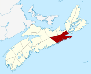
| Name
|
Address
|
Coordinates
|
IDF
|
IDP
|
IDM
|

|
Image
|
| 16 Cameron Road
|
16 Cameron Road, Sherbrooke, NS
|
 45°08′34″N 61°59′12″W / 45.1429°N 61.9866°W / 45.1429; -61.9866 (16 Cameron Road) 45°08′34″N 61°59′12″W / 45.1429°N 61.9866°W / 45.1429; -61.9866 (16 Cameron Road)
|
|
|
14741
|
|

|
| Campbell & MacKeen Law Office
|
146 Main St., Guysborough, NS
|
45°23′38″N 61°30′01″W / 45.394°N 61.5003°W / 45.394; -61.5003 (Campbell & MacKeen Law Office)
|
|
|
14881
|
|
|
| Canso Islands National Historic Site of Canada
|
School Street, Canso, NS
|
45°20′48″N 60°58′15″W / 45.3466°N 60.9707°W / 45.3466; -60.9707 (Canso Islands)
|
14304
|
|
|
|
|
| Christ Church Anglican
|
144 Church Street, Guysborough, NS
|
45°23′21″N 61°29′56″W / 45.3892°N 61.4990°W / 45.3892; -61.4990 (Christ Church Anglican)
|
|
|
14932
|
|
|
| Commercial Cable Building
|
10 Front Street, Hazel Hill, NS
|
45°19′42″N 61°01′40″W / 45.3282°N 61.0278°W / 45.3282; -61.0278 (Commercial Cable Building)
|
|
|
5744
|
|

More images
|
| Government of Canada Building
|
15 Main Street, Sherbrooke, NS
|
45°08′31″N 61°59′00″W / 45.1419°N 61.9832°W / 45.1419; -61.9832 (Government of Canada Building)
|
10973
|
|
|
|
|
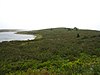
| Grassy Island Fort National Historic Site of Canada
|
, Canso, NS
|
45°20′15″N 60°58′19″W / 45.3374°N 60.972°W / 45.3374; -60.972 (Grassy Island Fort National Historic Site of Canada)
|
11666
|
|
|
|
|
| Harbour House
|
163 Green Street, Guysborough, NS
|
45°23′21″N 61°29′47″W / 45.3893°N 61.4964°W / 45.3893; -61.4964 (Harbour House)
|
|
3407
|
|
|
|
| Heritage Goldenville Society
|
199 Goldenville Road, Goldenville, NS
|
45°07′27″N 62°00′32″W / 45.1243°N 62.009°W / 45.1243; -62.009 (Heritage Goldenville Society)
|
|
|
15156
|
|
|
| Holy Trinity Anglican Church
|
16733 Route 316, Country Harbour Mines, NS
|
45°15′47″N 61°50′54″W / 45.2630°N 61.8484°W / 45.2630; -61.8484 (Holy Trinity Anglican Church)
|
|
|
14935
|
|
|
| Isaac's Harbour United Baptist Church
|
382 Isaac's Harbour Rd, Isaac's Harbour, NS
|
45°10′49″N 61°39′38″W / 45.1803°N 61.6605°W / 45.1803; -61.6605 (Isaac's Harbour United Baptist Church)
|
|
|
14841
|
|
|
| Jost House
|
62 Main Street, Guysborough, NS
|
45°23′28″N 61°29′52″W / 45.3910°N 61.4977°W / 45.3910; -61.4977 (Jost House)
|
|
13539
|
|
|
|
| Jost's Wharf Building
|
, Guysborough, NS
|
45°23′30″N 61°29′53″W / 45.3916°N 61.498°W / 45.3916; -61.498 (Jost's Wharf Building)
|
|
|
14897
|
|
|
| Kirk Memorial United Church
|
1007 Glenelg Church Road, Aspen, NS
|
45°16′51″N 62°04′36″W / 45.2809°N 62.0768°W / 45.2809; -62.0768 (Kirk Memorial United Church)
|
|
|
15161
|
|
|
| Light Tower
|
Country Island, off Seal Harbour, Guysborough County, NS
|
45°05′59″N 61°32′32″W / 45.0997°N 61.5423°W / 45.0997; -61.5423 (Light Tower (Country Island Light))
|
|
|
15161
|
|
|
| Queensport Lighthouse
|
Rook Island, Queensport, NS
|
45°20′53″N 61°16′18″W / 45.3480°N 61.2718°W / 45.3480; -61.2718 (Queensport Lighthouse)
|
2922
20773
|
|
|
|
|
| Lighttower
|
Isaac's Harbour Road, Isaacs Harbour, NS
|
45°09′52″N 61°39′17″W / 45.1645°N 61.6546°W / 45.1645; -61.6546 (Lighttower (Isaac's Harbour Light))
|
4805
|
|
|
|
|
| New Chester Community Club
|
New Chester Road, New Chester, NS
|
45°01′29″N 62°12′37″W / 45.0248°N 62.2103°W / 45.0248; -62.2103 (New Chester Community Club)
|
|
|
15141
|
|
|
| Old Guysborough Court House Museum
|
283 Church Street, Guysborough, NS
|
45°23′21″N 61°29′55″W / 45.3892°N 61.4986°W / 45.3892; -61.4986 (Old Guysborough Court House Museum)
|
|
3053
|
|
|
|
| Laurel Rebekah Lodge
|
, Goldboro, NS
|
45°10′49″N 61°39′02″W / 45.1804°N 61.6506°W / 45.1804; -61.6506 (Laurel Rebekah Lodge)
|
|
|
14901
|
|
|
| The Reynolds Property
|
5525 Hwy 16, Queensport, NS
|
45°14′28″N 61°21′10″W / 45.2412°N 61.3529°W / 45.2412; -61.3529 (The Reynolds Property)
|
|
|
14930
|
|
|
| St. Thomas Church
|
4029 South River Rd, Salmon River Lake, NS
|
45°21′33″N 61°43′13″W / 45.3592°N 61.7204°W / 45.3592; -61.7204 (St. Thomas Church)
|
|
|
14934
|
|
|
| St. Vincent de Paul Church
|
5475 Route 16, Queensport, NS
|
45°20′24″N 61°16′10″W / 45.3399°N 61.2695°W / 45.3399; -61.2695 (St. Vincent de Paul Church)
|
|
|
14933
|
|
|
| Stormont Masonic Lodge #96
|
530 Isaac's Harbour Rd, Isaac's Harbour, NS
|
45°10′29″N 61°39′19″W / 45.1747°N 61.6553°W / 45.1747; -61.6553 (Stormont Masonic Lodge #96)
|
|
|
14898
|
|
|
| Stormont Union Church
|
15324 Route 316, Stormont, NS
|
45°13′50″N 61°45′00″W / 45.2306°N 61.7499°W / 45.2306; -61.7499 (Stormont Union Church)
|
|
|
14936
|
|
|