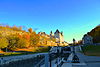
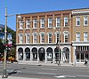
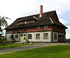
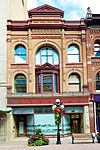
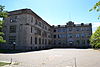
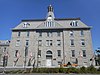
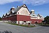
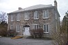
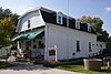
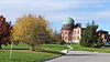
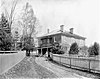
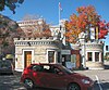
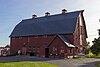
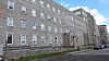
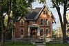
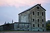
| The Beggs House
|
2323 Roger Stevens Drive, Ottawa (North Gower), ON
|
 45°07′54″N 75°42′57″W / 45.1317°N 75.7159°W / 45.1317; -75.7159 (The Beggs House) 45°07′54″N 75°42′57″W / 45.1317°N 75.7159°W / 45.1317; -75.7159 (The Beggs House)
|
|
|
14209
|
|

|
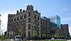
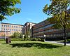
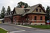
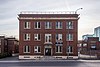
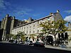
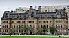
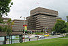
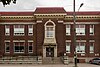
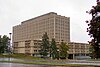
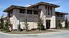
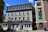
| Building 7; Health Protection Building (Former Department of Health & Welfare, Food and Drug Laboratory)
|
Tunney's Pasture Campus, Ottawa, ON
|
45°24′27″N 75°44′09″W / 45.4076°N 75.7359°W / 45.4076; -75.7359 (Building 7; Health Protection Building (Former Department of Health & Welfare, Food and Drug Laboratory))
|
12897
|
|
|
|

|
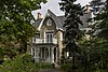
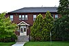
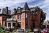
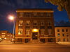
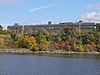
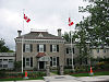
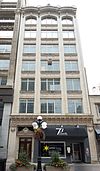
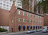
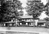
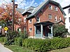
| Cheney House
|
176 Bronson Avenue, Ottawa, ON
|
45°24′52″N 75°42′27″W / 45.4144°N 75.7075°W / 45.4144; -75.7075 (Cheney House)
|
|
|
18596
|
|
|
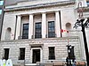
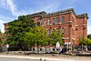
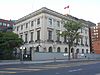
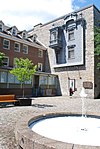
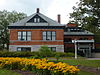
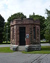
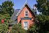
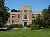
| Commissariat Building
|
3 Canal Lane, Rideau Canal National Historic Site of Canada, Ottawa (Downtown Ottawa), ON
|
45°25′33″N 75°41′52″W / 45.4258°N 75.6978°W / 45.4258; -75.6978 (Commissariat Building)
|
11116
|
|
|
|
More images
|
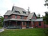
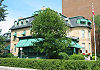
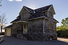
| Davidson House
|
3150 Donnelly Drive, Ottawa, ON
|
45°02′23″N 75°42′22″W / 45.0397°N 75.7062°W / 45.0397; -75.7062 (Davidson House)
|
|
|
10298
|
|
|
| The Kelly House
|
6576 Main Street (Fourth Line), Ottawa (North Gower), ON
|
45°07′58″N 75°43′05″W / 45.1327°N 75.718°W / 45.1327; -75.718 (The Kelly House)
|
|
|
15291
|
|
|
| Martin House
|
6732 Rideau Valley Drive South, Ottawa (Kars), ON
|
45°08′57″N 75°38′49″W / 45.1491°N 75.6470°W / 45.1491; -75.6470 (Martin House)
|
|
|
19796
|
|
|
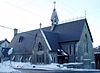
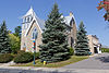
| Trinity United Church
|
6656 Rideau Valley Drive S, Ottawa (Kars), ON
|
45°09′17″N 75°38′56″W / 45.1546°N 75.6489°W / 45.1546; -75.6489 (Trinity United Church)
|
|
|
14208
|
|
|
| Weatherhead House
|
6924 Gallagher Road, Ottawa (), ON
|
45°03′31″N 75°45′46″W / 45.0586°N 75.7627°W / 45.0586; -75.7627 (Weatherhead House)
|
|
|
16323
|
|
|
| Bryan House
|
6700 Rideau Valley Drive South, Ottawa (Kars), ON
|
45°09′08″N 75°38′53″W / 45.1522°N 75.648°W / 45.1522; -75.648 (Bryan House)
|
|
|
10142
|
|
|
| The Weaver's House
|
1131 Mill Street, Ottawa (Manotick), ON
|
45°13′34″N 75°41′01″W / 45.2262°N 75.6837°W / 45.2262; -75.6837 (The Weaver's House)
|
|
|
14212
|
|

|
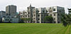
| New Edinburgh Heritage Conservation District
|
along the Rideau River, bounded by Sussex, MacKay, Dufferin and Stanley, Ottawa (New Edinburgh), ON
|
45°26′28″N 75°41′20″W / 45.441°N 75.689°W / 45.441; -75.689 (New Edinburgh Heritage Conservation District)
|
|
|
8447
|
|

|
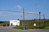
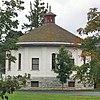
| "N" Division, Stable Building
|
1 Sandridge Rd, Ottawa (Manor Park), ON
|
45°27′24″N 75°39′19″W / 45.4568°N 75.6552°W / 45.4568; -75.6552 ("N" Division, Stable Building)
|
4631
|
|
|
|

|
| Aberdeen Pavilion
|
Capital Ward, Ottawa (The Glebe), ON
|
45°24′0″N 75°40′58″W / 45.40000°N 75.68278°W / 45.40000; -75.68278 (Aberdeen Pavilion)
|
4114
|
|
|
Q4666960
|

More images
|
| Hay House
|
700 Echo Drive, Ottawa (Old Ottawa South), ON
|
45°23′51″N 75°40′47″W / 45.3975309°N 75.679682°W / 45.3975309; -75.679682 (Hay House)
|
|
|
14211
|
|
More images
|
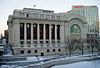
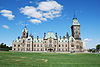
| Victoria Memorial Museum Building (Canadian Museum of Nature)
|
Somerset Ward, Ottawa (Centretown), ON
|
45°24′46″N 75°41′20″W / 45.41278°N 75.68889°W / 45.41278; -75.68889 (Victoria Memorial Museum Building)
|
9657
4483
|
|
|
Q1032232
|
More images
|
| Central Experimental Farm
|
, Ottawa (River Ward), ON
|
45°22′57″N 75°42′49″W / 45.38250°N 75.71361°W / 45.38250; -75.71361 (Central Experimental Farm)
|
13811
|
|
|
Q4504150
|

More images
|
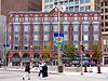
| Château Laurier
|
Rideau-Vanier Ward, Confederation Square, Ottawa (Downtown Ottawa), ON
|
45°25′32″N 75°41′42″W / 45.42556°N 75.69500°W / 45.42556; -75.69500 (Château Laurier)
|
14549
|
|
|
Q2089212
|

More images
|
| CFS Carp (Diefenbunker)
|
, Ottawa (Carp), ON
|
45°21′6″N 76°2′50″W / 45.35167°N 76.04722°W / 45.35167; -76.04722 (CFS Carp)
|
4169
|
|
|
Q5010827
|
More images
|
| Government Conference Centre
|
2 Rideau Street, Ottawa (Sandy Hill), ON
|
45°25′29″N 75°41′37″W / 45.4246°N 75.6937°W / 45.4246; -75.6937 (Government Conference Centre)
|
4305
|
|
|
|
More images
|
| National Research Council of Canada, Building M-12
|
1200 Montreal Road, Ottawa (Rideau-Rockcliffe Ward), ON
|
45°26′54″N 75°37′00″W / 45.4482°N 75.6167°W / 45.4482; -75.6167 (National Research Council of Canada, Building M-12)
|
10160
|
|
|
|
|
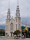
| Notre-Dame Cathedral Basilica
|
Rideau-Vanier Ward, Ottawa (Lowertown), ON
|
45°25′47″N 75°41′47″W / 45.42972°N 75.69639°W / 45.42972; -75.69639 (Notre-Dame Cathedral Basilica)
|
12135
|
|
8448
|
Q1051168
|
More images
|
| Former Ottawa Teachers' College (Ottawa Normal School)
|
, Ottawa (Ottawa City Hall), ON
|
45°25′12″N 75°41′27″W / 45.42000°N 75.69083°W / 45.42000; -75.69083 (Former Ottawa Teachers' College National Historic Site)
|
7437
|
|
|
Q7109219
|

More images
|
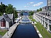
| Rideau Canal
|
Rideau Street, Ottawa / Kingston, Ontario, ON
|
45°25′35″N 75°41′53″W / 45.42639°N 75.69806°W / 45.42639; -75.69806 (Rideau Canal National Historic Site)
|
5727
|
|
|
Q651323
|
More images
|
| Rideau Hall, Complex as a whole
|
1 Sussex Drive, Ottawa (New Edinburgh), ON
|
45°26′38″N 75°41′09″W / 45.4439°N 75.6859°W / 45.4439; -75.6859 (Rideau Hall, Complex as a whole)
|
16881
|
|
|
|

More images
|
| Rideau Hall Visitor Centre
|
11 Rideau Gate, Ottawa (New Edinburgh), ON
|
45°26′39″N 75°41′29″W / 45.4442°N 75.6915°W / 45.4442; -75.6915 (Rideau Hall Visitor Centre)
|
21062
|
|
|
|
|
| Saint Brigid's Church
|
314 St. Patrick Street, Ottawa (Byward Market), ON
|
45°25′53″N 75°41′27″W / 45.4314°N 75.6907°W / 45.4314; -75.6907 (Saint Brigid's Church)
|
|
8906
|
18642
|
|

More images
|
| Church of St. Alban the Martyr
|
125 Daly Street, Ottawa (Sandy Hill), ON
|
45°25′39″N 75°41′06″W / 45.4275°N 75.6849°W / 45.4275; -75.6849 (Church of St. Alban the Martyr)
|
|
10422
|
|
|
More images
|
| Central Heating Plant
|
Tunney's Pasture, Ottawa (Tunney's Pasture), ON
|
45°24′19″N 75°44′15″W / 45.4052°N 75.7374°W / 45.4052; -75.7374 (Central Heating Plant)
|
12921
|
|
|
|

|
| Coach House for Prime Minister's Residence
|
10 Sussex Drive, Ottawa, ON
|
45°26′41″N 75°41′33″W / 45.4447°N 75.6926°W / 45.4447; -75.6926 (Coach House for Prime Minister's Residence)
|
19636
|
|
|
|
|
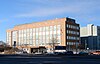
| Statistics Canada - Main Building (Former Dominion Bureau of Statistics Building)
|
, Ottawa (Tunney's Pasture), ON
|
45°24′21″N 75°44′3″W / 45.40583°N 75.73417°W / 45.40583; -75.73417 (Statistics Canada Main Building)
|
13122
|
|
|
Q6735940
|
More images
|
| 304-312 Queen Elizabeth Driveway
|
0, 304-312 Queen Elizabeth Driveway, Ottawa (The Glebe), ON
|
45°24′24″N 75°40′58″W / 45.4067°N 75.6828°W / 45.4067; -75.6828 (304-312 Queen Elizabeth Driveway)
|
|
|
10058
|
|

More images
|
| 41 York Street
|
41 York Street, Ottawa (Byward Market), ON
|
45°25′41″N 75°41′37″W / 45.428°N 75.6936°W / 45.428; -75.6936 (41 York Street)
|
|
|
13413
|
|
|
| 419-423 Sussex Drive
|
419-423 Sussex Drive, Ottawa (Byward Market), ON
|
45°25′50″N 75°41′47″W / 45.4305°N 75.6965°W / 45.4305; -75.6965 (419-423 Sussex Drive)
|
4627
|
|
|
|
|
| Administration Building
|
588 Booth Street, Ottawa (), ON
|
45°23′59″N 75°42′20″W / 45.3998°N 75.7056°W / 45.3998; -75.7056 (Administration Building)
|
11137
|
|
|
|
|
| Arc Biotech Building (No. 34)
|
Central Experimental Farm, Ottawa (River Ward), ON
|
45°23′30.4″N 75°42′47.1″W / 45.391778°N 75.713083°W / 45.391778; -75.713083 (Arc Biotech Building (No. 34))
|
9591
|
|
|
Q24046200
|
More images
|
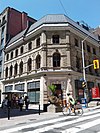
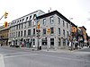
| Bank of Montreal
|
144 Wellington St., Ottawa (Downtown), ON
|
45°25′20″N 75°41′59″W / 45.4222°N 75.6997°W / 45.4222; -75.6997 (Bank of Montreal)
|
16147
|
|
|
|

More images
|
| Bank of Nova Scotia
|
125 Sparks Street, Ottawa (Downtown), ON
|
45°25′21″N 75°41′54″W / 45.4225°N 75.6984°W / 45.4225; -75.6984 (Bank of Nova Scotia)
|
16481
|
|
|
|
More images
|
| Bate Building
|
109-111 Sparks Street, Ottawa (Downtown), ON
|
45°25′22″N 75°41′53″W / 45.4228°N 75.6981°W / 45.4228; -75.6981 (Bate Building)
|
7392
|
|
|
|

More images
|
| Beechwood Cemetery
|
Vanier, Ottawa (Rideau-Rockcliffe Ward), ON
|
45°26′49″N 75°39′36″W / 45.44694°N 75.66000°W / 45.44694; -75.66000 (Beechwood Cemetery)
|
1210
|
|
|
Q4087599
|
More images
|
| Billings Estate
|
, Ottawa (Alta Vista), ON
|
45°23′23″N 75°40′20″W / 45.38972°N 75.67222°W / 45.38972; -75.67222 (Billings Estate)
|
12622
|
|
|
Q4911946
|
More images
|
| Birks Building
|
107 Sparks Street, Ottawa (Downtown), ON
|
45°25′22″N 75°41′52″W / 45.4227°N 75.6979°W / 45.4227; -75.6979 (Birks Building)
|
7391
|
|
|
|
|
| Blackburn Building
|
85 Sparks Street, Ottawa (Downtown), ON
|
45°25′24″N 75°41′50″W / 45.4233°N 75.6973°W / 45.4233; -75.6973 (Blackburn Building)
|
4042
|
|
|
|
More images
|
| Boathouse
|
501 Rockcliffe Driveway, Ottawa, ON
|
45°27′18″N 75°41′15″W / 45.4550°N 75.6876°W / 45.4550; -75.6876 (Boathouse)
|
19615
|
|
|
|
|
| Booth Building
|
165 Sparks Street, Ottawa (Downtown), ON
|
45°25′20″N 75°41′59″W / 45.4222°N 75.6997°W / 45.4222; -75.6997 (Booth Building)
|
4058
|
|
|
|
|
| Booth Street Complex, Surveys and Mapping Building
|
615 Booth Street, Ottawa (Glebe Annex), ON
|
45°24′03″N 75°42′18″W / 45.4007°N 75.705°W / 45.4007; -75.705 (Booth Street Complex, Surveys and Mapping Building)
|
10145
|
|
|
|

More images
|
| Bronson Company Office
|
150 Middle Street, Ottawa (Victoria Island), ON
|
45°25′13″N 75°42′51″W / 45.42014°N 75.71414°W / 45.42014; -75.71414 (Bronson Company Office)
|
4721
|
|
|
|
|
| Brooke Claxton Building
|
Colombine Driveway, Ottawa (Tunney's Pasture), ON
|
45°24′32″N 75°44′14″W / 45.4088°N 75.7373°W / 45.4088; -75.7373 (Brooke Claxton Building)
|
13173
|
|
|
|
|
| Brouse Building
|
181-183 Sparks Street, Ottawa (Downtown), ON
|
45°25′18″N 75°42′01″W / 45.4218°N 75.7003°W / 45.4218; -75.7003 (Brouse Building)
|
4059
|
|
|
|

More images
|
| Burritts Rapids Lockstation, Bridgehouse
|
near Burritts Rapids Lock, on an island between the Rideau River and Canal, Ottawa (Burritts Rapids), ON
|
44°58′50″N 75°47′47″W / 44.9805°N 75.7964°W / 44.9805; -75.7964 (Burritts Rapids Lockstation, Bridgehouse)
|
4713
|
|
|
|
|
| Bus Shelter; Vincent Massey Park
|
701 Heron Road, Ottawa, ON
|
45°22′42″N 75°41′49″W / 45.3782°N 75.6970°W / 45.3782; -75.6970 (Bus Shelter; Vincent Massey Park)
|
21076
|
|
|
|
|
| Byward Market Heritage Conservation District
|
St. Patrick Street, George Street, MacKenzie Avenue, Dalhousie Street, Ottawa (Byward Market), ON
|
45°25′44″N 75°41′35″W / 45.4289°N 75.693°W / 45.4289; -75.693 (Byward Market Heritage Conservation District)
|
|
|
8438
|
|

More images
|
| Canada's Four Corners Building
|
93 Sparks Street, Ottawa (Downtown), ON
|
45°25′23″N 75°41′51″W / 45.423°N 75.6976°W / 45.423; -75.6976 (Canada's Four Corners Building)
|
4640
|
|
|
|
More images
|
| Canadian Imperial Bank of Commerce
|
119 Sparks Street, Ottawa (Downtown), ON
|
45°25′22″N 75°41′54″W / 45.4227°N 75.6984°W / 45.4227; -75.6984 (Canadian Imperial Bank of Commerce)
|
4641
|
|
|
|

More images
|
| Carleton County Court House
|
2, Daly Avenue, Ottawa (Sandy Hill), ON
|
45°25′30″N 75°41′20″W / 45.425°N 75.6889°W / 45.425; -75.6889 (Carleton County Court House)
|
|
|
8442
|
|

More images
|
| Carleton County Gaol
|
75, Nicholas Street, Ottawa (Sandy Hill), ON
|
45°25′30″N 75°41′20″W / 45.425°N 75.6889°W / 45.425; -75.6889 (Carleton County Gaol)
|
|
|
8443
|
|
More images
|
| Carleton Place Town Hall
|
175, Bridge Street, Carleton Place, ON
|
45°14′00″N 75°45′00″W / 45.2333°N 75.75°W / 45.2333; -75.75 (Carleton Place Town Hall)
|
|
|
9810
|
|
More images
|
| Carpenter's Shop
|
, Ottawa (River Ward), ON
|
45°23′2″N 75°42′54″W / 45.38389°N 75.71500°W / 45.38389; -75.71500 (Carpenter's Shop)
|
9604
|
|
|
Q24046202
|

More images
|
| CBC Building
|
1500 Bronson Avenue, Ottawa (Confederation Heights), ON
|
45°22′42″N 75°41′14″W / 45.3784°N 75.6873°W / 45.3784; -75.6873 (CBC Building)
|
1865
|
|
|
|
More images
|
| CEF, Horticulture Building, No. 74
|
74 Central Experimental Farm, Ottawa (River Ward), ON
|
45°23′27″N 75°42′23″W / 45.3907°N 75.7065°W / 45.3907; -75.7065 (CEF, Horticulture Building, No. 74)
|
4692
|
|
|
|

More images
|
| Central Chambers
|
Confederation Square, Ottawa (Downtown Ottawa), ON
|
45°25′24″N 75°41′43″W / 45.42333°N 75.69528°W / 45.42333; -75.69528 (Central Chambers)
|
2857
|
|
|
Q5060536
|
More images
|
| Centretown Heritage Conservation District
|
south of Parliament Hill, north of Queensway corridor, and west of the Rideau Canal, Ottawa (Centretown), ON
|
45°24′53″N 75°41′28″W / 45.4146°N 75.691°W / 45.4146; -75.691 (Centretown Heritage Conservation District)
|
|
|
8439
|
|
More images
|
| Cereal Barn
|
, Ottawa (River Ward), ON
|
45°23′17″N 75°42′32″W / 45.38806°N 75.70889°W / 45.38806; -75.70889 (Cereal Barn)
|
14830
|
|
|
Q24046225
|
More images
|
| Cereal Crops Building
|
CEF campus Building 75, Ottawa, ON
|
45°23′21″N 75°42′32″W / 45.3892°N 75.7088°W / 45.3892; -75.7088 (Cereal Crops Building)
|
11056
|
|
|
|
|
| Service Building
|
CEF campus Building 56, Ottawa, ON
|
45°23′21″N 75°42′34″W / 45.3891°N 75.7094°W / 45.3891; -75.7094 (Service Building)
|
4658
|
|
|
|

|
| K.W. Neatby Building
|
, Ottawa (River Ward), ON
|
45°23′33″N 75°43′0″W / 45.39250°N 75.71667°W / 45.39250; -75.71667 (K.W. Neatby Building)
|
4673
|
|
|
Q6323030
|
More images
|
| Chemical Radioactive Ores Building
|
555 Booth Street, Ottawa (Glebe Annex), ON
|
45°24′08″N 75°42′22″W / 45.4023°N 75.7061°W / 45.4023; -75.7061 (Chemical Radioactive Ores Building)
|
9828
|
|
|
|
|
| Commercial Building
|
13-15 Clarence Street, Ottawa, ON
|
45°25′42″N 75°41′42″W / 45.4282°N 75.6950°W / 45.4282; -75.6950 (Commercial Building (13-15 Clarence Street))
|
4726
|
|
|
|
|
| Commercial Building
|
461-456 Sussex Drive, Ottawa, ON
|
45°25′42″N 75°41′44″W / 45.4282°N 75.6956°W / 45.4282; -75.6956 (Commercial Building (461-465 Sussex Drive))
|
11408
|
|
|
|

|
| Commercial Building
|
457-459 Sussex Drive, Ottawa (Byward Market), ON
|
45°25′42″N 75°41′44″W / 45.4283°N 75.6955°W / 45.4283; -75.6955 (Commercial Building (457-459 Sussex Drive))
|
4715
|
|
|
|

|
| Confederation Building
|
229 Wellington Street (Downtown), Ottawa, ON
|
45°25′19″N 75°42′10″W / 45.422°N 75.7028°W / 45.422; -75.7028 (Confederation Building)
|
3586
|
|
|
|
More images
|
| Confederation Square
|
Somerset Ward, Ottawa (Downtown), ON
|
45°25′26″N 75°41′44″W / 45.42389°N 75.69556°W / 45.42389; -75.69556 (Confederation Square)
|
12073
|
|
|
Q4365607
|
More images
|
| Connaught Building
|
550 Sussex Drive, Ottawa (Byward Market), ON
|
45°25′37″N 75°41′43″W / 45.427°N 75.6952°W / 45.427; -75.6952 (Connaught Building)
|
4029
4165
|
|
|
|
More images
|
| Dairy Technology Annex
|
Building 57, Central Experimental Farm, Ottawa (River Ward), ON
|
45°23′02″N 75°42′54″W / 45.384°N 75.715°W / 45.384; -75.715 (Dairy Technology Annex)
|
4637
|
|
|
|

More images
|
| Defensible Lockmaster's House
|
at the top of the Hartwell Locks, Ottawa (River Ward), ON
|
45°23′02″N 75°42′00″W / 45.384°N 75.7°W / 45.384; -75.7 (Defensible Lockmaster's House)
|
11055
|
|
|
|

More images
|
| Store House
|
Hartwell Locks, Ottawa (River Ward), ON
|
45°23′03″N 75°42′03″W / 45.3841°N 75.7007°W / 45.3841; -75.7007 (Store House)
|
11054
|
|
|
|
|
| Dominion Observatory
|
Central Experimental Farm, bounded by Carling Avenue and Observatory Drive, Ottawa (River Ward), ON
|
45°23′37″N 75°42′51″W / 45.3936°N 75.7143°W / 45.3936; -75.7143 (Dominion Observatory)
|
4376
|
|
|
|

More images
|
| Dover Building
|
185-187 Sparks Street, Ottawa (Downtown), ON
|
45°25′18″N 75°42′01″W / 45.4218°N 75.7004°W / 45.4218; -75.7004 (Dover Building)
|
4643
|
|
|
|
More images
|
| Drill Hall
|
1 Cartier Square, Ottawa, ON
|
45°25′18″N 75°41′21″W / 45.4217°N 75.6892°W / 45.4217; -75.6892 (Drill Hall)
|
15942
|
|
|
|

More images
|
| Earnscliffe
|
, Ottawa (Lower Town), ON
|
45°26′15″N 75°41′56″W / 45.43750°N 75.69889°W / 45.43750; -75.69889 (Earnscliffe)
|
12684
|
|
|
Q5326955
|

More images
|
| East Memorial Building
|
284 Wellington Street, Ottawa (Downtown), ON
|
45°25′12″N 75°42′17″W / 45.42°N 75.7048°W / 45.42; -75.7048 (East Memorial Building)
|
9541
|
|
|
|

More images
|
| EMR Complex: Fuel Testing Laboratory
|
562 Booth Street, Ottawa (Glebe Annex), ON
|
45°24′07″N 75°42′23″W / 45.4019°N 75.7063°W / 45.4019; -75.7063 (EMR Complex: Fuel Testing Laboratory)
|
4666
|
|
|
|
More images
|
| Energy, Mines and Resources Complex, Ore Dressing Laboratory
|
552 Booth Street, Ottawa (Glebe Annex), ON
|
45°14′56″N 75°25′21″W / 45.249°N 75.4225°W / 45.249; -75.4225 (Energy, Mines and Resources Complex, Ore Dressing Laboratory)
|
4667
|
|
|
|
More images
|
| Engineering Research Building
|
Central Experimental Farm, Ottawa (River Ward), ON
|
45°23′18″N 75°42′40″W / 45.3883°N 75.711°W / 45.3883; -75.711 (Engineering Research Building)
|
9505
|
|
|
|

More images
|
| First Avenue Public School
|
73 First Avenue, Ottawa (The Glebe), ON
|
45°24′22″N 75°41′07″W / 45.4061°N 75.6852°W / 45.4061; -75.6852 (First Avenue Public School)
|
|
|
10299
|
|
More images
|
| Forintek Building
|
800 Montreal Road, Ottawa (Rideau-Rockcliffe Ward), ON
|
45°26′39″N 75°38′02″W / 45.4441°N 75.634°W / 45.4441; -75.634 (Forintek Building)
|
4659
|
|
|
|
|
| Former Archives Building and former War Museum
|
Former Archives Building, Ottawa (Lower Town), ON
|
45°25′50″N 75°41′55″W / 45.43056°N 75.69861°W / 45.43056; -75.69861 (Former Archives Building)
|
3462
13220
|
|
|
Q5570166
|
More images
|
| Former Geological Survey of Canada Building
|
, Ottawa (Byward Market), ON
|
45°25′35″N 75°41′38″W / 45.42639°N 75.69389°W / 45.42639; -75.69389 (Former Geological Survey of Canada Building)
|
4649
1142
|
|
|
Q15218037
|
More images
|
| Former NCC Building (demolished)
|
401 Lebreton Street, Ottawa (Glebe Annex), ON
|
45°24′01″N 75°42′09″W / 45.4002°N 75.7025°W / 45.4002; -75.7025 (Former NCC Building (demolished))
|
4661
|
|
|
|
|
| Former Ottawa City Hall
|
111 Sussex Drive, Ottawa (Green Island), ON
|
45°26′23″N 75°41′38″W / 45.4398°N 75.694°W / 45.4398; -75.694 (Former Ottawa City Hall)
|
6629
|
|
|
|

More images
|
| Former U.S. Embassy
|
100 Wellington Street, Ottawa (Downtown), ON
|
45°25′24″N 75°41′54″W / 45.4232°N 75.6984°W / 45.4232; -75.6984 (Former U.S. Embassy)
|
15144
|
|
|
|
|
| Fraser School House
|
62 John Street, Ottawa (New Edinburgh), ON
|
45°26′33″N 75°41′36″W / 45.4425°N 75.6932°W / 45.4425; -75.6932 (Fraser School House)
|
4694
|
|
|
|

|
| Fry House
|
4148 Donnelly Drive, Ottawa (Burritts Rapids), ON
|
44°59′27″N 75°46′28″W / 44.9909°N 75.7745°W / 44.9909; -75.7745 (Fry House)
|
|
|
15269
|
|
|
| Geological Survey of Canada Building
|
601 Booth Street, Ottawa (Glebe Annex), ON
|
45°23′59″N 75°42′20″W / 45.3998°N 75.7056°W / 45.3998; -75.7056 (Geological Survey of Canada Building)
|
11135
|
|
|
|
|
| George Sparks House
|
936-940 River Road, Ottawa (Manotick), ON
|
45°14′12″N 75°41′09″W / 45.2368°N 75.6859°W / 45.2368; -75.6859 (George Sparks House)
|
4630
|
|
|
|
|
| Gilroy Farm
|
7406 Gilroy Road, Ottawa (Burritts Rapids), ON
|
44°58′09″N 75°49′43″W / 44.9693°N 75.8285°W / 44.9693; -75.8285 (Gilroy Farm)
|
|
|
10300
|
|
|
| Hangar H 11 / VIP Reception Building
|
Ottawa International Airport, Ottawa (Gloucester-Southgate Ward), ON
|
45°19′N 75°40′W / 45.32°N 75.66°W / 45.32; -75.66 (Hangar H 11 / VIP Reception Building)
|
2740
|
|
|
|
|
| Hangar H 14
|
Ottawa International Airport, Ottawa (Gloucester-Southgate Ward), ON
|
45°19′N 75°40′W / 45.32°N 75.66°W / 45.32; -75.66 (Hangar H 14)
|
2751
|
|
|
|
|
| Health Care Centre
|
Valour Drive, Ottawa (Riverview), ON
|
45°24′06″N 75°39′33″W / 45.4016°N 75.6593°W / 45.4016; -75.6593 (Health Care Centre)
|
1889
|
|
|
|
|
| Heritage House (Building 54)
|
Central Experimental Farm National Historic Site, Ottawa (River Ward), ON
|
45°23′22″N 75°42′39″W / 45.38946°N 75.71095°W / 45.38946; -75.71095 (Heritage House (Building 54))
|
9612
|
|
|
|

More images
|
| Heritage House, No. 60
|
Central Experimental Farm, Ottawa (River Ward), ON
|
45°23′25″N 75°42′31″W / 45.3904°N 75.7085°W / 45.3904; -75.7085 (Heritage House, No. 60)
|
4711
|
|
|
|
More images
|
| Hollywood Parade
|
103 James Street, Ottawa, ON
|
45°24′42″N 75°41′55″W / 45.4118°N 75.6986°W / 45.4118; -75.6986 (Hollywood Parade)
|
|
18640
|
|
|
|
| Hope Building
|
61-63 Sparks Street, Ottawa (Downtown), ON
|
45°25′25″N 75°41′48″W / 45.4235°N 75.6966°W / 45.4235; -75.6966 (Hope Building)
|
4632
|
|
|
|
More images
|
| Horticulture Building
|
Building 55, Central Experimental Farm, Ottawa (River Ward), ON
|
45°23′20″N 75°42′40″W / 45.389°N 75.711°W / 45.389; -75.711 (Horticulture Building)
|
4653
|
|
|
|
More images
|
| Industrial Minerals and Ceramics
|
405 Rochester Street, Ottawa (Glebe Annex), ON
|
45°24′09″N 75°42′28″W / 45.4025°N 75.7077°W / 45.4025; -75.7077 (Industrial Minerals and Ceramics)
|
4671
|
|
|
|
More images
|
| Jeanne D'Arc Institute
|
493 Sussex Drive, Ottawa (Byward Market), ON
|
45°25′40″N 75°41′42″W / 45.4277°N 75.695°W / 45.4277; -75.695 (Jeanne D'Arc Institute)
|
4647
|
|
|
|
|
| John R. Booth Residence National Historic Site
|
252 Metcalfe Street, Ottawa (Centretown), ON
|
45°24′59″N 75°41′32″W / 45.4164°N 75.6922°W / 45.4164; -75.6922 (John R. Booth Residence National Historic Site)
|
12018
|
|
|
|

|
| Justice Building
|
294 Wellington Street, Ottawa (Downtown), ON
|
45°25′17″N 75°42′14″W / 45.4215°N 75.7038°W / 45.4215; -75.7038 (Justice Building)
|
4688
|
|
|
|

|
| La Salle Academy
|
373 Sussex Drive, Ottawa (Lower Town), ON
|
45°15′06″N 75°25′19″W / 45.2518°N 75.4219°W / 45.2518; -75.4219 (La Salle Academy)
|
3563
|
|
|
|
|
| Laboratory Services Building No. 22
|
Central Experimental Farm, Ottawa (River Ward), ON
|
45°23′31″N 75°43′08″W / 45.3919°N 75.7188°W / 45.3919; -75.7188 (Laboratory Services Building No. 22)
|
4655
|
|
|
|

|
| Langevin Block
|
62 Wellington Street, Ottawa (Downtown), ON
|
45°25′25″N 75°41′51″W / 45.4237°N 75.6974°W / 45.4237; -75.6974 (Langevin Block)
|
4031
|
|
|
|
|
| Langevin Block National Historic Site
|
80 Wellington Street, Ottawa (Downtown), ON
|
45°25′25″N 75°41′50″W / 45.4235°N 75.6972°W / 45.4235; -75.6972 (Langevin Block National Historic Site)
|
14127
|
|
|
|

More images
|
| Larocque-Lafortune College
|
445-447 Sussex Drive, Ottawa (Byward Market), ON
|
45°25′43″N 75°41′45″W / 45.4286°N 75.6957°W / 45.4286; -75.6957 (Larocque-Lafortune College)
|
4716
|
|
|
|
More images
|
| Laurier House
|
335 Laurier Avenue East, Ottawa (Sandy Hill), ON
|
45°25′39″N 75°40′40″W / 45.4275°N 75.6779°W / 45.4275; -75.6779 (Laurier House)
|
4038
7634
|
|
|
|
More images
|
| Lester B. Pearson Building
|
125 Sussex Drive, Ottawa, ON
|
45°26′14″N 75°41′46″W / 45.4371°N 75.6962°W / 45.4371; -75.6962 (Lester B. Pearson Building)
|
19637
|
|
|
|
|
| Lindsay House
|
6722 Rideau Valley Drive South, Ottawa (Kars), ON
|
45°09′01″N 75°38′51″W / 45.1503°N 75.6474°W / 45.1503; -75.6474 (Lindsay House)
|
|
|
10302
|
|
|
| Lisgar Collegiate Institute
|
29 Lisgar Street, Ottawa (Golden Triangle), ON
|
45°25′13″N 75°41′20″W / 45.4204°N 75.689°W / 45.4204; -75.689 (Lisgar Collegiate Institute)
|
|
|
15277
|
|
More images
|
| Lock Office
|
upper end of the Ottawa Locks, Ottawa (Downtown), ON
|
45°25′30″N 75°41′45″W / 45.4249°N 75.6958°W / 45.4249; -75.6958 (Lock Office)
|
11088
|
|
|
|

|
| Lowertown West Heritage Conservation District
|
North of the Byward Market, south of the Ottawa River and east of the Rideau Canal, Ottawa (Lowertown), ON
|
45°25′59″N 75°41′38″W / 45.433°N 75.694°W / 45.433; -75.694 (Lowertown West Heritage Conservation District)
|
|
|
8446
|
|

More images
|
| Machine Shop (#4)
|
Observatory Campus, Central Experimental Farm, Ottawa (River Ward), ON
|
45°23′02″N 75°42′54″W / 45.384°N 75.715°W / 45.384; -75.715 (Machine Shop (#4))
|
4701
|
|
|
|
|
| MacKay Castle
|
1 Sussex Drive, Ottawa (New Edinburgh), ON
|
45°26′41″N 75°41′29″W / 45.444611°N 75.691457°W / 45.444611; -75.691457 (MacKay Castle)
|
4302
|
|
|
|

More images
|
| Main Dairy Barn
|
Building 88 Central Experimental Farm, Ottawa (River Ward), ON
|
45°23′19″N 75°42′37″W / 45.3886°N 75.7104°W / 45.3886; -75.7104 (Main Dairy Barn)
|
3460
|
|
|
|
More images
|
| Main Greenhouse Range
|
Central Experimental Farm, Ottawa (River Ward), ON
|
45°23′25″N 75°42′43″W / 45.3902°N 75.712°W / 45.3902; -75.712 (Main Greenhouse Range)
|
4670
|
|
|
|

More images
|
| Maintenance Building
|
Major's Hill Park, Ottawa (Byward Market), ON
|
45°25′42″N 75°41′56″W / 45.4283°N 75.6989°W / 45.4283; -75.6989 (Maintenance Building)
|
9947
|
|
|
|
More images
|
| Manotick United Church
|
5567 Manotick Main Street, Ottawa (Manotick), ON
|
45°13′27″N 75°40′57″W / 45.2242°N 75.6826°W / 45.2242; -75.6826 (Manotick United Church)
|
|
|
10308
|
|
More images
|
| Mansfield Building
|
481 Sussex Drive, Ottawa (Byward Market), ON
|
45°25′40″N 75°41′42″W / 45.4277°N 75.695°W / 45.4277; -75.695 (Mansfield Building)
|
4645
|
|
|
|

|
| Maplelawn
|
529 Richmond Road, Ottawa (Westboro), ON
|
45°23′17″N 75°45′41″W / 45.3881°N 75.7614°W / 45.3881; -75.7614 (Maplelawn)
|
15836
|
|
|
|
|
| Maplelawn & Gardens National Historic Site
|
529 Richmond Road, Ottawa (Westboro), ON
|
45°23′18″N 75°45′42″W / 45.3883°N 75.7617°W / 45.3883; -75.7617 (Maplelawn & Gardens National Historic Site)
|
16461
|
|
|
|
More images
|
| Marlborough Township Office
|
3048 Pierce Road, Ottawa (Malakoff), ON
|
45°05′30″N 75°45′26″W / 45.0916°N 75.7571°W / 45.0916; -75.7571 (Marlborough Township Office)
|
|
|
10309
|
|
|
| Marshall Building
|
14 Metcalfe Street, Ottawa (Downtown), ON
|
45°25′23″N 75°41′52″W / 45.4231°N 75.6978°W / 45.4231; -75.6978 (Marshall Building)
|
4718
|
|
|
|
|
| May Building
|
489 Sussex Drive, Ottawa (Byward Market), ON
|
45°25′39″N 75°41′42″W / 45.4276°N 75.6949°W / 45.4276; -75.6949 (May Building)
|
4648
|
|
|
|
|
| Miller's Oven
|
1137 Mill Street, Ottawa (Manotick), ON
|
45°13′34″N 75°41′02″W / 45.2262°N 75.684°W / 45.2262; -75.684 (Miller's Oven)
|
|
|
10310
|
|
More images
|
| Monastère du Précieux Sang
|
774 Echo Drive, Ottawa (Old Ottawa South), ON
|
45°23′54″N 75°40′44″W / 45.3982°N 75.679°W / 45.3982; -75.679 (Monastère du Précieux Sang)
|
|
|
10311
|
|
|
| Mutchmor Public School
|
185 Fifth Avenue, Ottawa (The Glebe), ON
|
45°24′03″N 75°41′25″W / 45.4008°N 75.6904°W / 45.4008; -75.6904 (Mutchmor Public School)
|
|
|
18490
|
|
|
| National Arts Centre National Historic Site
|
53 Elgin Street, Ottawa (Downtown Ottawa), ON
|
45°25′25″N 75°41′36″W / 45.4235°N 75.6934°W / 45.4235; -75.6934 (National Arts Centre National Historic Site)
|
9091
|
|
|
|

|
| National Press Building
|
150 Wellington St. / Sparks Street, Ottawa (Downtown), ON
|
45°25′20″N 75°42′01″W / 45.4223°N 75.7003°W / 45.4223; -75.7003 (National Press Building)
|
4690
|
|
|
|

|
| National Research Council Canada Laboratories
|
100 Sussex Drive, Ottawa (Lowertown), ON
|
45°26′19″N 75°41′51″W / 45.4386°N 75.6976°W / 45.4386; -75.6976 (National Research Council Canada Laboratories)
|
4030
|
|
|
|
More images
|
| National Research Council of Canada, Building M-20
|
1200 Montreal Road, Ottawa (Rideau-Rockcliffe Ward), ON
|
45°26′51″N 75°37′12″W / 45.4476°N 75.6201°W / 45.4476; -75.6201 (National Research Council of Canada, Building M-20)
|
10794
|
|
|
|
|
| North Gower Old Town Hall
|
6581 Fourth Line Road, Ottawa (North Gower), ON
|
45°07′58″N 75°43′04″W / 45.1327°N 75.7177°W / 45.1327; -75.7177 (North Gower Old Town Hall)
|
|
|
10312
|
|
|
| Nutrition Building
|
Central Experimental Farm, Ottawa (River Ward), ON
|
45°23′25″N 75°42′30″W / 45.3902°N 75.7082°W / 45.3902; -75.7082 (Nutrition Building)
|
4709
|
|
|
|
More images
|
| Observatory House
|
Central Experimental Farm, Ottawa (River Ward), ON
|
45°23′38″N 75°42′48″W / 45.3939°N 75.7132°W / 45.3939; -75.7132 (Observatory House)
|
4704
|
|
|
|
|
| Office Building
|
35 George Street, Ottawa (Byward Market), ON
|
45°25′37″N 75°41′35″W / 45.427°N 75.6931°W / 45.427; -75.6931 (Office Building (35 George Street))
|
4717
|
|
|
|
|
| Office Building
|
17-19 York Street, Ottawa, ON
|
45°25′40″N 75°41′39″W / 45.4277°N 75.6943°W / 45.4277; -75.6943 (Office Building (17-19 York Street))
|
4719
|
|
|
|
|
| Official Guest Residence
|
7 Rideau Gate, Ottawa (New Edinburgh), ON
|
45°26′39″N 75°41′32″W / 45.4441°N 75.6921°W / 45.4441; -75.6921 (Official Guest Residence)
|
4650
|
|
|
|
|
| Ore Dressing Laboratory (550 Booth Street)
|
552 Booth Street, Ottawa (Glebe Annex), ON
|
45°24′08″N 75°42′23″W / 45.4021°N 75.7065°W / 45.4021; -75.7065 (Ore Dressing Laboratory (550 Booth Street))
|
4665
|
|
|
|
|
| Ottawa Electric Railway Company Steam Plant
|
Middle Street, Ottawa (Victoria Island), ON
|
45°25′11″N 75°42′58″W / 45.4196°N 75.716°W / 45.4196; -75.716 (Ottawa Electric Railway Company Steam Plant)
|
4714
|
|
|
|
|
| Ottawa Hydro Generating Station No. 2
|
Mill Street, Ottawa (Victoria Island), ON
|
45°25′09″N 75°42′49″W / 45.4193°N 75.7137°W / 45.4193; -75.7137 (Ottawa Hydro Generating Station No. 2)
|
4360
|
|
|
|

More images
|
| Parkdale Fire Station
|
424 Parkdale Avenue, Ottawa (Wellington Street West), ON
|
45°23′59″N 75°43′44″W / 45.3998°N 75.7289°W / 45.3998; -75.7289 (Parkdale Fire Station)
|
|
|
1199
|
|

More images
|
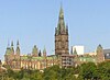
| Parliament Hill
|
, Ottawa (Downtown), ON
|
45°25′29″N 75°41′58″W / 45.42472°N 75.69944°W / 45.42472; -75.69944 (Parliament Hill)
|
17943
18470
|
|
|
Q1589289
|

More images
|
| Centre Block
|
, Ottawa (Downtown), ON
|
45°25′30″N 75°41′59″W / 45.42500°N 75.69972°W / 45.42500; -75.69972 (Parliament Hill (Centre Block))
|
4675
|
|
|
Q5062237
|

More images
|
| East Block
|
, Ottawa (Downtown), ON
|
45°25′29″N 75°41′51″W / 45.42472°N 75.69750°W / 45.42472; -75.69750 (Parliament Hill (East Block))
|
4680
|
|
|
Q5327883
|
More images
|
| Library of Parliament
|
, Ottawa (Downtown), ON
|
45°25′32″N 75°42′1″W / 45.42556°N 75.70028°W / 45.42556; -75.70028 (Library of Parliament)
|
4679
|
|
|
Q1125633
|

More images
|
| West Block
|
Parliament Hill, Ottawa (Downtown), ON
|
45°25′24″N 75°42′2″W / 45.42333°N 75.70056°W / 45.42333; -75.70056 (Parliament Hill (West Block))
|
4681
|
|
|
Q7984482
|
More images
|
| Patterson Creek Pavilion
|
Linden Terrace, Ottawa (The Glebe), ON
|
45°24′29″N 75°40′57″W / 45.4081°N 75.6825°W / 45.4081; -75.6825 (Patterson Creek Pavilion)
|
4677
|
|
|
|

More images
|
| Pavilion A
|
1495 Heron Road, Ottawa (Alta Vista), ON
|
45°22′52″N 75°39′10″W / 45.3812°N 75.6527°W / 45.3812; -75.6527 (Pavilion A)
|
13968
|
|
|
|
|
| Pavilion B
|
1495 Heron Road, Ottawa (Alta Vista), ON
|
45°22′53″N 75°39′10″W / 45.3813°N 75.6527°W / 45.3813; -75.6527 (Pavilion B)
|
13043
|
|
|
|
|
| Pavilion C at the Federal Study Centre
|
1495 Heron Road, Ottawa (Alta Vista), ON
|
45°22′53″N 75°39′10″W / 45.3814°N 75.6527°W / 45.3814; -75.6527 (Pavilion C at the Federal Study Centre)
|
15841
|
|
|
|
|
| Pavilion D at the Federal Study Centre
|
1495 Heron Road, Ottawa (Alta Vista), ON
|
45°22′53″N 75°39′10″W / 45.3815°N 75.6527°W / 45.3815; -75.6527 (Pavilion D at the Federal Study Centre)
|
15842
|
|
|
|
|
| Pavilion E at the Federal Study Centre
|
1495 Heron Road, Ottawa (Alta Vista), ON
|
45°22′54″N 75°39′10″W / 45.3816°N 75.6527°W / 45.3816; -75.6527 (Pavilion E at the Federal Study Centre)
|
15843
|
|
|
|
|
| Pavilion F at the Federal Study Centre
|
1495 Heron Road, Ottawa (Alta Vista), ON
|
45°22′53″N 75°39′09″W / 45.3814°N 75.6525°W / 45.3814; -75.6525 (Pavilion F at the Federal Study Centre)
|
15844
|
|
|
|
|
| Pavilion H at the Federal Study Centre
|
1495 Heron Road, Ottawa (Alta Vista), ON
|
45°22′53″N 75°39′09″W / 45.3814°N 75.6526°W / 45.3814; -75.6526 (Pavilion H at the Federal Study Centre)
|
15846
|
|
|
|
|
| Pavilion I at the Federal Study Centre
|
1495 Heron Road, Ottawa (Alta Vista), ON
|
45°22′53″N 75°39′10″W / 45.3814°N 75.6528°W / 45.3814; -75.6528 (Pavilion I at the Federal Study Centre)
|
15847
|
|
|
|
|
| Pavilion J at the Federal Study Centre
|
1495 Heron Road, Ottawa (Alta Vista), ON
|
45°22′53″N 75°39′10″W / 45.3814°N 75.6529°W / 45.3814; -75.6529 (Pavilion J at the Federal Study Centre)
|
15854
|
|
|
|
|
| Pavilion K at the Federal Study Centre
|
1495 Heron Road, Ottawa (Alta Vista), ON
|
45°22′53″N 75°39′09″W / 45.3813°N 75.6525°W / 45.3813; -75.6525 (Pavilion K at the Federal Study Centre)
|
15855
|
|
|
|
|
| Pavilion L at the Federal Study Centre
|
1495 Heron Road, Ottawa (Alta Vista), ON
|
45°22′53″N 75°39′09″W / 45.3813°N 75.6526°W / 45.3813; -75.6526 (Pavilion L at the Federal Study Centre)
|
15857
|
|
|
|
|
| Photo Equatorial Building
|
Central Experimental Farm, Ottawa (River Ward), ON
|
45°23′36″N 75°42′50″W / 45.3934°N 75.714°W / 45.3934; -75.714 (Photo Equatorial Building)
|
4378
|
|
|
|

More images
|
| Physical Metallurgy Laboratory, Building A
|
568 Booth Street, Ottawa (Glebe Annex), ON
|
45°24′05″N 75°42′22″W / 45.4015°N 75.7061°W / 45.4015; -75.7061 (Physical Metallurgy Laboratory, Building A)
|
4698
|
|
|
|
|
| Physical Metallurgy Laboratory, Building B
|
568 Booth Street, Ottawa (Glebe Annex), ON
|
45°24′05″N 75°42′22″W / 45.4013°N 75.7062°W / 45.4013; -75.7062 (Physical Metallurgy Laboratory, Building B)
|
4699
|
|
|
|
|
| Physical Metallurgy Laboratory, Building C
|
568 Booth Street, Ottawa (Glebe Annex), ON
|
45°24′06″N 75°42′23″W / 45.4016°N 75.7065°W / 45.4016; -75.7065 (Physical Metallurgy Laboratory, Building C)
|
4702
|
|
|
|
|
| Physical Metallurgy Laboratory, Building D
|
568 Booth Street, Ottawa (Glebe Annex), ON
|
45°24′04″N 75°42′24″W / 45.4011°N 75.7067°W / 45.4011; -75.7067 (Physical Metallurgy Laboratory, Building D)
|
4705
|
|
|
|
|
| Physical Metallurgy Laboratory, Building E
|
568 Booth Street, Ottawa (Glebe Annex), ON
|
45°24′05″N 75°42′25″W / 45.4014°N 75.707°W / 45.4014; -75.707 (Physical Metallurgy Laboratory, Building E)
|
4708
|
|
|
|
|
| Postal Station B
|
47-59 Sparks Street, Ottawa (Downtown), ON
|
45°25′25″N 75°41′47″W / 45.4236°N 75.6963°W / 45.4236; -75.6963 (Postal Station B)
|
16388
|
|
|
|

More images
|
| Potting Shed
|
CEF campus Building 77, Ottawa, ON
|
45°23′17″N 75°42′35″W / 45.3881°N 75.7097°W / 45.3881; -75.7097 (Potting Shed)
|
11345
|
|
|
|
|
| Prime Minister's Residence
|
24 Sussex Drive, Ottawa (New Edinburgh), ON
|
45°26′40″N 75°41′38″W / 45.4444°N 75.6938°W / 45.4444; -75.6938 (Prime Minister's Residence)
|
4298
|
|
|
|
More images
|
| Public Archives and National Library Building
|
395 Wellington Street, Ottawa (Downtown), ON
|
45°25′11″N 75°42′28″W / 45.4196°N 75.7078°W / 45.4196; -75.7078 (Public Archives and National Library Building)
|
13053
|
|
|
|
|
| Public Grounds of the Parliament Buildings National Historic Site
|
Wellington St, Ottawa (Downtown), ON
|
45°25′29″N 75°41′58″W / 45.4246°N 75.6995°W / 45.4246; -75.6995 (Public Grounds of the Parliament Buildings National Historic Site)
|
17422
|
|
|
|

|
| Refreshment Stand
|
Hogs Back, Ottawa (River Ward), ON
|
45°22′18″N 75°41′46″W / 45.3716°N 75.696°W / 45.3716; -75.696 (Refreshment Stand)
|
4664
|
|
|
|
More images
|
| Residence
|
9 Rideau Gate Street, Ottawa (New Edinburgh), ON
|
45°26′37″N 75°41′12″W / 45.4436°N 75.6867°W / 45.4436; -75.6867 (Residence)
|
9656
|
|
|
|
|
| Revere Hotel
|
475 Sussex Drive, Ottawa (Byward Market), ON
|
45°25′40″N 75°41′43″W / 45.4279°N 75.6952°W / 45.4279; -75.6952 (Revere Hotel)
|
4644
|
|
|
|
|
| Rideau Cottage
|
, Ottawa (New Wdinburgh), ON
|
45°26′37.291″N 75°40′57.857″W / 45.44369194°N 75.68273806°W / 45.44369194; -75.68273806 (Rideau Cottage)
|
4652
|
|
|
Q21209442
|
More images
|
| Rideau Hall and Landscaped Grounds National Historic Site
|
1 Sussex Drive, Ottawa (New Edinburgh), ON
|
45°26′41″N 75°41′30″W / 45.4448°N 75.6918°W / 45.4448; -75.6918 (Rideau Hall and Landscaped Grounds National Historic Site)
|
7692
|
|
|
|
|
| Rideau Hall, Cricket Clubhouse
|
1 Sussex Drive, Ottawa (New Edinburgh), ON
|
45°26′32″N 75°41′13″W / 45.4422°N 75.6869°W / 45.4422; -75.6869 (Rideau Hall, Cricket Clubhouse)
|
4662
|
|
|
|
|
| Rideau Hall, Dairy Building
|
1 Sussex Drive, Ottawa (New Edinburgh), ON
|
45°26′38″N 75°41′13″W / 45.444°N 75.687°W / 45.444; -75.687 (Rideau Hall, Dairy Building)
|
4657
|
|
|
|
|
| Rideau Hall, Gasometer
|
1 Sussex Drive, Ottawa (New Edinburgh), ON
|
45°26′39″N 75°41′13″W / 45.4442°N 75.687°W / 45.4442; -75.687 (Rideau Hall, Gasometer)
|
4656
|
|
|
|
|
| Rideau Hall, Gate Lodge
|
1 Sussex Drive, Ottawa (New Edinburgh), ON
|
45°26′41″N 75°41′30″W / 45.4446°N 75.6916°W / 45.4446; -75.6916 (Rideau Hall, Gate Lodge)
|
4654
|
|
|
|

|
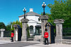
| Rideau Hall, Main Gate
|
1 Sussex Drive, Ottawa (New Edinburgh), ON
|
45°26′40″N 75°41′30″W / 45.4445°N 75.6918°W / 45.4445; -75.6918 (Rideau Hall, Main Gate)
|
4304
|
|
|
|
More images
|
| Rideau Hall, Secondary gates and fences
|
1 Sussex Drive, Ottawa (New Edinburgh), ON
|
45°26′38″N 75°41′15″W / 45.444°N 75.6875°W / 45.444; -75.6875 (Rideau Hall, Secondary gates and fences)
|
9815
|
|
|
|
|
| Rochon Residence
|
138 St. Patrick Street, Ottawa (Byward Market), ON
|
45°25′45″N 75°41′47″W / 45.4293°N 75.6964°W / 45.4293; -75.6964 (Rochon Residence)
|
4720
|
|
|
|

|
| Rockcliffe Pavilion
|
Rockcliffe Parkway, Ottawa (Rockcliffe Park), ON
|
45°26′38″N 75°41′13″W / 45.444°N 75.687°W / 45.444; -75.687 (Rockcliffe Pavilion)
|
4674
|
|
|
|
|
| Royal Canadian Mint
|
320 Sussex Drive, Ottawa (Lowertown), ON
|
45°26′04″N 75°41′57″W / 45.4344°N 75.6992°W / 45.4344; -75.6992 (Royal Canadian Mint)
|
9212
3339
|
|
|
|
More images
|
| Royal Canadian Mounted Police Headquarters Building
|
1200 Vanier Parkway, Ottawa (Overbrook), ON
|
45°25′10″N 75°39′33″W / 45.4195°N 75.6593°W / 45.4195; -75.6593 (Royal Canadian Mounted Police Headquarters Building)
|
4706
|
|
|
|
|
| Sandy Hill West Heritage Conservation District
|
east of the Rideau canal, south of the Byward Market and north of the University of Ottawa, Ottawa (Sandy Hill), ON
|
45°25′35″N 75°41′13″W / 45.4265°N 75.687°W / 45.4265; -75.687 (Sandy Hill West Heritage Conservation District)
|
|
|
8462
|
|

More images
|
| Saxe Building
|
75 Sparks Street, Ottawa (Downtown), ON
|
45°25′25″N 75°41′48″W / 45.4235°N 75.6967°W / 45.4235; -75.6967 (Saxe Building)
|
4635
|
|
|
|
More images
|
| Scottish Ontario Chambers
|
42-50 Sparks Street, Ottawa (Downtown), ON
|
45°25′25″N 75°41′45″W / 45.4235°N 75.6958°W / 45.4235; -75.6958 (Scottish Ontario Chambers)
|
4623
|
|
|
|

More images
|
| Seismology Survey Building
|
Central Experimental Farm National Historic Site, Ottawa (River Ward), ON
|
45°23′38″N 75°42′54″W / 45.394°N 75.7151°W / 45.394; -75.7151 (Seismology Survey Building)
|
4700
|
|
|
|

More images
|
| Geophysical Laboratory 3
|
Building No. 3 at Central Experimental Farm National Historic Site, Ottawa (River Ward), ON
|
|
4703
|
|
|
|
|
| Silver Springs Farm, Barn
|
3502 Richmond Road, Ottawa (College Ward), ON
|
45°20′02″N 75°48′54″W / 45.334°N 75.8149°W / 45.334; -75.8149 (Silver Springs Farm, Barn)
|
4325
|
|
|
|

More images
|
| Silver Springs Farm, House
|
3501 Richmond Road, Ottawa (College Ward), ON
|
45°20′02″N 75°48′53″W / 45.3338°N 75.8148°W / 45.3338; -75.8148 (Silver Springs Farm, House)
|
11516
|
|
|
|

|
| Sir Charles Tupper Building
|
2250 Riverside Drive, Ottawa (Billings Bridge), ON
|
45°22′31″N 75°41′34″W / 45.3753°N 75.6929°W / 45.3753; -75.6929 (Sir Charles Tupper Building)
|
7660
|
|
|
|

More images
|
| Sir John Carling Building
|
930 Carling Avenue, Ottawa (River Ward), ON
|
45°23′38″N 75°42′40″W / 45.394°N 75.711°W / 45.394; -75.711 (Sir John Carling Building)
|
4263
|
|
|
|
More images
|
| Sir Leonard Tilley Building
|
719 Heron Road, Ottawa (Confederation Heights), ON
|
45°22′N 75°41′W / 45.37°N 75.69°W / 45.37; -75.69 (Sir Leonard Tilley Building)
|
2898
|
|
|
|
|
| Slater Building
|
177-179 Sparks Street, Ottawa (Downtown), ON
|
45°25′19″N 75°42′01″W / 45.4219°N 75.7002°W / 45.4219; -75.7002 (Slater Building)
|
4642
|
|
|
|

More images
|
| Small Dairy Barn
|
Building 95, Central Experimental Farm, Ottawa (River Ward), ON
|
45°23′16″N 75°42′42″W / 45.3879°N 75.7116°W / 45.3879; -75.7116 (Small Dairy Barn)
|
9946
|
|
|
|
More images
|
| South Azimuth Building
|
Central Experimental Farm National Historic Site, Ottawa (River Ward), ON
|
45°23′36″N 75°42′53″W / 45.3932°N 75.7147°W / 45.3932; -75.7147 (South Azimuth Building)
|
4377
|
|
|
|
More images
|
| Sparrow Building
|
489 Sussex Drive, Ottawa (Byward Market), ON
|
45°25′41″N 75°41′43″W / 45.428°N 75.6952°W / 45.428; -75.6952 (Sparrow Building)
|
4646
|
|
|
|
|
| St. Louis House
|
1579 Washington Street, Ottawa (Kars), ON
|
45°09′02″N 75°38′48″W / 45.1506°N 75.6466°W / 45.1506; -75.6466 (St. Louis House)
|
|
|
13341
|
|
|
| Stable / Garage Recognized Federal Heritage Building
|
1 Sussex Drive, Ottawa (New Edinburgh), ON
|
45°26′N 75°41′W / 45.44°N 75.69°W / 45.44; -75.69 (Stable / Garage Recognized Federal Heritage Building)
|
2734
|
|
|
|
|
| Stornoway
|
541 Acacia Drive, Ottawa (Rockcliffe Park), ON
|
45°27′10″N 75°40′44″W / 45.4528°N 75.6788°W / 45.4528; -75.6788 (Stornoway)
|
4651
|
|
|
|

More images
|
| Supreme Court of Canada Building
|
301 Wellington Street, Ottawa (Downtown), ON
|
45°25′19″N 75°42′20″W / 45.422°N 75.7056°W / 45.422; -75.7056 (Supreme Court of Canada Building)
|
3564
|
|
|
|

More images
|
| Swine Showcase Building No. 91
|
Central Experimental Farm National Historic Site, Ottawa (River Ward), ON
|
45°23′16″N 75°42′36″W / 45.3878°N 75.7099°W / 45.3878; -75.7099 (Swine Showcase Building No. 91)
|
9601
|
|
|
|
|
| The Albion Hotel
|
1 Daly Ave., Ottawa (Sandy Hill), ON
|
45°25′32″N 75°41′22″W / 45.4255°N 75.6894°W / 45.4255; -75.6894 (The Albion Hotel)
|
|
|
17482
|
|
|
| The Canada Goose Shop
|
5538 Manotick Main Street, Ottawa (Manotick), ON
|
45°13′31″N 75°41′04″W / 45.2252°N 75.6845°W / 45.2252; -75.6845 (The Canada Goose Shop)
|
|
|
10297
|
|
|
| The City Registry Office
|
70 Nicholas Street, Ottawa (Sandy Hill), ON
|
45°25′30″N 75°41′21″W / 45.425°N 75.6891°W / 45.425; -75.6891 (The City Registry Office)
|
|
|
8463
|
|

|
| The Eastman House
|
6727 Lord Nelson Street, Ottawa (Kars), ON
|
45°09′00″N 75°38′47″W / 45.1501°N 75.6463°W / 45.1501; -75.6463 (The Eastman House)
|
|
|
15224
|
|
|
| The Grey Nuns Mother House
|
9 Bruyere Street, Ottawa (Lowertown), ON
|
45°25′53″N 75°41′52″W / 45.4313°N 75.6979°W / 45.4313; -75.6979 (The Grey Nuns Mother House)
|
|
|
15271
|
|
|
| The Horticulture Building
|
957 Bank Street, Ottawa (The Glebe), ON
|
45°23′59″N 75°41′11″W / 45.3998°N 75.6865°W / 45.3998; -75.6865 (The Horticulture Building)
|
|
|
8445
|
|
More images
|
| The McCulla House
|
2944 Pierce Road, Ottawa (Pierces Corners), ON
|
45°05′46″N 75°44′59″W / 45.0962°N 75.7497°W / 45.0962; -75.7497 (The McCulla House)
|
|
|
14206
|
|
|
| The McFadden House
|
5561 Manotick Main Street, Ottawa (Manotick), ON
|
45°13′28″N 75°40′58″W / 45.2244°N 75.6829°W / 45.2244; -75.6829 (The McFadden House)
|
|
|
15276
|
|

|
| The Old Presbyterian Manse
|
1130 O'Grady Street, Ottawa (Manotick), ON
|
45°13′31″N 75°40′55″W / 45.2254°N 75.682°W / 45.2254; -75.682 (The Old Presbyterian Manse)
|
|
|
17481
|
|

|
| Powell House
|
Ridge Road, Ottawa (Gloucester), ON
|
45°23′35″N 75°33′24″W / 45.3931°N 75.5568°W / 45.3931; -75.5568 (Powell House)
|
4152
|
|
|
|
|
| The Powell House
|
85 Glebe Ave., Ottawa (The Glebe), ON
|
45°24′21″N 75°41′16″W / 45.4059°N 75.6879°W / 45.4059; -75.6879 (The Powell House)
|
|
|
15267
|
|
More images
|
| The Pritchard House
|
5559 Manotick Main Street, Ottawa (Manotick), ON
|
45°13′28″N 75°40′59″W / 45.2245°N 75.683°W / 45.2245; -75.683 (The Pritchard House)
|
|
|
15273
|
|

|
| The Thomas Craig House
|
6607 Fourth Line Road, Ottawa (North Gower), ON
|
45°07′53″N 75°42′58″W / 45.1314°N 75.716°W / 45.1314; -75.716 (The Thomas Craig House)
|
|
|
14207
|
|
|
| The Williams House
|
1126 John Street, Ottawa (Manotick), ON
|
45°13′31″N 75°40′55″W / 45.2253°N 75.682°W / 45.2253; -75.682 (The Williams House)
|
|
|
14204
|
|
|
| Toller House
|
229 Chapel Street, Ottawa (Sandy Hill), ON
|
45°25′45″N 75°40′47″W / 45.4293°N 75.6796°W / 45.4293; -75.6796 (Toller House)
|
|
|
17581
|
|
More images
|
| Union Bank Building
|
128 Wellington Street, Ottawa, ON
|
45°25′22″N 75°41′58″W / 45.4228°N 75.6995°W / 45.4228; -75.6995 (Union Bank Building)
|
4267
|
|
|
|
|
| Union Mission
|
47-49 Daly Ave., Ottawa (Sandy Hill), ON
|
45°25′35″N 75°41′15″W / 45.4263°N 75.6876°W / 45.4263; -75.6876 (Union Mission)
|
|
|
18641
|
|
|
| Valade Residence
|
142-44 St. Patrick Street, Ottawa (Byward Market), ON
|
45°25′46″N 75°41′45″W / 45.4295°N 75.6958°W / 45.4295; -75.6958 (Valade Residence)
|
4729
|
|
|
|

More images
|
| VIA Rail Station
|
200 Tremblay Road, Ottawa (Eastway Gardens), ON
|
45°24′58″N 75°39′07″W / 45.416°N 75.652°W / 45.416; -75.652 (VIA Rail Station)
|
15815
|
|
|
|

More images
|
| Victoria Building
|
140 Wellington Street, Ottawa (Downtown), ON
|
45°25′22″N 75°41′58″W / 45.4227°N 75.6995°W / 45.4227; -75.6995 (Victoria Building)
|
4687
|
|
|
|

|
| Wellington Building
|
180 Wellington St. / Sparks, Ottawa (Downtown), ON
|
45°25′18″N 75°42′03″W / 45.4218°N 75.7009°W / 45.4218; -75.7009 (Wellington Building)
|
3458
|
|
|
|

|
| West Memorial Building
|
344 Wellington Street, Ottawa (Downtown), ON
|
45°25′10″N 75°42′24″W / 45.4195°N 75.7066°W / 45.4195; -75.7066 (West Memorial Building)
|
4374
|
|
|
|
|
| Wilbrod Street Heritage Conservation District
|
a few blocks within Sandy Hill East, west of the Rideau River and south of Lowertown in Ottawa, Ottawa (Sandy Hill), ON
|
45°25′46″N 75°40′31″W / 45.4294°N 75.6753°W / 45.4294; -75.6753 (Wilbrod Street Heritage Conservation District)
|
|
|
8464
|
|
More images
|
| William Saunders Building
|
Building 49, Central Experimental Farm, Ottawa (River Ward), ON
|
45°23′28″N 75°42′39″W / 45.391°N 75.7108°W / 45.391; -75.7108 (William Saunders Building)
|
4676
|
|
|
|
More images
|
| Willson Carbide Mill
|
1 Victoria Island, Ottawa (Victoria Island), ON
|
45°25′18″N 75°42′44″W / 45.4216°N 75.7122°W / 45.4216; -75.7122 (Willson Carbide Mill)
|
4634
|
|
|
|
More images
|
| Burritt House
|
4390 Donnelly Drive, Ottawa (Burritts Rapids), ON
|
44°59′03″N 75°47′44″W / 44.9841°N 75.7956°W / 44.9841; -75.7956 (Burritt House)
|
|
|
10278
|
|
|
| The (James) Lindsay House
|
6836 Rideau Valley Drive South, Ottawa (Kars), ON
|
45°08′45″N 75°38′47″W / 45.1459°N 75.6465°W / 45.1459; -75.6465 (The (James) Lindsay House)
|
|
|
13342
|
|
|
| Rockcliffe Park Heritage Conservation District
|
east of Ottawa centre within an elbow of the Ottawa River, Ottawa (Rockliffe Park), ON
|
45°27′N 75°41′W / 45.45°N 75.68°W / 45.45; -75.68 (Rockcliffe Park Heritage Conservation District)
|
|
|
8460
|
|
|
| 5 Blackburn Avenue
|
5 Blackburn Avenue, Ottawa (Sandy Hill), ON
|
45°25′40″N 75°40′38″W / 45.4277°N 75.6771°W / 45.4277; -75.6771 (5 Blackburn Avenue)
|
|
17801
|
19829
|
|

More images
|


