List of listed buildings in Glasgow/2
This is a list of listed buildings in Glasgow, Scotland.
List[]
| Name | Location | Date Listed | Grid Ref. [note 1] | Geo-coordinates | Notes | LB Number [note 2] | Image |
|---|---|---|---|---|---|---|---|
| 85 West George Street, 79 Nelson Mandela Place And West Nile Street | 55°51′43″N 4°15′17″W / 55.861983°N 4.254704°W | Category B | 33221 | 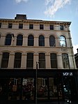
| |||
| 215-221 (Odd Nos) West George Street And 110-116 (Even Nos) West George Lane | 55°51′45″N 4°15′39″W / 55.862582°N 4.260764°W | Category B | 33229 | 
| |||
| 239-247 (Odd Nos) West George Street | 55°51′46″N 4°15′42″W / 55.862673°N 4.261696°W | Category B | 33231 | 
| |||
| 19-30 (Excluding Nos 23, 23A, 23B, 26A) St Vincent Crescent And 21 Corunna Street | 55°51′48″N 4°17′00″W / 55.863308°N 4.28326°W | Category A | 33128 | 
| |||
| 31-70 (Excluding Nos 35A,36A,37A,39A) St Vincent Crescent And 30 Corunna Street | 55°51′51″N 4°17′20″W / 55.864121°N 4.288838°W | Category A | 33129 | 
| |||
| 67-79 (Odd Nos) St Vincent Street, 10-14 (Even Nos) Drury Street | 55°51′40″N 4°15′21″W / 55.861135°N 4.255901°W | Category B | 33133 | 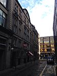
| |||
| 101-103A (Odd Nos) St Vincent Street And 19-25 (Odd Nos) Renfield Street And 4, 6 And 6A St Vincent Lane | 55°51′41″N 4°15′26″W / 55.86131°N 4.25711°W | Category B | 33136 | 
| |||
| 185, 187 St Vincent Street | 55°51′43″N 4°15′43″W / 55.861869°N 4.261889°W | Category B | 33145 | 
| |||
| 217-245A (Odd Nos) St Vincent Street And 79 Blythswood Street, 128 St Vincent Lane | 55°51′43″N 4°15′47″W / 55.862035°N 4.263177°W | Category B | 33149 | 
| |||
| 200 St Vincent Street | 55°51′44″N 4°15′39″W / 55.862273°N 4.260954°W | Category A | 33162 | 
| |||
| 260-280 (Even Nos) St Vincent Street, 95-101 (Odd Nos) Douglas Street And 124 Pitt Street | 55°51′45″N 4°15′52″W / 55.862566°N 4.264566°W | Category B | 33167 | 
| |||
| 1-27 (Inclusive Nos) Sandyford Place (Sauchiehall Street), 141-149(Odd Nos) Elderslie Street Including Low Wall With Railings Between Service Road To Sandyford Place And Sauchiehall Street | 55°51′56″N 4°16′48″W / 55.865508°N 4.279985°W | Category B | 33169 | 
| |||
| 183-209 (Even Nos) Kent Road With 998-1004 (Even Nos) Argyle Street | 55°51′50″N 4°16′50″W / 55.863882°N 4.280417°W | Category B | 33079 | 
| |||
| 8-20 (Even Nos) Minerva Street And 995-1017 (Odd Nos) Argyle Street (Finnieston) | 55°51′49″N 4°16′56″W / 55.863481°N 4.282152°W | Category B | 33085 | 
| |||
| 1-17 (Inclusive Nos) Newton Terrace, Sauchiehall Street, 128 Elderslie Street And 33 Granville Street | 55°51′57″N 4°16′29″W / 55.865839°N 4.27473°W | Category B | 33092 | 
| |||
| 206 - 212 (Even Nos) Old Dumbarton Road, Former Bishop Mills | 55°52′06″N 4°17′57″W / 55.868393°N 4.299271°W | Category B | 33096 | 
| |||
| 221 Renfrew Street, Garnetbank Primary School And Janitor's House | 55°51′59″N 4°16′02″W / 55.866401°N 4.267155°W | Category B | 33107 | 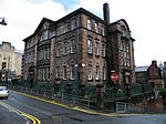
| |||
| 23, 25 Rose Street, St Aloysius' Church (Roman Catholic) | 55°51′59″N 4°15′42″W / 55.8665°N 4.261791°W | Category A | 33115 | 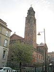
| |||
| 41-47 (Odd Nos) Rose Street And 29, 31 Buccleuch Street | 55°52′02″N 4°15′41″W / 55.867138°N 4.261316°W | Category B | 33116 | 
| |||
| 1-24 (Inclusive Nos) Royal Crescent With 1 North Claremont Street And 36 Kelvingrove Street | 55°51′57″N 4°16′59″W / 55.865847°N 4.28301°W | Category B | 33120 | 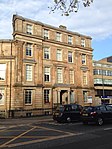
| |||
| 2-30 (Even Nos) St George's Road, 540-546 (Even Nos) Sauchiehall Street And 357,359 Renfrew Street, Charing Cross Mansions | 55°52′00″N 4°16′14″W / 55.866619°N 4.27046°W | Category A | 33127 | 
| |||
| 11-27 (Odd Nos) Elmbank Street | 55°51′49″N 4°16′07″W / 55.86367°N 4.26853°W | Category B | 33021 | 
| |||
| 1-17 (Inclusive Nos) Fitzroy Place And 85 Claremont Street (Sauchiehall Street) | 55°51′56″N 4°16′51″W / 55.865438°N 4.280844°W | Category B | 33023 | 
| |||
| 1-25 (Odd Nos) Carfrae Street And 164 And 172 Yorkihill Street, Former Pearson Hall | 55°51′53″N 4°17′38″W / 55.864817°N 4.293945°W | Category B | 33024 | 
| |||
| 1-9 (Odd Nos) Gordon Street And 101-111 (Odd Nos) Buchanan Street | 55°51′37″N 4°15′17″W / 55.86014°N 4.254773°W | Category B | 33025 | 
| |||
| 71, 97, 99 Gordon St, And 16, 18, 50 Hope St, Central Station & Hotel, (Former Caledonian Railway Station) With 229-263 (Odd Nos) & 194-240 (Even Nos) Argyle St, 15-19 (Odd Nos) & 12-24 (Even Nos) Midland Street & 9-17 (Odd Nos) Clyde Place | 55°51′35″N 4°15′31″W / 55.859699°N 4.258711°W | Category A | 33029 | 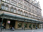
| |||
| 72-80 (Even Nos) Gordon Street, Grosvenor Building | 55°51′39″N 4°15′28″W / 55.860787°N 4.257719°W | Category A | 33034 | 
| |||
| Granville Street, Berkeley Street And Kent Road Mitchell Theatre, Formerly St Andrew's Halls | 55°51′53″N 4°16′24″W / 55.864739°N 4.273451°W | Category A | 33036 | 
| |||
| 80, 82 Hill Street | 55°52′02″N 4°15′53″W / 55.867238°N 4.264679°W | Category C(S) | 33042 | 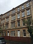
| |||
| 102-112 (Even Nos) Hill Street, And 37, 39 Garnethill Street, Peel Terrace | 55°52′03″N 4°15′57″W / 55.867504°N 4.265829°W | Category A | 33044 | 
| |||
| 15, 17 Hope Street | 55°51′32″N 4°15′34″W / 55.858983°N 4.259548°W | Category B | 33048 | 
| |||
| 67 Hope Street (Known As No 55) | 55°51′36″N 4°15′34″W / 55.859911°N 4.259426°W | Category B | 33051 | 
| |||
| 91-115 (Odd Nos) Hope Street, 2-14 (Even Nos) Waterloo Street And 1-13 (Odd Nos) Bothwell Street | 55°51′38″N 4°15′34″W / 55.860549°N 4.259431°W | Category A | 33052 | 
| |||
| 307-335 (Odd Nos) Hope Street And 91, Cowcaddens Street, Mcconnel's Building | 55°52′00″N 4°15′25″W / 55.866572°N 4.256856°W | Category B | 33055 | 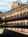
| |||
| 160-166 (Even Nos) Hope Street And West Regent Street | 55°51′47″N 4°15′27″W / 55.863046°N 4.257515°W | Category C(S) | 33058 | 
| |||
| 170, 172 Hope Street, Lion Chambers | 55°51′49″N 4°15′26″W / 55.863499°N 4.257349°W | Category A | 33059 | 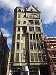
| |||
| 226-228 (Even Nos) Hope Street, And 55 Renfrew Street, Hope Street Post Office | 55°51′55″N 4°15′24″W / 55.865226°N 4.256746°W | Category B | 33060 | 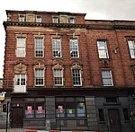
| |||
| Kelvingrove Park, Kelvingrove Art Gallery And Museum | 55°52′07″N 4°17′26″W / 55.868608°N 4.290636°W | Category A | 33071 | 
| |||
| 13 Kelvinhaugh Street, Sandyford-Henderson Memorial Church | 55°51′53″N 4°17′09″W / 55.864832°N 4.285875°W | Category B | 33075 | 
| |||
| 202-218 (Even Nos) Bath Street, 121 Douglas Street, Adelaide Place (North) | 55°51′54″N 4°15′52″W / 55.864967°N 4.264514°W | Category B | 32968 | 
| |||
| 34-56 (Even Nos) Bentinck Street And 46 Gray Street | 55°52′01″N 4°17′10″W / 55.866897°N 4.286028°W | Category B | 32972 | 
| |||
| 53-91 (Odd Nos) Berkeley Street, 108, 110 Elderslie Street And 13-17 (Odd Nos) Granville Street | 55°51′54″N 4°16′28″W / 55.865052°N 4.274524°W | Category B | 32973 | 
| |||
| 1-7 (Inclusive Nos) Blythswood Square And 112 Douglas Street | 55°51′51″N 4°15′48″W / 55.864105°N 4.263457°W | Category B | 32975 | 
| |||
| 21-26A (Inclusive Nos) Blythswood Square, 268 West George Street And 177 West Regent Street | 55°51′48″N 4°15′52″W / 55.863424°N 4.264361°W | Category B | 32978 | 
| |||
| 15-25 (Odd Nos) Bothwell Street | 55°51′39″N 4°15′35″W / 55.860936°N 4.259853°W | Category B | 32979 | 
| |||
| 81-107 (Odd Nos) Bothwell Street, 80 Blythswood Street, And 89 West Campbell Street, Scottish Legal Life Assurance Society | 55°51′40″N 4°15′45″W / 55.861157°N 4.262535°W | Category B | 32982 | 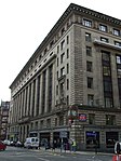
| |||
| 2-28 (Even Nos) Bothwell Street, 123 Hope Street | 55°51′41″N 4°15′32″W / 55.861257°N 4.259025°W | Category A | 32983 | 
| |||
| 54-64 (Even Nos) Broomielaw, 5, 9 Oswald Street | 55°51′24″N 4°15′37″W / 55.856805°N 4.260173°W | Category B | 32988 | 
| |||
| 46-60 (Even Nos) Buccleuch Street And 53 Dalhousie Street | 55°52′04″N 4°15′47″W / 55.86778°N 4.263048°W | Category B | 32990 | 
| |||
| 71-79 (Odd Nos) Buchanan Street | 55°51′35″N 4°15′17″W / 55.859662°N 4.254857°W | Category B | 32995 | 
| |||
| 87, 89 Buchanan Street | 55°51′36″N 4°15′17″W / 55.85987°N 4.254758°W | Category B | 32997 | 
| |||
| 2-13 (Excluding No 4) Clairmont Gardens | 55°52′00″N 4°16′40″W / 55.866691°N 4.277753°W | Category B | 33009 | 
| |||
| 71, 73 Claremont Street And 178 Berkeley Street, Henry Wood Hall, (Sno Centre), Former Trinity Congregational Church | 55°51′55″N 4°16′50″W / 55.865182°N 4.280573°W | Category B | 33010 | 
| |||
| 24 Elliot Street And 93 Houldsworth Street (Known As 93 Houldsworth Street) | 55°51′44″N 4°16′45″W / 55.862225°N 4.279169°W | Category B | 33017 | 
| |||
| 1F Gilmorehill, University Of Glasgow, Chemistry Building (Including Inorganic, Physical, And Organic Chemistry) Former "Institute Of Chemistry" | 55°52′19″N 4°17′36″W / 55.872066°N 4.293206°W | Category A | 32918 | 
| |||
| 1 Gilmorehill, University Of Glasgow, Hunter Memorial | 55°52′19″N 4°17′18″W / 55.87205°N 4.288265°W | Category B | 32920 | 
| |||
| 1-13 (Inclusive) Professors' Square And Principal's Residence, University Of Glasgow | 55°52′18″N 4°17′27″W / 55.871654°N 4.290704°W | Category B | 32926 | 
| |||
| 321-333 (Odd Nos) Argyle Street | 55°51′31″N 4°15′43″W / 55.858643°N 4.261893°W | Category C(S) | 32939 | 
| |||
| 1185-1263 (Odd Nos) Argyle Street, Franklin Terrace | 55°51′56″N 4°17′14″W / 55.865427°N 4.287269°W | Category B | 32946 | 
| |||
| 1058-1100 Excluding No 1070 (Even Nos) Argyle Street And 4-8 (Even Nos) Kelvingrove Street | 55°51′53″N 4°17′01″W / 55.8648°N 4.283732°W | Category B | 32954 | 
| |||
| 2 And 4 Dumbarton Road, Kelvingrove Park, Sunlight Cottages | 55°52′14″N 4°17′30″W / 55.870557°N 4.29171°W | Category B | 32883 | 
| |||
| 34-52 (Even Nos) Lawrence Street, 45-49 (Odd Nos) Dowanhill Street, 29-47 (Odd Nos) Havelock Street, 86-90 (Even Nos) Hyndland Street | 55°52′24″N 4°18′01″W / 55.873392°N 4.300158°W | Category B | 32885 | 
| |||
| 1-17 (Inclusive Nos) Lilybank Gardens, University Of Glasgow | 55°52′28″N 4°17′30″W / 55.874377°N 4.29168°W | Category C(S) | 32886 | 
| |||
| 1-4 (Inclusive Nos) Lilybank Terrace, Laurel Park School | 55°52′28″N 4°17′24″W / 55.874524°N 4.290042°W | Category B | 32887 | 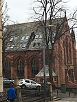
| |||
| 62-70 (Even Nos) Oakfield Avenue And 63 Gibson Street, Hillhead | 55°52′23″N 4°17′09″W / 55.873126°N 4.285947°W | Category C(S) | 32888 | 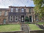
| |||
| 72-80 (Even Nos) Oakfield Avenue And 70 University Avenue, Hillhead | 55°52′22″N 4°17′11″W / 55.87268°N 4.286272°W | Category C(S) | 32889 | 
| |||
| 10-18 (Even Nos) Queen Margaret Drive, 75-81 (Odd Nos) Hamilton Drive And 11, 13 Buckingham Street | 55°52′41″N 4°17′16″W / 55.878069°N 4.287916°W | Category C(S) | 32901 | 
| |||
| 53-63 (Odd Nos) Southpark Avenue | 55°52′25″N 4°17′11″W / 55.873723°N 4.28627°W | Category B | 32905 | 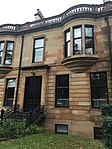
| |||
| Southpark Terrace,1-15 (Inclusive Nos) | 55°52′29″N 4°17′10″W / 55.874848°N 4.286192°W | Category B | 32908 | 
| |||
| 44 Oakfield Avenue And 37 Southpark Avenue, Hillhead High School And Entrance Lodge | 55°52′28″N 4°17′07″W / 55.87445°N 4.285337°W | Category B | 32909 | 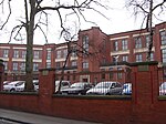
| |||
| 5-11 (Odd Nos) Turnberry Road With Gatepiers | 55°52′32″N 4°18′24″W / 55.875555°N 4.306553°W | Category B | 32910 | 
| |||
| 13, 15 Turnberry Road | 55°52′32″N 4°18′25″W / 55.875564°N 4.307017°W | Category B | 32911 | 
| |||
| 1-16 (Inclusive Nos) Buckingham Terrace, 2, 4 Buckingham Street, 1, 3 Ruskin Place (Great Western Road) With Retaining Wall And Piers To Great Western Road | 55°52′38″N 4°17′13″W / 55.877288°N 4.286879°W | Category A | 32850 | 
| |||
| 24-31 (Inclusive Nos) Buckingham Terrace, 2 Queen Margaret Drive, 1, 3, 5 Buckingham Street | 55°52′40″N 4°17′18″W / 55.877699°N 4.288454°W | Category B | 32851 | 
| |||
| 62 Church Street, 10C Dumbarton Road, Western Infirmary, Outpatients And Dispensary | 55°52′20″N 4°17′20″W / 55.872111°N 4.288829°W | Category B | 32857 | 
| |||
| 33, 35 Dumbarton Road, Partick Sewage Pumping Station | 55°52′11″N 4°17′45″W / 55.8697°N 4.29572°W | Category B | 32862 | 
| |||
| 271-285 (Odd Nos) Dumbarton Road | 55°52′14″N 4°18′16″W / 55.870642°N 4.304455°W | Category B | 32863 | 
| |||
| 383-405 (Odd Nos) Dumbarton Road, 2-10 (Even Nos) Vine Street And 1 Merkland Street | 55°52′14″N 4°18′31″W / 55.870655°N 4.308564°W | Category B | 32865 | 
| |||
| 2-8 (Even Nos) North Gardner Street And 28-30 (Even Nos) Partickhill Road | 55°52′27″N 4°18′19″W / 55.874247°N 4.305388°W | Category B | 32868 | 
| |||
| 2-28 (Even Nos) Granby Terrace, Hillhead Street | 55°52′34″N 4°17′13″W / 55.876049°N 4.286822°W | Category B | 32870 | 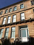
| |||
| 1-33 (Odd Nos) Hamilton Drive, Kelvinside | 55°52′36″N 4°17′00″W / 55.876732°N 4.283457°W | Category B | 32873 | 
| |||
| 35-51 (Odd Nos) Hamilton Drive (1-9 Inclusive Nos) Northpark Terrace, Kelvinside | 55°52′39″N 4°17′09″W / 55.877398°N 4.285798°W | Category A | 32874 | 
| |||
| 53-67 (Odd Nos) Hamilton Drive And 6 Buckingham Street With Boundary Walls, Gatepiers, Garden Steps And Balustrading | 55°52′39″N 4°17′11″W / 55.877594°N 4.286385°W | Category B | 32875 | 
| |||
| 2-30 (Even Nos) Hamilton Drive And 21 Hamilton Park Avenue | 55°52′38″N 4°17′00″W / 55.877302°N 4.283235°W | Category C(S) | 32876 | 
| |||
| 45-67 (Odd Nos) Queen Street, The Guild Hall | 55°51′33″N 4°15′10″W / 55.859194°N 4.252913°W | Category B | 32815 | 
| |||
| 73-87 (Odd Nos) Queen Street Including 77 A-D Queen Street (South Exchange Court) And 85 A-D Queen Street (Royal Exchange Court) | 55°51′35″N 4°15′10″W / 55.859645°N 4.252843°W | Category B | 32817 | 
| |||
| 46-48 (Inclusive Nos) St Andrews Square | 55°51′17″N 4°14′37″W / 55.854733°N 4.243739°W | Category B | 32832 | 
| |||
| 17-29 (Odd Nos) St Vincent Place, Scottish Provident Institution | 55°51′39″N 4°15′10″W / 55.860761°N 4.252764°W | Category A | 32836 | 
| |||
| 31-39 (Odd Nos) St Vincent Place | 55°51′39″N 4°15′12″W / 55.860812°N 4.25339°W | Category B | 32837 | 
| |||
| 12-16 (Even Nos) St Vincent Place, Anchor Building | 55°51′41″N 4°15′08″W / 55.861281°N 4.252314°W | Category A | 32839 | 
| |||
| 24 St Vincent Place, Citizen Building | 55°51′41″N 4°15′10″W / 55.861319°N 4.252684°W | Category A | 32840 | 
| |||
| 30-40 (Even Nos) St Vincent Place, Known As 30 St Vincent Place | 55°51′41″N 4°15′11″W / 55.861418°N 4.253169°W | Category A | 32841 | 
| |||
| 1-37 (Odd Nos) Banavie Road | 55°52′31″N 4°18′43″W / 55.875139°N 4.311964°W | Category B | 32847 | 
| |||
| 97 Hutcheson Street And 14 Garth Street | 55°51′34″N 4°14′53″W / 55.859335°N 4.248175°W | Category B | 32730 | 
| |||
| 223-229 (Odd Nos) Ingram Street And 89 Miller Street | 55°51′35″N 4°15′03″W / 55.85976°N 4.250964°W | Category B | 32737 | 
| |||
| 10-20 (Even Nos) Ingram Street And 19-23 (Odd Nos) College Street | 55°51′34″N 4°14′31″W / 55.85934°N 4.241991°W | Category C(S) | 32738 | 
| |||
| 98 Ingram Street, Ramshorn Theatre, Former St Paul's And St David's Church, (Church Of Scotland) And Churchyard And Boundary Railings | 55°51′35″N 4°14′42″W / 55.859734°N 4.245002°W | Category A | 32740 | 
| |||
| 3-39 (Odd Nos) Trongate 2 Saltmarket 5-7 (Odd Nos) Chisholm Street | 55°51′23″N 4°14′41″W / 55.856515°N 4.244592°W | Category B | 32768 | 
| |||
| 71 Trongate, Tron Steeple | 55°51′25″N 4°14′44″W / 55.856912°N 4.245526°W | Category A | 32769 | 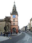
| |||
| 79-83 (Odd Nos) Trongate And 5-11 (Odd Nos) King Street | 55°51′25″N 4°14′46″W / 55.856883°N 4.246116°W | Category B | 32771 | 
| |||
| 167 Trongate | 55°51′25″N 4°14′55″W / 55.8569°N 4.248625°W | Category B | 32778 | 
| |||
| 173-187 (Odd Nos) Trongate And 17-43 (Odd Nos) Stockwell Street And 118-122 (Even Nos) Osborne Street | 55°51′25″N 4°14′57″W / 55.856909°N 4.249105°W | Category B | 32779 | 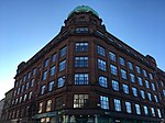
| |||
| 20-46 (Even Nos) Trongate And 2-58 (Even Nos) Albion Street And 38-40 (Even Nos) Bell Street | 55°51′27″N 4°14′39″W / 55.857566°N 4.244126°W | Category B | 32781 | 
| |||
| 60-90 (Even Nos) Trongate And 19-29 (Odd Nos) Albion Street | 55°51′26″N 4°14′45″W / 55.857267°N 4.245754°W | Category A | 32782 | 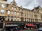
| |||
| 140-144 (Even Nos) Trongate | 55°51′11″N 4°14′49″W / 55.853056°N 4.247013°W | Category B | 32787 | 
| |||
| 54 St Andrews Square And 51 Turnbull Street, Former Central Police Headquarters | 55°51′18″N 4°14′39″W / 55.85511°N 4.244272°W | Category B | 32792 | 
| |||
| 37-47 (Odd Nos) Virginia Street | 55°51′32″N 4°15′01″W / 55.858804°N 4.250157°W | Category A | 32795 | 
| |||
| 49-53 (Odd Nos) Virginia Street | 55°51′32″N 4°15′00″W / 55.858939°N 4.250133°W | Category A | 32796 | 
| |||
| 32 Walls Street And 7-21 (Odd Nos) Blackfriars Street, 23 Blackfriars Street (Blackfriars Court) | 55°51′30″N 4°14′35″W / 55.858413°N 4.243008°W | Category B | 32800 | 
| |||
| Cathedral Square, Statue Of David Livingstone | 55°51′46″N 4°14′11″W / 55.862783°N 4.236484°W | Category B | 32655 | 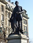
| |||
| 72 Clyde Street And 135 Bridgegate, Old Fish Market Known As The Briggait | 55°51′16″N 4°14′58″W / 55.854358°N 4.249533°W | Category A | 32664 | 
| |||
| Clyde Street And South Portland Street, Suspension Bridge | 55°51′18″N 4°15′20″W / 55.854993°N 4.255561°W | Category A | 32668 | 
| |||
| 7-13 (Odd Nos) Duke Street | 55°51′37″N 4°14′20″W / 55.860356°N 4.238981°W | Category B | 32677 | 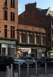
| |||
| 15-31 (Odd Nos) Duke Street | 55°51′37″N 4°14′19″W / 55.860355°N 4.238565°W | Category B | 32678 | 
| |||
| 7 Garth Street | 55°51′33″N 4°14′54″W / 55.859107°N 4.248353°W | Category C(S) | 32683 | 
| |||
| 24 George Square And 12-16 (Even Nos) Anchor Lane | 55°51′41″N 4°15′07″W / 55.861335°N 4.251822°W | Category A | 32688 | 
| |||
| George Square, William Ewart Gladstone Statue | 55°51′41″N 4°15′00″W / 55.861367°N 4.250098°W | Category B | 32695 | 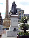
| |||
| George Square, Sir John Moore Statue | 55°51′39″N 4°14′58″W / 55.860805°N 4.249378°W | Category A | 32698 | 
| |||
| 280 George Street And 24 North Frederick Street | 55°51′42″N 4°14′55″W / 55.861648°N 4.2485°W | Category B | 32710 | 
| |||
| 33-39 (Odd Nos) Greendyke Street, Former Hide, Skin And Tallow Market | 55°51′14″N 4°14′38″W / 55.854005°N 4.24376°W | Category B | 32716 | 
| |||
| High Street Glasgow Cross The Tolbooth Steeple | 55°51′25″N 4°14′37″W / 55.856811°N 4.243651°W | Category A | 32717 | 
| |||
| 15-55 (0Dd Nos) High Street And 84-88 (Even Nos) Bell Street | 55°51′27″N 4°14′36″W / 55.857384°N 4.2433°W | Category B | 32718 | 
| |||
| 42-47 (Inclusive Nos) Westbourne Gardens | 55°52′49″N 4°18′13″W / 55.880399°N 4.303706°W | Category B | 32603 | 
| |||
| 52 Westbourne Gardens, Belhaven - Westbourne Church And Hall, Church Of Scotland | 55°52′53″N 4°18′12″W / 55.881477°N 4.303243°W | Category A | 32605 | 
| |||
| 50 Argyle Street With 3 Miller Street | 55°51′29″N 4°15′06″W / 55.858004°N 4.251629°W | Category B | 32611 | 
| |||
| 98-102 (Even Nos) Argyle Street | 55°51′30″N 4°15′13″W / 55.858222°N 4.253495°W | Category B | 32612 | 
| |||
| Argyle Street, Argyll Arcade (Through 98-102 Argyle Street) 3-66 (Inclusive Nos, Leading To Buchanan Street) | 55°51′30″N 4°15′12″W / 55.858333°N 4.25331°W | Category A | 32613 | 
| |||
| 62 Argyll Arcade, 108 Argyle Street, Morrison Court, David Sloan's Arcade Cafe | 55°51′31″N 4°15′13″W / 55.858533°N 4.253705°W | Category A | 32614 | 
| |||
| 17 Parson Street, Martyr's School With Retaining Walls And Gates | 55°51′55″N 4°14′15″W / 55.865364°N 4.237399°W | Category A | 32619 | 
| |||
| 28-32 (Even Nos) Buchanan Street, Argyll Chambers | 55°51′32″N 4°15′16″W / 55.858942°N 4.2544°W | Category B | 32633 | 
| |||
| 78-90 (Even Nos) Buchanan Street With 9-17 (Odd Nos) Exchange Place | 55°51′36″N 4°15′14″W / 55.860011°N 4.253951°W | Category B | 32638 | 
| |||
| 106-112 (Even Nos) Buchanan Street With 1 Royal Bank Place | 55°51′38″N 4°15′13″W / 55.860591°N 4.253713°W | Category B | 32640 | 
| |||
| 109-123 (Odd Nos) Candleriggs | 55°51′33″N 4°14′44″W / 55.859293°N 4.245552°W | Category B | 32645 | 
| |||
| 60-106 (Even Nos) Candleriggs 3-31 (Odd Nos) Bell Street And 69-97 (Odd Nos) Albion Street Candleriggs City Hall And Bazaar | 55°51′32″N 4°14′43″W / 55.858985°N 4.245182°W | Category A | 32647 | 
| |||
| 1-15 (Inclusive Nos) Princes Gardens | 55°52′34″N 4°18′18″W / 55.876242°N 4.304883°W | Category B | 32575 | 
| |||
| Nos 1,5,6,7,8 Queens Gardens, With Gatepiers And Rear Boundary Railings | 55°52′36″N 4°17′59″W / 55.876723°N 4.299828°W | Category B | 32578 | 
| |||
| 5-9 (Odd Nos) Redlands Road And Retaining Walls | 55°52′53″N 4°17′51″W / 55.881439°N 4.297596°W | Category B | 32580 | 
| |||
| 1-16A (Inclusive Nos) Rosslyn Terrace | 55°52′45″N 4°17′48″W / 55.879253°N 4.296748°W | Category B | 32581 | 
| |||
| 17-19 (Inclusive Nos) Rosslyn Terrace, And Gatepiers | 55°52′47″N 4°17′52″W / 55.879727°N 4.297815°W | Category C(S) | 32582 | 
| |||
| 6, 6A And 6B Victoria Circus, (Kensington Tower), With Boundary Walls And Gatepiers | 55°52′44″N 4°18′04″W / 55.879011°N 4.301018°W | Category B | 32593 | 
| |||
| 10 Victoria Circus, (Ramoyle), With Walls And Gatepiers | 55°52′41″N 4°18′06″W / 55.878119°N 4.301637°W | Category B | 32594 | 
| |||
| 6-34 (Even Nos) Victoria Crescent Road With Walls To Crescent Lane | 55°52′34″N 4°17′49″W / 55.876158°N 4.2969°W | Category B | 32598 | 
| |||
| 38-52A (Even Nos) Victoria Crescent Road | 55°52′37″N 4°17′55″W / 55.87682°N 4.298506°W | Category B | 32599 | 
| |||
| 1A And 2-18A (Inclusive Nos) Westbourne Gardens | 55°52′52″N 4°18′09″W / 55.881223°N 4.30238°W | Category B | 32600 | 
| |||
| 20-27 (Inclusive Nos) Westbourne Gardens | 55°52′49″N 4°18′03″W / 55.880265°N 4.300773°W | Category B | 32601 | 
| |||
| 28-41 (Inclusive Nos) Westbourne Gardens | 55°52′49″N 4°18′05″W / 55.880296°N 4.301494°W | Category B | 32602 | 
| |||
| 22-38 (Even Nos) Kingsborough Gardens | 55°52′44″N 4°18′15″W / 55.878846°N 4.304062°W | Category B | 32544 | 
| |||
| 42-54 (Even Nos) Kingsborough Gardens | 55°52′42″N 4°18′15″W / 55.878207°N 4.304104°W | Category B | 32546 | 
| |||
| 3 Kirklee Road And 1 Redlands Road | 55°52′52″N 4°17′50″W / 55.88123°N 4.297216°W | Category A | 32550 | 
| |||
| 7-23 (Odd Nos) Kirklee Road And 2 Redlands Road, With Walls, Gatepiers And Railings | 55°52′54″N 4°17′48″W / 55.881764°N 4.29656°W | Category A | 32551 | 
|
Key[]
The scheme for classifying buildings in Scotland is:
- Category A: "buildings of national or international importance, either architectural or historic; or fine, little-altered examples of some particular period, style or building type."[1]
- Category B: "buildings of regional or more than local importance; or major examples of some particular period, style or building type, which may have been altered."[1]
- Category C: "buildings of local importance; lesser examples of any period, style, or building type, as originally constructed or moderately altered; and simple traditional buildings which group well with other listed buildings."[1]
In March 2016 there were 47,288 listed buildings in Scotland. Of these, 8% were Category A, and 50% were Category B, with the remaining 42% being Category C.[2]
See also[]
Notes[]
- ^ Sometimes known as OSGB36, the grid reference (where provided) is based on the British national grid reference system used by the Ordnance Survey.
• "Guide to National Grid". Ordnance Survey. Retrieved 12 December 2007.
• "Get-a-map". Ordnance Survey. Retrieved 17 December 2007. - ^ Historic Environment Scotland assign a unique alphanumeric identifier to each designated site in Scotland, for listed buildings this always begins with "LB", for example "LB12345".
References[]
- All entries, addresses and coordinates are based on data from Historic Scotland. This data falls under the Open Government Licence
- ^ a b c "What is Listing?". Historic Environment Scotland. Retrieved 29 May 2018.
- ^ Scotland's Historic Environment Audit 2016 (PDF). Historic Environment Scotland and the Built Environment Forum Scotland. pp. 15–16. Retrieved 29 May 2018.
Categories:
- Lists of listed buildings in Glasgow