List of listed buildings in Leuchars, Fife
This is a list of listed buildings in the parish of in Fife, Scotland.
List[]
| Name | Location | Date Listed | Grid Ref. [note 1] | Geo-coordinates | Notes | LB Number [note 2] | Image |
|---|---|---|---|---|---|---|---|
| Parish Kirkyard | 56°22′53″N 2°53′00″W / 56.381527°N 2.883467°W | Category B | 8843 | 
| |||
| 2 Main Street 'Rachel's Inn' | 56°22′53″N 2°52′56″W / 56.3814°N 2.88233°W | Category C(S) | 8847 |
| |||
| Schoolbrae | 56°22′54″N 2°53′08″W / 56.381575°N 2.885492°W | Category C(S) | 8849 |
| |||
| Mileplate At Balmullo Farm | 56°22′30″N 2°55′41″W / 56.374885°N 2.928017°W | Category B | 8855 |
| |||
| Clayton House (Now Flatted) | 56°21′14″N 2°55′23″W / 56.353825°N 2.923169°W | Category C(S) | 8859 |
| |||
| Kinshaldy House, Farmsteading And Walled Garden | 56°24′06″N 2°49′52″W / 56.401744°N 2.831131°W | Category B | 8865 |
| |||
| Strathburn Farmhouse | 56°24′00″N 2°55′31″W / 56.400106°N 2.925391°W | Category B | 8896 |
| |||
| Mileplate At Pickletillem | 56°24′38″N 2°54′52″W / 56.410664°N 2.914351°W | Category B | 8897 |
| |||
| Guardbridge, Seggie House Including Gate Lodge And Walled Garden | 56°21′36″N 2°54′02″W / 56.359949°N 2.90048°W | Category C(S) | 50494 |
| |||
| Guardbridge, Paper Mill (Former), Boiler House (Mill Building 49) And Stalk | 56°21′56″N 2°53′24″W / 56.365488°N 2.889959°W | Category B | 51397 |
| |||
| Raf Leuchars, Domestic Side, Officers' Mess, Building Nos 10, 11, 65 And 175 | 56°22′38″N 2°53′08″W / 56.377218°N 2.885424°W | Category C(S) | 51420 |
| |||
| Raf Leuchars, Domestic Side, Former Barracks Blocks, Buildings 25, 26 And 27 | 56°22′42″N 2°53′01″W / 56.378282°N 2.883667°W | Category B | 51418 |
| |||
| Mileplate 300 Yards North Of Muirhead | 56°21′44″N 2°56′22″W / 56.36214°N 2.939442°W | Category B | 13699 |
| |||
| Earlshall Walled Garden | 56°22′44″N 2°52′04″W / 56.378961°N 2.867717°W | Category B | 8805 | 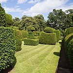
| |||
| Parish Kirk Manse | 56°22′55″N 2°52′55″W / 56.381898°N 2.881808°W | Category B | 8844 |
| |||
| 3, 5, 7 Pitlethie Road ('Briar Cottage', 'The Anchorage' And 'Rose Cottage') | 56°22′59″N 2°53′00″W / 56.38301°N 2.883307°W | Category C(S) | 8845 |
| |||
| 7 Main Street 'Wayside' | 56°22′53″N 2°52′58″W / 56.381271°N 2.882797°W | Category C(S) | 8848 |
| |||
| Doocot, Leuchars Castle | 56°23′11″N 2°53′20″W / 56.386331°N 2.88889°W | Category A | 8851 | 
| |||
| Earlshall | 56°22′44″N 2°52′06″W / 56.378992°N 2.8683°W | Category A | 8852 | 
| |||
| Guardbridge (Old) Over River Eden | 56°21′33″N 2°53′19″W / 56.359028°N 2.888676°W | Category A | 8861 |
| |||
| Raf Leuchars, Domestic Side, Barracks Blocks, Buildings 1, 2, 3 And 5 | 56°22′42″N 2°52′57″W / 56.37838°N 2.882536°W | Category C(S) | 51417 |
| |||
| Vicarsford Cemetery, Lodge, Boundary Walls, Gates, Gatepiers And Railings | 56°25′16″N 2°54′47″W / 56.421014°N 2.913173°W | Category B | 13476 |
| |||
| Balmullo Farmhouse And Gatepiers | 56°22′29″N 2°55′45″W / 56.374732°N 2.929244°W | Category B | 8893 |
| |||
| Earlshall, Sundial To West Of House | 56°22′44″N 2°52′07″W / 56.37882°N 2.868507°W | Category C(S) | 13014 |
| |||
| The Cottage (Now Willowbank) Guardbridge | 56°21′35″N 2°53′31″W / 56.359822°N 2.891964°W | Category B | 8860 |
| |||
| Vicarsford Cemetery Chapel | 56°25′13″N 2°54′41″W / 56.420335°N 2.911471°W | Category A | 8863 |
| |||
| Guideplates At Junction Of A92 And Wormit Road 700 Yards North Of St Michael's | 56°23′56″N 2°54′40″W / 56.39882°N 2.911086°W | Category B | 8898 |
| |||
| Guardbridge, Paper Mill (Former), Main Street Buildings Numbers 1, 2, 3, 3A, 4, 6, 7, 8, 17 And 26 | 56°21′54″N 2°53′32″W / 56.365049°N 2.892199°W | Category B | 51396 |
| |||
| Raf Leuchars, Domestic Side, Former Squash Court, Building No 70 | 56°22′41″N 2°53′03″W / 56.378126°N 2.884165°W | Category C(S) | 51419 |
| |||
| Raf Leuchars, Technical Side, Former Operations Block, Building 181 | 56°22′43″N 2°52′48″W / 56.378532°N 2.880127°W | Category C(S) | 51422 |
| |||
| Craigie House | 56°24′25″N 2°53′13″W / 56.407072°N 2.88696°W | Category B | 8808 |
| |||
| Parish Kirk Of St Athernase | 56°22′54″N 2°53′00″W / 56.381679°N 2.88347°W | Category A | 8842 |
| |||
| Mileplates At Junction Of A91 And A92 North-East Of Dairsie Village | 56°20′53″N 2°56′33″W / 56.347965°N 2.942605°W | Category B | 8856 |
| |||
| Raf Leuchars, Domestic Side, Old Sergeants' Mess, Building 8 | 56°22′45″N 2°52′55″W / 56.379111°N 2.882051°W | Category C(S) | 51421 |
| |||
| Leuchars War Memorial | 56°23′05″N 2°53′56″W / 56.384812°N 2.898848°W | Category C(S) | 10798 |
| |||
| 86 Main Street, 'st Annes' | 56°23′02″N 2°53′21″W / 56.383866°N 2.889238°W | Category B | 8850 |
| |||
| Pitcullo Castle | 56°21′44″N 2°57′03″W / 56.362187°N 2.950871°W | Category A | 8857 | 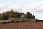
| |||
| Raf Leuchars, Technical Side, General Service Aircraft Sheds, Buildings 55 And 57 | 56°22′35″N 2°52′33″W / 56.376326°N 2.875704°W | Category A | 51423 |
| |||
| Craigsanquhar House | 56°21′40″N 2°58′50″W / 56.361021°N 2.980672°W | Category B | 43925 |
| |||
| Craigsanquhar House, Steading | 56°21′41″N 2°58′53″W / 56.361285°N 2.981342°W | Category C(S) | 43926 |
| |||
| Leuchars Lodge, Hermitage Lodge | 56°23′43″N 2°54′18″W / 56.395244°N 2.904926°W | Category C(S) | 13723 |
| |||
| Earlshall, Sundial On East Side Of Terraced Garden | 56°22′44″N 2°52′02″W / 56.378784°N 2.867275°W | Category B | 13015 |
| |||
| Pitlethie House | 56°23′11″N 2°52′42″W / 56.386478°N 2.878318°W | Category B | 8807 |
| |||
| Mileplate Near Southfield | 56°23′11″N 2°54′57″W / 56.386269°N 2.915807°W | Category B | 8854 |
| |||
| Clayton Den Ice House Above Moonzie Burn | 56°21′28″N 2°55′51″W / 56.357838°N 2.930824°W | Category C(S) | 8864 |
| |||
| 59 And 61 Main Street, Ye Olde Hotel Including Gig House With Hayloft And Boundary Wall | 56°22′57″N 2°53′15″W / 56.382496°N 2.887376°W | Category B | 49915 |
| |||
| Craigsanquhar House, Walled Garden | 56°21′43″N 2°58′47″W / 56.36199°N 2.979661°W | Category B | 43927 |
| |||
| Earlshall Lodge | 56°22′46″N 2°52′08″W / 56.379564°N 2.868799°W | Category B | 8806 |
| |||
| 9 Pitlethie Road 'seaview' | 56°22′56″N 2°52′59″W / 56.382357°N 2.882984°W | Category C(S) | 8846 |
| |||
| Earlshall Doocot | 56°22′42″N 2°52′07″W / 56.378254°N 2.868526°W | Category A | 8853 | 
| |||
| Pitcullo Doocot | 56°21′39″N 2°57′00″W / 56.360972°N 2.950015°W | Category B | 8858 |
| |||
| Inner Bridge (Old) Over Motray Water, Guardbridge | 56°22′01″N 2°53′31″W / 56.366938°N 2.891952°W | Category B | 8862 |
| |||
| Balmullo Steading | 56°22′30″N 2°55′43″W / 56.375005°N 2.928749°W | Category C(S) | 8894 |
| |||
| Hayston Farmhouse | 56°22′08″N 2°56′26″W / 56.369013°N 2.940599°W | Category B | 8895 |
| |||
| Mileplate Approx 500 Yards North Of St Michael's | 56°23′51″N 2°54′34″W / 56.397483°N 2.909531°W | Category B | 8899 |
| |||
| Raf Leuchars, Technical Side, Watch Office, Building 213 | 56°22′31″N 2°52′49″W / 56.375378°N 2.8802°W | Category C(S) | 51424 |
|

Key[]
The scheme for classifying buildings in Scotland is:
- Category A: "buildings of national or international importance, either architectural or historic; or fine, little-altered examples of some particular period, style or building type."[1]
- Category B: "buildings of regional or more than local importance; or major examples of some particular period, style or building type, which may have been altered."[1]
- Category C: "buildings of local importance; lesser examples of any period, style, or building type, as originally constructed or moderately altered; and simple traditional buildings which group well with other listed buildings."[1]
In March 2016 there were 47,288 listed buildings in Scotland. Of these, 8% were Category A, and 50% were Category B, with the remaining 42% being Category C.[2]
See also[]
Notes[]
- ^ Sometimes known as OSGB36, the grid reference (where provided) is based on the British national grid reference system used by the Ordnance Survey.
• "Guide to National Grid". Ordnance Survey. Retrieved 12 December 2007.
• "Get-a-map". Ordnance Survey. Retrieved 17 December 2007. - ^ Historic Environment Scotland assign a unique alphanumeric identifier to each designated site in Scotland, for listed buildings this always begins with "LB", for example "LB12345".
References[]
- All entries, addresses and coordinates are based on data from Historic Scotland. This data falls under the Open Government Licence
- ^ a b c "What is Listing?". Historic Environment Scotland. Retrieved 29 May 2018.
- ^ Scotland's Historic Environment Audit 2016 (PDF). Historic Environment Scotland and the Built Environment Forum Scotland. pp. 15–16. Retrieved 29 May 2018.
Categories:
- Lists of listed buildings in Fife
- Leuchars