List of local nature reserves in Lincolnshire
Lincolnshire is an English ceremonial county consisting of the North Lincolnshire and North East Lincolnshire unitary authorities and the non-metropolitan Lincolnshire County Council, made up of six districts (Boston, East Lindsey, North Kesteven, South Holland, South Kesteven and West Lindsey) and the City of Lincoln. The non-metropolitan county is in the East Midlands, while the two unitary authorities are part of the Yorkshire and Humber region. Bound to the south by Rutland, Northamptonshire and Cambridgeshire, to the south-east by Norfolk and to the west by Leicestershire, Nottinghamshire and South Yorkshire, Lincolnshire's eastern edge follows the coastline with the North Sea and the southern bank of the River Humber to the north. The county's area is the fourth largest in England, but its population, at 714,800, is only the 14th highest.
Local nature reserves (LNRs) are designated by local authorities under the National Parks and Access to the Countryside Act 1949. The local authority must have legal control over the site, by owning or leasing it or having an agreement with the owner. LNRs are sites which have a special local interest either biologically or geologically, and local authorities have a duty to care for them. They can apply local bye-laws to manage and protect LNRs.[1][2] As of January 2018, Lincolnshire has 32 designated Local Nature Reserves.
Sites[]
| Site | Photograph | Area | Location | Declaring authority | Other classifications | Map | Details | Description | Ref |
|---|---|---|---|---|---|---|---|---|---|
| Atkinsons Warren | 
|
32.8 hectares | Ferry Road, Scunthorpe
SE 877 121 |
North Lincolnshire Council | [3] | ||||
| Axholme Line-Haxey | 7.23 hectares | Isle of Axholme, Haxey Village
SE 773 005 |
North Lincolnshire Council | [4] | |||||
| Bradley and Dixon Woods | 
|
41.77 hectares | South of Grimsby
TA 242 058 |
North East Lincolnshire Council | [5] | ||||
| Brumby Wood | 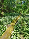
|
21.84 hectares | Scunthorpe
SE 880 103 |
North Lincolnshire Council | [6] | ||||
| Cleethorpes Country Park | 
|
62.01 hectares | Between Cleethorpes and Humberston
TA 304 067 |
North East Lincolnshire Council | [7] | ||||
| 457.24 hectares | Cleethorpes
TA 325 070 |
North East Lincolnshire Council | Humber Estuary SSSI, Humber Estuary Ramsar, Humber Estuary SAC, Humber Estuary SPA | [8] | |||||
| ? | SE 891 146 | Lincolnshire County Council | [9] | ||||||
| 1.70 hectares | Off Cross O'Cliff Hill, Lincoln
SK 975 688 |
Lincolnshire County Council | [10] | ||||||

|
15.15 hectares | Barton-upon-Humber
TA 010 228 |
North Lincolnshire Council | [11] | |||||
| 1.73 hectares | Scunthorpe
SE 889 106 |
North Lincolnshire Council | [12] | ||||||
| Havenside | 18.91 hectares | Fishtoft
TF 350 415 |
Boston Borough Council | [13] | |||||
| Lollycocks Field | 
|
2.15 hectares | Sleaford
TF 074 459 |
North Kesteven District Council | [14] | ||||
| Mareham Pastures | 11.00 hectares | Sleaford
TF 073 446 |
Lincolnshire County Council | [15] | |||||
| 50.28 hectares | Blyton
SK 829 952 |
Lincolnshire County Council | [16] | ||||||
| Owston Ferry Castle | 
|
0.90 hectares | Owston Ferry
SE 804 002 |
North Lincolnshire Council | [17] | ||||
| 24.10 hectares | SE 878 140 | [18] | |||||||
| 20.81 hectares | Scunthorpe
SE 880 133 |
North Lincolnshire District Council | [19] | ||||||
| 2.87 hectares | Goulceby
TF 264 877 |
Lincolnshire County Council | [20] | ||||||
| 14.86 hectares | Scunthorpe
SE 903 132 |
North Lincolnshire Council | [21] | ||||||
| 9.49 hectares | Scunthorpe
SE 876 078 |
North Lincolnshire Council | [22] | ||||||
| Snipe Dales | 
|
82.16 hectares |
(near Hagworthingham) F 319 683 |
Lincolnshire County Council | [23] | ||||
| 12.43 hectares | South Thoresby
TF 394 762 |
Lincolnshire County Council | [24] | ||||||
| Stanton's Pit | 
|
8.05 hectares | Little Bytham
TF 032 174 |
Lincolnshire County Council | [25] | ||||

|
52.51 hectares | Lincoln
SK 944 685 |
City of Lincoln Council | [26] | |||||
| 3.42 hectares | Coningsby
TF 230 854 |
East Lindsey District Council | [27] | ||||||
| 4.39 hectares | Long Sutton
TF 425 234 |
Lincolnshire County Council | [28] | ||||||
| 2.25 hectares | Gainsborough
SK 830 903 |
West Lindsey District Council | [29] | ||||||
| 1.68 hectares | Spalding
TF 249 240 |
South Holland District Council | [30] | ||||||

|
41.46 hectares | Barton-upon-Humber
TA 030 231 |
North Lincolnshire Council | [31] | |||||

|
34.7 hectares | Grimsby
TA 285 076 |
North East Lincolnshire Council | [32] | |||||
| Whisby Nature Park | 
|
107.57 hectares | Thorpe-on-the-Hill
SK 912 662 |
North Kesteven District Council | [33] | ||||
| 6.24 hectares | Willoughby
TF 472 734 |
Lincolnshire County Council | [34] |
References[]
- ^ "Protected or designated areas". Department for Environment, Food & Rural Affairs and Natural England. 9 April 2013. Retrieved 29 July 2015.
- ^ "Local nature reserves: setting up and management". Department for Environment, Food & Rural Affairs and Natural England. 2 October 2014. Retrieved 29 July 2015.
- ^ "Atkinsons Warren LNR", Natural England. Retrieved 27 January 2018.
- ^ "Designated Sites View".
- ^ "Designated Sites View".
- ^ "Designated Sites View".
- ^ "Designated Sites View".
- ^ "Designated Sites View".
- ^ "Designated Sites View".
- ^ "Designated Sites View".
- ^ "Designated Sites View".
- ^ "Designated Sites View".
- ^ "Designated Sites View".
- ^ "Designated Sites View".
- ^ "Designated Sites View".
- ^ "Designated Sites View".
- ^ "Designated Sites View".
- ^ "Designated Sites View".
- ^ "Designated Sites View".
- ^ "Designated Sites View".
- ^ "Designated Sites View".
- ^ "Designated Sites View".
- ^ "Designated Sites View".
- ^ "Designated Sites View".
- ^ "Designated Sites View".
- ^ "Designated Sites View".
- ^ "Designated Sites View".
- ^ "Designated Sites View".
- ^ "Designated Sites View".
- ^ "Designated Sites View".
- ^ "Designated Sites View".
- ^ "Designated Sites View".
- ^ "Designated Sites View".
- ^ "Designated Sites View".
- Lincolnshire-related lists
- Lists of local nature reserves in the United Kingdom
- Local Nature Reserves in Lincolnshire