List of mountains and hills of Thuringia
(Thuringian Forest)

(Thuringian Forest)

(Thuringian Forest)


(Thuringian Forest)


(Thuringian Forest)

(Thuringian Highland)


(Thuringian Forest)

This list of the mountains and hills of Thuringia contains a selection of the mountains and hills to be found in the German federal state of Thuringia. They are arranged alphabetically with their height given in metres (m) above sea level (Normalnull).
Highest mountains and hills by region[]
The following table lists the highest mountains and hills in each Thuringian region:
| Mountain / hill |
Height (m) |
Region |
Regional list |
Rural/urban district |
|---|---|---|---|---|
| Grosser Beerberg | 982.9 | Thuringian Forest | List | Ilm |
| Großer Farmdenkopf | 868.7 | Thuringian Highland | List | Sonneberg |
| Ellenbogen (813.2 m) (Schnitzersberg: 815.5 m) |
815.5 | Rhön | List | Wartburg |
| Wetzstein | 792.7 | Franconian Forest | List | Saalfeld-Rudolstadt |
| Schneeberg | 692.4 | Little Thuringian Forest | List | Suhl (urban district), Hildburghausen |
| Großer Gleichberg | 679.0 | Grabfeld | List | Hildburghausen |
| Pleß | 645.4 | Salzungen Werra Upland | List | Wartburg |
| Großer Ehrenberg | 635.3 | Harz | List | Nordhausen |
| Halskappe | 604.1 | List | Ilmkreis | |
| 582.6 | List | Ilm | ||
| Goburg | 543.4 | Gobert | List | Eichsfeld |
| Birkenberg | 533.4 | Ohm Hills | List | Eichsfeld |
| unnamed hill | 522.3 | Dün | List | Kyffhäuser |
| Walleskuppe | 513.5 | Lange Berge | List | Hildburghausen |
| Riechheimer Berg | 511.8 | List | Ilm | |
| Junkerkuppe | 508.9 | Südeichsfeld | List | Eichsfeld |
| Alter Berg | 493.9 | Hainich | List | Wartburg |
| Kulm | 481.9 | List | Saalfeld-Rudolstadt | |
| Großer Ettersberg | 477.8 | Thuringian Basin | List | Weimar (urban district) |
| Kulpenberg | 473.4 | Kyffhäuser | List | Kyffhäuser |
| unnamed hill | 463.2 | Hainleite | List | Kyffhäuser |
| Ziegenrück | 460.8 | Bleicherode Hills | List | Eichsfeld |
| Wassenberg |
420.8 | Drei Gleichen | List | Ilm |
| Abtsberg | 413.0 | Fahner Höhe (Fahnersche Höhe) |
List | Gotha |
| Wöllmisse | 404.8 | Wöllmisse | List | |
| Künzelsberg | 380.1 | Schmücke | List | Sömmerda, Kyffhäuser |
| Zimmerberg | 374.4 | List | , Kyffhäuser | |
| unnamed hill | 370.1 | Hohe Schrecke | List | Kyffhäuser |
| Königskopf | 357.7 | Alter Stolberg | List | Nordhausen |
| Stunzelberg | 347.9 | List | Erfurt (urban district) | |
| Mühlberg | 310.4 | Finne | List | Sömmerda |
All mountains and hills in Thuringia[]
Name, Height, Location (district(s), region); three "???" means not yet known; please add!
Alter Stolberg[]
→ see below in the section on the Harz
Bleicherode Hills[]
→ see below in the section on the Ohm Hills
Drei Gleichen[]
- (Wachsenburg Castle) (421 m), Ilm district
Dün[]
- unnamed hill (522.3 m), near Keula, near Keulaer Rondell, Kyffhäuser district
- (515.4 m), near Kreuzebra, Eichsfeld district
- (498.2 m), near Rehungen, Nordhausen district
- (493.6 m), near Beuren, Eichsfeld district
Fahner Höhe (Fahnersche Höhe)[]
- All hills are in the district of Gotha.
- (413 m)
- (384 m)
- (345 m)
- (275 m)
- (199 m)
Finne[]
- All hills are in the district of Sömmerda.
- (353.6 m), near Ostramondra
- (347.4 m), near Ostramondra
- (336.3 m), near Bachra
- Finnberg (332,4 m), near Burgwenden
- (329.3 m), near Ostramondra
- (321.4 m), near Ostramondra
- (319.8 m), near Bachra
- (310.4 m), near Rastenberg
Franconian Forest[]
→ For these and other mountains and hills (some outside Thuringia) see the section on Mountains in the article on the Franconian Forest.
- Wetzstein (792,7 m), near Lehesten, Saalfeld-Rudolstadt district
- (726.7 m), near Schlegel, Saale-Orla district
- (664 m), near Titschendorf, Saale-Orla district
Gleichberge[]
→ For details see the section on mountains and hills in the article on the Gleichberge.
- All mountains and hills are near Römhild in the district of Nordhausen:
- Großer Gleichberg (679 m)
- Kleiner Gleichberg (641 m)
- Kuppe (529 m)
- Schwanberg (518 m)
- Schwabhäuser Berg (511 m)
- Rother Kopf (456 m)
- Alterburg (430 m)
- Hartenburg (404 m)
- Eichelberg (382 m)
Gobert[]
- All hills are located in the district of Eichsfeld
- Goburg (543.4 m), near Volkerode, near the border with Hesse
- Rachelsberg (523.4 m), northwest of Wiesenfeld
- Hesselkopf (504.4 m), west-northwest of Wiesenfeld
- Pfaffschwender Kuppe (493.6 m), southwest of Pfaffschwende
- Meinhard (491.3 m), between Neuerode and Kella, border with Hesse
- Uhlenkopf (480 m), west of Volkerode, border with Hesse
- Kahlenberg (460.8 m), northeast of Asbach
- Iberg (426.1 m), east of Asbach
Grabfeld[]
→ For these and other mountains and hills (including some outside Thuringia) see the section on mountains and hills in the article on Grabfeld.
- the Gleichberge (max. 679 m): see also the section above on the Gleichberge
- (536 m), near Neubrunn
- (536 m), near Westenfeld
- (530 m), near Henneberg
- Ransberg (514 m), near Bibra
Hainich / Südeichsfeld[]
- Rain (516.7 m), Eichsfeld district, near Effelder
- (508.9 m), Eichsfeld district, Eichsfeld-Hainich-Werratal Nature Park, Höheberg
- (503 m), Wartburgkreis, Eichsfeld-Hainich-Werratal Nature Park
- (503 m), Eichsfeld district, Eichsfeld-Hainich-Werratal Nature Park
- (493.9 m), Wartburgkreis, Hainich National Park
- Hohes Rode (493.0 m)
- Craulaer Kreuz (483.2 m)
- Renn (473.2 m)
- Lohberg (468.2 m)
- Winterstein (467.6 m), Unstrut-Hainich district, Eichsfeld-Hainich-Werratal Nature Park
- Otterbühl (465.6 m)
- Sommerstein (461.8 m)
- Alter Busch (454.7 m)
- (454 m), Eichsfeld district, Eichsfeld-Hainich-Werratal Nature Park
- (453.2 m), Eichsfeld district, Eichsfeld-Hainich-Werratal Nature Park
- Haardt (451.3 m)
- Steiger (448.9 m)
- Lindenhecke (447 m) Wartburgkreis, Eichsfeld-Hainich-Werratal Nature Park
- (444 m), Unstrut-Hainich district, Hainich National Park
- Rittergasserberg (440.3 m)
- Wartenberg (429.9 m)
- (421.5 m), Unstrut-Hainich district, Eichsfeld- Hainich-Werratal Nature Park / Hainich National Park
- Mittelberg (413.3 m)
- Harsberg (409.7 m)
- Pfarrkopf (399.4 m)
- Burgberg (398.0 m)
- Schlossberg (377.0 m)
- Elsberg (360.5 m)
Hainleite[]
- (463.2 m), between Straußberg and Immenrode, Kyffhäuser district
- unnamed hill (452,3 m), near Großlohra-Friedrichslohra, Nordhausen district
- unnamed hill (445.5 m), eastern foothills of the Straußberg near Großfurra, Kyffhäuser district
- (441.6 m), near Sondershausen, Kyffhäuser district
- (431.5 m), west-northwestern foothills of the Wolfshof
- (428.1 m), near Kleinberndten, Kyffhäuser district
- (411.3 m), near Sondershausen, Kyffhäuser district
- (405.8 m), near Seega, aber Gemarkung Oberbösa, Kyffhäuser district
- (403.3 m), near Hachelbich, Kyffhäuser district
- unnamed hill (391.0 m), near Bilzingsleben-Düppel, district Sömmerda
- (309.0 m), near Günserode, Kyffhäuser district
- (302,7 m), with the nearby , near Oldisleben-Sachsenburg, Kyffhäuser district
also:
- Spur on which , near Großlohra, Nordhausen district
Harz[]
→ For these and other mountains and hills (including those outside Thuringia) see List of mountains in the Harz.
- All mountains and hills (incl. those of Alter Stolberg and Rüdigsdorf Switzerland) are located in the district of Nordhausen.
- Großer Ehrenberg (635.3 m), near Rothesütte
- (634.4 m), near Rothesütte
- (619.5 m), near Rothesütte
- (610.1 m), near Rothesütte
- (602,4 m), near Rothesütte
- Poppenberg (600.8 m), near Ilfeld
- (599.8 m), near Neustadt Dam
- (585.1 m), near Rothesütte and Sülzhayn
- (579.0 m), near Rothesütte
- (577.8 m), near Sülzhayn
- (575.8 m) and Langer Berg (515.9 m), near Sülzhayn, on border with Lower Saxony
- (570.7 m), between Netzkater and Rothesütte
- (569.0 m), near Neustadt Dam
- (567.4 m), between Rothesütte and Netzkater
- (552,9 m), between Rothesütte and Netzkater
- (551.8 m), near Rothesütte
- (548.9 m), near Rothesütte
- (548.7 m), near Rothesütte and Sülzhayn
- (539.5 m), between Eisfelder Talmühle station and Birkenmoor
- (538.6 m), between Netzkater and Birkenmoor
- (536.3 m), near Sülzhayn
- (534.5 m), between Rothesütte and Netzkater
- (533.0 m), near Neustadt Dam
- (530.8 m), between Rothesütte and Netzkater
- (527.5 m), by Neustadt Dam
- (524.7 m), near Sülzhayn
- Sandlünz (516.2 m), near Netzkater
- (512,0 m), near Haltepunkt Tiefenbachmühle
- (510.4 m), between Rothesütte and Netzkater
- (511.7 m), near Ilfeld
- (508.9 m), near Sülzhayn
- (507.0 m), near Sülzhayn
- (497.2 m), near Eisfelder Talmühle station
- (492,6 m), near Appenrode
- (475.9 m), near Sülzhayn
- (464.8 m), near Sülzhayn
- (461.6 m), near Appenrode
- (460.3 m), near Netzkater
- (457.6 m), near Sülzhayn
- (441.4 m), near Ilfeld
- Burgberg der Ruine (ca. 440 m), near Herrmannsacker
- Burgberg der (402,9 m), near Neustadt
- (402,4 m), near Werna
- (400.1 m), near Ellrich
- (392,5 m), near Appenrode
- (387.1 m), near Werna
- (386.4 m), near Ellrich
- (386.2 m), near Sülzhayn
- (374.4 m), near Sülzhayn
- (371.1 m), near Neustadt
- (363.8 m), near Appenrode
- (357.7 m), near Stempeda, in Alter Stolberg
- (353.6 m), near Herrmannsacker
- (350.1 m), near Buchholz, in Rüdigsdorf Switzerland
- (346.2 m), near Ellrich
- Kohnstein (334.9 m), near Nordhausen
- (325.2 m), near Urbach, in Alter Stolberg
- (322,9 m), near Rüdigsdorf, in Rüdigsdorf Switzerland
- (317.6 m), near Appenrode
- (Harzrigi; 316.6 m), near Petersdorf, in Rüdigsdorf Switzerland
- (303.7 m), near Petersdorf, in Rüdigsdorf Switzerland
- (302,7 m), near Rüdigsdorf, in Rüdigsdorf Switzerland
- (300.3 m), near Petersdorf, in Rüdigsdorf Switzerland
- (295.5 m), near Rüdigsdorf, in Rüdigsdorf Switzerland
- (295.5 m), near Rüdigsdorf, in Rüdigsdorf Switzerland
- (290.5 m), between Leimbach and Steigerthal, in Alter Stolberg
- (277.8 m), near Krimderode, in the Rüdigsdorf Switzerland
- (273.2 m), near Niedersachswerfen, in Rüdigsdorf Switzerland
- (272.6 m), near Krimderode, in Rüdigsdorf Switzerland
- (263.0 m), near Krimderode/Ellersiedlung, in Rüdigsdorf Switzerland
- (256.3 m), near Nordhausen, in Rüdigsdorf Switzerland
- (252,9 m), near Niedersachswerfen, in Rüdigsdorf Switzerland
- (245.4 m), near Krimderode, in Rüdigsdorf Switzerland
in addition there is the following of unknown height:
- Burgberg der , near Neustadt
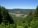
Thuringian Highland and Thuringian Forest[]
‣ Main summits are in boldface. Side-peaks are indented under the appropriate main peak.
‣ Abbreviations:
|
|
- Grosser Beerberg (982.9 m) (R/S), Ilm district, TF
- (943 m), Schmalkalden-Meiningen district, TF
- (941 m) (L), Schmalkalden-Meiningen district, TF
- (891 m) (L), Suhl, TF
- (890 m) (L), Schmalkalden-Meiningen district, TF
- Schneekopf (978 m) (L/R), Ilm district, TF
- Grosser Finsterberg (944 m) (A/R), Ilm district, TF
- Finsterberger Koepfchen ("Kleiner Finsterberg"; 875 m) (L), Ilm district, TF
- (916.5 m) (L/N/R/S), Schmalkalden-Meiningen, TF
- Großer Hermannsberg (867 m) (A/S), Schmalkalden-Meiningen, TF
- Hettstädt (808.1 m), TH
- Mittelberg (803.6 m), Lichte, TH, R
- (803 m), Brotterode, TF
- Rauhhügel (801.9 m), Schmiedefeld (Lichtetal), TS
- Spitzer Berg (790.3 m), Lichte TH
- (786 m) (L), Meuselbach-Schwarzmühle, TH
- Apelsberg (780 m), Lichte, TH, R
- Mutzenberg (770 m), Lichte, TH
- Rückertsbiel (756 m), Lichte, TH
- Sauhügel (722 m), Lichte, TH
- (707 m), Lichte, TH
- Assberg (Thuringian Highland) (703 m), Lichte, TH
- Hopfenberg (536.1 m), Waltershausen, TF
- Hahnberg (686 m), Lichte, TH
- (461.2 m), Wartburgkreis district, (L) TF
- (460 m), Saalfeld-Rudolstadt district, TH
- (425 m), Schmalkalden, TF
- (342 m), Wartburgkreis district, TF
See also[]
- Mountain
- List of the highest mountains in Germany
- List of mountain and hill ranges in Germany
Mountains and hills by state of Germany | ||
|---|---|---|
See also: List of the highest mountains in the German states, List of the highest mountains in Germany | ||
- Lists of mountains of Germany
- Thuringia-related lists
- Mountains and hills of Thuringia