List of mountains and hills of the Rhenish Massif


(307.5 m)
(281.5)
(244.97)
(213.74)
(~880)
(843.2)
(816.32)
(773.0)
(746.9)
(694.24)
(686.5)
(675.3)
(663.3)
(657.3)
(~652)
(635.5)
(626.0)
(~586)
(517.4)
(460.1)
– Highest points in the sub-ranges and several neighbouring landscapes
– several river/-mouth elevations
– Four largest reservoirs
– Most important cities
heights in metres (m) above sea level (NHN)
This list of mountains and hills of the Rhenish Massif (German: Rheinisches Schiefergebirge: "Rhenish Slate Mountains") is a selection of the mountains, hills and foothills of the ranges and landscapes that form the Rhenish Massif − sorted by natural regional main unit groups and heights in metres (m) above sea level (NHN).
- See also these lists:
– Mountains of Hesse
– Mountains and hills of North Rhine-Westphalia
– Mountains and hills of Rhineland-Palatinate
– Mountains and hills of the Saarland
An explanation of the abbreviations used is given below.
Ardennes[]
The Ardennes lie in Belgium, with foothills in France and Luxembourg.
- Baraque de Fraiture (652 m), Province of Luxembourg (B)
- (589 m), Province of Luxembourg (B)
- (Hüttensknipp; 510 m), Province of Liege (B)
- Croix Scaille (505 m), Province of Namur (B)
Eifel[]
The Eifel lies in Germany with foothills in Belgium and Luxembourg.
→ main article: List of mountains and hills of the Eifel
- Hohe Acht (746.9 m), High Eifel (RP)
- Ernstberg (699.8 m), Vulkan Eifel (RP)
- unnamed peak (near Schwarzer Mann; 699.1 m), Schnee Eifel (RP)
- Schwarzer Mann (697.8 m), Schnee Eifel (RP)
- Botrange (694.24 m), High Fens (B)
- Weißer Stein (693 m), North Eifel (NW / B)
- Scharteberg (691.4 m), Vulkan Eifel (RP)
- Nürburg (ca. 678 m), High Eifel (RP)
- Hochkelberg (674.9 m), High Eifel (RP)
- Raßberg (663.8 m), High Eifel (RP)
- Steling (658.3 m), High Fens (NW / B)
- (652 m), North Eifel (NW)
- Nerother Kopf (651.7 m), Vulkan Eifel (RP)
- Aremberg (623.8 m), Ahr Hills (RP)
- Hardtkopf (601.5 m), South Eifel (RP)
- Michelsberg (586.1 m), Ahr Hills (NW)
- Eigart (565.5 m), North Eifel (NW)
- Rockeskyller Kopf (554.6 m), Vulkan Eifel (RP)
- Hoher List (549.1 m), Vulkan Eifel (RP)
- Wildbretshügel (525.3 m), North Eifel/Rur Eifel (NW)
- Herkelstein (434.5 m), North Eifel (NW)
- Veitskopf (428.1), Vulkan Eifel (RP)
- Burgberg (400.8), Rur Eifel, North Eifel (NW)
- Sonnenberg (393.3 m), Rur Eifel (NW)
- Calmont (378.4 m), Anterior Eifel (RP)
- Bausenberg (339.8 m), North Eifel (RP)
- Landskrone (271.7 m), Ahr Hills (RP)
High Fens[]
The High Fens lie in Belgium with foothills in Germany.
- Botrange (694.24 m), Province of Liege (B)
- (Bovel; ca. 662 m), Province of Liege (B)
- (659.9 m), county of Euskirchen (North Rhine-Westphalia)
- Steling (658.3 m), county of Aachen (North Rhine-Westphalia) / Province of Liege (B)
- (636.3 m), county of Aachen (North Rhine-Westphalia) / Province of Liege (B)
- (ca. 609 m), Province of Liege (B)
Hunsrück[]
The Hunsrück lies in Rhineland-Palatinate with foothills in the Saarland.

- Erbeskopf (816.32 m), Schwarzwälder Hochwald (RP)
- An den zwei Steinen (766.2 m), Idar Forest
- Kahlheid (766.0 m), Idar Forest(RP)
- (762.7 m), Schwarzwälder Hochwald (RP)
- (757.4 m), Schwarzwälder Hochwald (RP)
- (756.6 m), Idarwald (RP)
- Idarkopf (745.7 m), Idar Forest(RP)
- (725.4 m), Idar Forest(RP)
- Rösterkopf (708.1 m), Osburger Hochwald (RP)
- Friedrichskopf (707.4 m), Schwarzwälder Hochwald (RP)
- Dollberg (695.4 m), Schwarzwälder Hochwald (RP, SL)
- (695.0 m), Schwarzwälder Hochwald (RP)
- Schimmelkopf (694.8 m), Schwarzwälder Hochwald (RP, SL)
- (692.6), Schwarzwälder Hochwald (RP)
- Hohe Wurzel (668.9 m), Osburger Hochwald (RP)
- Ellerspring (656.8 m), Soonwald – source of the Ellerbach (RP)
- (653.0 m), Soonwald (RP)
- (650.1 m), Idar Forest(RP)
- (648.3 m), Soonwald (RP)
- (643.5 m), Soonwald (RP)
- Kandrich (638.6 m), Bingen Forest (RP)
- (633.5 m), Soonwald (RP)
- (620.5 m), Soonwald (RP)
- Womrather Höhe (599.1 m), Lützelsoon (RP)
- (554.9 m), Soonwald (RP)
Kellerwald[]

The Kellerwald lies entirely within Hesse.
→ main article:
- Wüstegarten (675.3 m), county of Waldeck-Frankenberg, Schwalm-Eder-Kreis
- Hohes Lohr (656.7 m), county of Waldeck-Frankenberg
- Große Aschkoppe (639.8 m), county of Waldeck-Frankenberg
- Hunsrück (635.9 m), Schwalm-Eder-Kreis
- Traddelkopf (626.4 m), county of Waldeck-Frankenberg
- (610.7 m), county of Waldeck-Frankenberg
- Jeust (ca. 585 m), county of Waldeck-Frankenberg, Schwalm-Eder-Kreis
- Sauklippe (584.4 m), Schwalm-Eder-Kreis
- Talgang (566.1 m), county of Waldeck-Frankenberg
- Homberg (518.5 m), county of Waldeck-Frankenberg
- Peterskopf (506.6 m), county of Waldeck-Frankenberg
- Hundskopf (470.6 m), Schwalm-Eder-Kreis
- Rabenstein (439.3 m), county of Waldeck-Frankenberg
- Keseberg (431.2 m), county of Waldeck-Frankenberg
- Uhrenkopf (ca. 405 m), county of Waldeck-Frankenberg
Süder Uplands[]
The Süder Uplands (Süderbergland) comprise inter alia the historic regions of the Sauerland, Upland, Siegerland, , Bergisches Land and parts of the Hessian Hinterland.
Rothaar Mountains[]
The subdivisions of the Rothaar is based largely on historic regions. It lies in North Rhine-Westphalia with foothills in Hesse.
→ main article:
Sauerland and Upland[]


The following mountains in the highest area of the Rothaar Mountains are those belonging to the historic Upland which lies in the Hessian county of Waldeck-Frankenberg.
→ see also section: Mountains in the article on Upland
- Langenberg (843.2 m), counties of Hochsauerlandkreis (NW) and Waldeck-Frankenberg (HE)
- Hegekopf (842.9 m), county of Waldeck-Frankenberg (HE)
- Kahler Asten (841.9 m), Hochsauerlandkreis, Rothaar Mountains (NW)
- Ettelsberg (837.7 m), county of Waldeck-Frankenberg (HE)
- (837 m), Hochsauerlandkreis (NW)
- Hopperkopf (832.3 m), counties of Hochsauerlandkreis and Waldeck-Frankenberg (NW, HE)
- Mühlenkopf (ca. 815 m), county of Waldeck-Frankenberg (HE)
- (818.5 m), Hochsauerlandkreis (NW)
- (815.9 m), Hochsauerlandkreis (NW)
- (812.1 m), Hochsauerlandkreis (NW)
- Bremberg (ca. 810 m), Hochsauerlandkreis (NW)
- Hoher Eimberg (806.1 m), counties of Hochsauerlandkreis and Waldeck-Frankenberg (NW, HE)
- (805.0 m), counties of Hochsauerlandkreis and Waldeck-Frankenberg (NW, HE)
- (804.9 m), Hochsauerlandkreis (NW)
- Mittelsberg (801.0 m), county of Waldeck-Frankenberg (HE)
- (792.2 m), Hochsauerlandkreis (NW)
- (791.3 m), Hochsauerlandkreis (NW)
- (757.7 m), Hochsauerlandkreis (NW)
- (756.3 m), county of Olpe (NW)
[]
The Wittgenstein Land lies entirely within North Rhine-Westphalia.
- (768 m), county of Siegen-Wittgenstein
- (742.8 m), county of Siegen-Wittgenstein
- (740 m), county of Siegen-Wittgenstein
- (694.1 m), county of Siegen-Wittgenstein
- (686.3 m), county of Siegen-Wittgenstein
Siegerland (historic)[]
The historic Siegerland (not to be confused with the natural region of ) lies entirely within North Rhine-Westphalia:
→ see also section: Hills in the article on Siegerland
- (677.7 m), county of Siegen-Wittgenstein
- (644.9 m), county of Siegen-Wittgenstein
- (653.5 m), county of Siegen-Wittgenstein
- (618.1 m), county of Siegen-Wittgenstein
[]
The Hessian Hinterland lies entirely within Hesse.
- (673.5 m), counties of Marburg-Biedenkopf and Waldeck-Frankenberg (HE)
- Rimberg (495.1 m), county of Marburg-Biedenkopf
[]
Saalhausen Hills[]
The Saalhausen Hills lie entirely within North Rhine-Westphalia.
→ see also section: Hills in the article on Saalhausen Hills
- (688.5 m), county of Hochsauerlandkreis (NW)
- (668.8 m), county of Olpe (NW)
- (619.2 m), county of Olpe (NW)
- (614.1 m), county of Hochsauerlandkreis (NW)
Ebbe Mountains[]
The Ebbe Mountains lies entirely within North Rhine-Westphalia.
→ see also section: Hills in the article on Ebbe Mountains
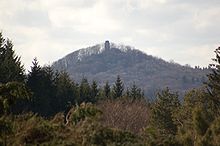
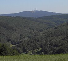
- Nordhelle (663.3 m), county of Märkischer Kreis
- (ca. 638 m), county of Märkischer Kreis
- (538.3 m), county of Märkischer Kreis
Lenne Mountains[]
The Lenne Mountains lies entirely within North Rhine-Westphalia.
→ see also section: Hills in the article on Lenne Mountains
- Homert (656.1 m), county of Hochsauerlandkreis
- (647.6 m), county of Hochsauerlandkreis
- (686.8 m), county of Hochsauerlandkreis
- (575.5 m), county of Hochsauerlandkreis
[]

- (523.1 m), county of Märkischer Kreis
- (519 m), county of Oberbergischer Kreis
- (514.9 m), county of Märkischer Kreis
- (497.1 m), county of Märkischer Kreis
- (458.5 m), county of Olpe
- (437.2), county of Märkischer Kreis
- (429.1 m), county of Olpe
- (410.7 m), county of Olpe
- (360.0 m), county of Olpe
[]
The natural region of Siegerland (not to be confused with the historic Siegerland) lies entirely within North Rhine-Westphalia:
→ see also section: in the article on Siegerland (natural region)
- (633.0 m), county of Siegen-Wittgenstein, (NW)
- (616.9 m), county of Altenkirchen (RP), county of Siegen-Wittgenstein (NW)
- (ca. 606 m), county of Siegen-Wittgenstein, (NW)
- (ca. 598 m), county of Siegen-Wittgenstein (NW)
- (594.5 m), county of Siegen-Wittgenstein (NW)
- (517.5 m), county of Siegen-Wittgenstein (NW), county of Altenkirchen (RP)
- (482.3 m), borough of Siegen (NW)
[]
Arnsberg Forest[]
The Arnsberg Forest lies in the eponymous nature park entirely within North Rhine-Westphalia.
→ see also section: Hills in the article on Arnsberg Forest Nature Park
- Plackweghöhe (actually an unnamed peak; 581.5), county of Hochsauerlandkreis
- second highest hill: unnamed peak (559.5), county of Hochsauerlandkreis
- third highest hill: unnamed peak (557.4), county of Hochsauerlandkreis
- (556.9 m), county of Hochsauerlandkreis
- (551.9 m), county of Hochsauerlandkreis
- (550.4 m), county of Soest
[]
- (505.7 m), county of Oberbergischer Kreis
Taunus[]
The Taunus lies in Hesse with foothills in Rhineland-Palatinate.
→ main article: List of mountains and hills of the Taunus
- Großer Feldberg (881.5 m), county of Hochtaunuskreis
- Kleiner Feldberg (825.2 m), Hochtaunuskreis
- Altkönig (798.2 m), Hochtaunuskreis
- Weilsberg (700.7 m), Hochtaunuskreis
- Glaskopf (686.8 m), Hochtaunuskreis
- Pferdskopf (662.6 m), Hochtaunuskreis
- Kalte Herberge (619.3 m), Rheingau-Taunus-Kreis
- Hohe Wurzel (617.9 m), Rheingau-Taunus-Kreis
- Hohe Kanzel (591.8 m), Rheingau-Taunus-Kreis
- Herzberg (591.4 m), Hochtaunuskreis
- Hallgarter Zange (580.5 m), Rheingau-Taunus-Kreis
- Erbacher Kopf (579.8 m), Rheingau-Taunus-Kreis
- Wolfsküppel (545.1 m), Hochtaunuskreis
- Rassel (539.4 m), Wiesbaden
- Kuhbett (525.6 m), county of Limburg-Weilburg
- Steinkopf (518.0 m), Wetteraukreis
- Rossert (515.9 m), Main-Taunus-Kreis
- Atzelberg (506.7 m), Main-Taunus-Kreis
- Großer Lindenkopf (498.7 m), Rheingau-Taunus-Kreis
- Buchwaldskopf (ca. 492 m), Rheingau-Taunus-Kreis
- (492.0 m), Hochtaunuskreis
- Kellerskopf (474.0 m), Wiesbaden
- Suterkopf (461.8 m), county of Limburg-Weilburg
- (451.0 m), Main-Taunus-Kreis
- Hühnerküppel (369.3 m), county of Limburg-Weilburg
Westerwald (natural region)[]

Westerwald[]
The Westerwald lies within Rhineland-Palatinate with foothills in North Rhine-Westphalia and Hesse.
→ main article: List of mountains and hills of the Westerwald
- Fuchskaute (657.3 m), Westerwaldkreis (RP)
- Stegskopf (654.4 m), county of Altenkirchen (RP)
- Salzburger Kopf (654.2 m), Westerwaldkreis (RP)
- Höllberg (642.8 m), Lahn-Dill-Kreis (HE)
- Auf der Baar (> 621.25 m), Lahn-Dill-Kreis (HE)
- Bartenstein (Barstein; ca. 614 m), Lahn-Dill-Kreis (HE)
- Knoten (605.4 m), Lahn-Dill-Kreis (HE)
- Alarmstange (545.2 m), Westerwaldkreis (RP)
- Köppel (540.2 m), Westerwaldkreis (RP)
- (517.5 m), county of Siegen-Wittgenstein (NW), county of Altenkirchen (RP)
- Gräbersberg (513.1 m), Westerwaldkreis (RP)
- (509.3 m), county of Siegen-Wittgenstein (NW) and county of Altenkirchen (RP)
- (491.3 m), Westerwaldkreis (RP)
- Asberg (441.0 m), county of Neuwied (RP)
- (Mehrberg; 430.5 m), county of Neuwied (RP)
- (422.0 m), Westerwaldkreis (RP)
- (417.4 m), county of Neuwied (RP)
- (411 m), county of Neuwied (RP)
- Heidenhäuschen (397.9 m), county of Limburg-Weilburg (HE)
- (388.3 m), Rhein-Sieg-Kreis (RP)
- (388.2 m), county of Altenkirchen (RP)
- (366.4 m), Rhein-Sieg-Kreis (RP)
- (358.8 m), Rhein-Sieg-Kreis (RP)
- (Pfahlberg; 346.2 m), Westerwaldkreis (RP)
Gladenbach Uplands[]

The Gladenbach Upland lies entirely within Hesse.
→ see also section: Hills in the article on Gladenbach Uplands
- Angelburg (609.4 m), Lahn-Dill-Kreis
- Eschenburg (589.0 m), Lahn-Dill-Kreis
- Schwarzenberg (561.2 m), county of Marburg-Biedenkopf
- (551.8 m), county of Marburg-Biedenkopf
- (503.7 m), county of Marburg-Biedenkopf
- Dünsberg (497.7 m), county of Gießen
- Hornberg (451.0 m), county of Marburg-Biedenkopf
- Altenberg (442.2 m), Lahn-Dill-Kreis
- Volpertsberg (426.4 m), Lahn-Dill-Kreis
[]
- (561 m), Lahn-Dill-Kreis
Abbreviations[]
The following abbreviations are used in the table:
German states (Bundesländer; ISO 3166-2):
- HE = Hesse
- NW = North Rhine-Westphalia
- RP = Rhineland-Palatinate
- SL = Saarland
Countries (based on their international vehicle registration codes):
- B = Belgium
- D = Germany (generally not used above)
- F = France (not used above as no mountains are listed yet)
- L = Luxembourg (not used above as no mountains are listed yet)
- Lists of mountains by range
- Rhenish Massif