List of windmills in County Down

From Wikipedia, the free encyclopedia

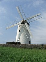
This is a list of windmills in County Down, Northern Ireland.

Locations[]

Location Name of mill and
coordinate
Type Maps First mention
or built
Last mention
or demise
Photograph
Ardkeen 1836[1] 1836[1]
1779[2] 1779[2]
Ballybohillbo Mill[3]
Ballydugan 1792[2] 1792[2]
1836[2] 1836[2]
Ballyhalbert Ballyhalbert Mill Tower Demolished 1940[4]
Windmill World
1836[5] 1836[5]
Ballyherley (2nd mill)[5] 1836[5] 1836[5]
Ballyholme Ballyholme Mill Burnt down 9 July 1922
Windmill World
Ballykeel 1834[5] 1834[5]
1836[5] 1836[5]
1834[5] 1834[5]
1836[5] 1836[5]
1836[6] 1836[6]
1836[6] 1863[6]
Ballyskeagh 1836[6] 1836[6]
1836[6] 1836[6]
Ballywalter 1681[7] 1681[7]
Ballywalter Ballyferis Mill
54°32′45″N 5°29′17″W / 54.54581°N 5.4881°W / 54.54581; -5.4881
Tower 19th century[8] Windmill World Windmill stump, Ballywalter (August 2017) (geograph 5502939).jpg
Balloo Ballyminstragh Mill[9] Tower
Boardmills Mill
54°28′12″N 5°55′43″W / 54.46999°N 5.9287°W / 54.46999; -5.9287
Tower 1813 Windmill World Windmill - geograph.org.uk - 66718.jpg
1836[10] 1836[10]
1836[10] 1836[10]
Cloghey Cloghey Mill
54°26′21″N 5°27′56″W / 54.43922°N 5.4656°W / 54.43922; -5.4656
Tower 1836[11] Windmill World Old windmill near Cloughey - geograph.org.uk - 295439.jpg
Crawfordsburn Crawfordsburn Mill
54°39′40″N 5°43′33″W / 54.66098°N 5.7258°W / 54.66098; -5.7258
Tower 1830 Windmill World Windmill stump, Crawfordsburn - geograph.org.uk - 524211.jpg
1836[11] 1826[11]
1836[12] 1836[12]
Ganaway 1836[13] 1836[13]
Greyabbey Ballybryan Mill
54°31′11″N 5°32′57″W / 54.51984°N 5.5493°W / 54.51984; -5.5493
Tower 19th century[14] Windmill World Ruined windmill near Greyabbey - geograph.org.uk - 762590.jpg
Holywood Holywood Mill
54°38′33″N 5°49′40″W / 54.6424°N 5.8279°W / 54.6424; -5.8279
Tower Windmill World Old windmill, Holywood - geograph.org.uk - 841420.jpg
Killinchy Killinchy Mill
54°27′08″N 5°39′55″W / 54.45223°N 5.6653°W / 54.45223; -5.6653
Tower c. 1702[15] Windmill World The Ardview Road near Killinchy - geograph.org.uk - 292444.jpg
Killough Killough Mill
54°15′15″N 5°38′45″W / 54.25416°N 5.6458°W / 54.25416; -5.6458
Tower 1823[16] Windmill World Old Windmill behind School Road (geograph 2627346).jpg
Killyleagh Ringdufferin Mill[17] tower
Killyleagh Ringdufferin Mill
(2nd mill)[18]
Kirkistown Mill[19] Tower
Knockinelder Mill
54°23′07″N 5°28′08″W / 54.38537°N 5.4690°W / 54.38537; -5.4690
Tower Windmill World The Old Windmill, Knockinelder - geograph.org.uk - 3808.jpg
1836[20] 1836[20]
1836[20] 1836[20]
Millisle Ballycopeland Mill
54°36′28″N 5°33′22″W / 54.60781°N 5.5561°W / 54.60781; -5.5561
Tower c. 1785[21] Windmill World Ballycopeland windmill 279350930 a90dcc8d8c b.jpg
Newtownards Newtownards Mill
54°36′52″N 5°41′18″W / 54.61447°N 5.6884°W / 54.61447; -5.6884
Tower Windmill World Whitespots Country Park, Newtownards (1) - geograph.org.uk - 256280.jpg
Portaferry Portaferry Mill
54°22′47″N 5°32′28″W / 54.37961°N 5.5412°W / 54.37961; -5.5412
Tower Windmill World Old windmill, Portaferry - geograph.org.uk - 591389.jpg
Poyntzpass Poyntzpass Mill Tower Windmill World
Saintfield Saintfield Mill
54°27′51″N 5°49′30″W / 54.46406°N 5.8251°W / 54.46406; -5.8251
Tower Windmill World Saintfield Windmill.jpg
1836[22] 1836[22]
Tullykevin Mill[3]
Warrenpoint Ringmackilroy Mill[23] Tower 1802[24] Warrenpoint Windmill.jpg
1836[7] 1836[7]

Sources[]

Unless otherwise stated, the source for all entries is the linked Windmill World webpage.

References[]

  1. ^ a b "Place Names of Co. Down: A..." Rootsweb. Retrieved 4 July 2009.
  2. ^ a b c d e f "Place names of Co. Down: Ballya......Ballyg..." Rootsweb. Retrieved 4 July 2009.
  3. ^ a b "Flax Mills". Ballywalter. Archived from the original on 18 December 2014. Retrieved 4 July 2009.
  4. ^ "RAF BALLYHALBERT". Ballyhalbert Historical Society. Retrieved 4 July 2009.
  5. ^ a b c d e f g h i j k l m "Place names of Co. Down: Ballyh......Ballym..." Rootsweb. Retrieved 4 July 2009.
  6. ^ a b c d e f g h "Place names of Co. Down; Ballym......Ballyw..." Rootsweb. Retrieved 4 July 2009.
  7. ^ a b c d "Place Names of Co. Down: U,V,W, Y and Z". Rootsweb. Retrieved 4 July 2009.
  8. ^ "Ballyferis Windmill, Ballywalter". Natural Stone Database. Retrieved 4 July 2009.
  9. ^ "Ballyminstragh Windmill, Killinchy Road, Balloo". Natural Stone Database. Retrieved 4 July 2009.
  10. ^ a b c d "Place Names of Co. Down: Ca....- Ch..." Rootsweb. Retrieved 4 July 2009.
  11. ^ a b c "Place Names of Co. Down: Ci...- Cu..." Rootsweb. Retrieved 4 July 2009.
  12. ^ a b "Place Names of Co. Down: Dru......- Dy..." Rootsweb. Retrieved 4 July 2009.
  13. ^ a b "Place Names of Co. Down: G..." Rootsweb. Retrieved 4 July 2009.
  14. ^ "Ballybryan Windmill, Greyabbey". Natural Stone Database. Retrieved 4 July 2009.
  15. ^ "The Mill, 37 Main Street Killinchy, BT23 6PN". Tim Martin Estate Agents. Retrieved 4 July 2009.
  16. ^ "Killough Windmill Tower". Irish Antiquities. Retrieved 4 July 2009.
  17. ^ "Ringdufferin Windmill, Ringdufferin House, 35 Ringdufferin Road, Killyleagh BT30 9PH". Natural Stone Database. Retrieved 4 July 2009.
  18. ^ "Dufferin Chronicles". killyleagh.org. Retrieved 4 July 2009.
  19. ^ "Kirkistown Windmill, Kirkistown Golf Course, Kirkistown". Natural Stone Database. Retrieved 4 July 2009.
  20. ^ a b c d "Place Names of Co. Down: L..." Rootsweb. Retrieved 4 July 2009.
  21. ^ "Talking of Windmills". Shamrock Club of Wisconsin. Retrieved 4 July 2009.
  22. ^ a b "Place Names of Co. Down: T..." Rootsweb. Retrieved 4 July 2009.
  23. ^ "Ringmackilroy Windmill, Off Mary Street, Warrenpoint". Natural Stone Database. Retrieved 4 July 2009.
  24. ^ "South Down". Brian T McElherron. Retrieved 4 July 2009.

See also[]

Retrieved from ""