Little High Rock Canyon Wilderness
| Little High Rock Canyon | |
|---|---|
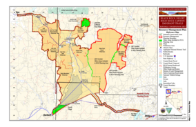
 BLM map of the Black Rock-High Rock NCA and 10 wilderness areas including Little High Rock Canyon Wilderness | |
| Location | Black Rock Desert, Nevada, United States |
| Coordinates | 41°15′4.627″N 119°23′41.691″W / 41.25128528°N 119.39491417°WCoordinates: 41°15′4.627″N 119°23′41.691″W / 41.25128528°N 119.39491417°W |
| Elevation | 1,677 m (5,502 ft) |
| Established | 2000 |
| Operator | Bureau of Land Management |
The Little High Rock Canyon Wilderness is a US Wilderness Area in Nevada under the Bureau of Land Management. It is located south of the High Rock Canyon Wilderness and west of the High Rock Lake Wilderness.[1][2]
History[]
In the winter of 1911, Mike Daggett and his band were camped at Little High Rock Canyon where they ran low on food and killed some cattle. Laster, Daggett and his band killed a cattleman and three sheepmen who had gone to investigate the missing cattle. Daggett and his band were pursued to Kelley Creek, near Winnemucca where the Battle of Kelley Creek occurred. Daggett and seven of his band were killed along with a posse member. Only four children of the band survived the battle.

Site of Deserted Indian Camp where bodies of Stockmen were found at lower right 1911

Bodies of the four stockmen as found at the Indian Camp

Bodies of the four stockmen out of the Back Country
See also[]
- Black Rock Desert-High Rock Canyon Emigrant Trails National Conservation Area
References[]
- ^ Jump up to: a b "Little High Rock Canyon Wilderness". Geographic Names Information System. United States Geological Survey. Retrieved 2009-05-04.
- ^ "BLM Black Rock Desert-High Rock Canyon Emigrant Trails National Conservation Area". Bureau of Land Management. Archived from the original on 2007-07-03. Retrieved 2007-12-30.
External links[]
- Wilderness Areas of Nevada
- Protected areas of Washoe County, Nevada
- Protected areas of Humboldt County, Nevada
- IUCN Category Ib
- Bureau of Land Management areas in Nevada
- Protected areas established in 2000
- 2000 establishments in Nevada
- Nevada geography stubs
- Western United States protected area stubs


