Little Snake River
This article needs additional citations for verification. (January 2011) |
| Little Snake River[1] | |
|---|---|
 The river as it passes under Wyoming Highway 70 near Dixon. | |
 | |
| Physical characteristics | |
| Source | |
| • location | Confluence of Middle Fork and North Fork |
| • coordinates | 40°59′36″N 107°02′51″W / 40.99333°N 107.04750°W |
| • elevation | 7,001 ft (2,134 m) |
| Mouth | |
• location | Confluence with Yampa River |
• coordinates | 40°27′09″N 108°26′32″W / 40.45250°N 108.44222°WCoordinates: 40°27′09″N 108°26′32″W / 40.45250°N 108.44222°W |
• elevation | 5,620 ft (1,710 m) |
| Basin features | |
| Progression | Yampa—Green—Colorado |

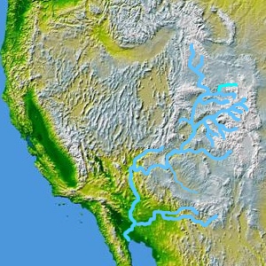
The Little Snake River is a tributary of the Yampa River, approximately 155 miles (249 km) long, in southwestern Wyoming and northwestern Colorado in the United States.
It rises near the continental divide, in Routt National Forest in northern Routt County, Colorado, along the northern edge of the Park Range. It flows west along the Wyoming-Colorado state line, meandering across the border several times and flowing past the Wyoming towns of Dixon and Baggs. It turns southwest and flows through Moffat County, Colorado, joining the Yampa approximately 45 mi (72 km) west of Craig, just east of Dinosaur National Monument. The Little Snake is not generally navigable except seasonally in years of plentiful water.
See also[]
References[]
- ^ "Little Snake River". Geographic Names Information System. United States Geological Survey. Retrieved 2011-01-27.
| Authority control |
|---|
This article related to a river in Wyoming is a stub. You can help Wikipedia by . |
This article related to a river in Colorado is a stub. You can help Wikipedia by . |
- Rivers of Colorado
- Rivers of Wyoming
- Tributaries of the Colorado River
- Rivers of Moffat County, Colorado
- Rivers of Routt County, Colorado
- Tributaries of the Colorado River in Colorado
- Rivers of Carbon County, Wyoming
- Wyoming river stubs
- Colorado river stubs