Livingston County Spencer J. Hardy Airport
Coordinates: 42°37′46″N 083°58′56″W / 42.62944°N 83.98222°W

Livingston County Spencer J. Hardy Airport | |||||||||||
|---|---|---|---|---|---|---|---|---|---|---|---|
| Summary | |||||||||||
| Airport type | Public | ||||||||||
| Owner | Livingston County | ||||||||||
| Location | Howell, Michigan | ||||||||||
| Elevation AMSL | 962 ft / 293 m | ||||||||||
| Map | |||||||||||
 OZW Location of airport in Michigan | |||||||||||
| Runways | |||||||||||
| |||||||||||
| Statistics (2005) | |||||||||||
| |||||||||||

Livingston County Spencer J. Hardy Airport (ICAO: KOZW, FAA LID: OZW) is a county-owned public-use airport located three miles (5 km) northwest of the central business district of Howell, a city in Livingston County, Michigan, United States.[1] It is included in the Federal Aviation Administration (FAA) National Plan of Integrated Airport Systems for 2017–2021, in which it is categorized as a regional reliever airport facility.[2]
Although most U.S. airports use the same three-letter location identifier for the FAA and IATA, Livingston County Spencer J. Hardy Airport is assigned OZW by the FAA but has no designation from the IATA.[3]
Facilities and aircraft[]
Livingston County Spencer J. Hardy Airport covers an area of 217 acres (88 ha) which contains one runway designated 13/31 with a 5,002 x 100 ft (1,525 x 30 m) concrete surface. For the 12-month period ending December 31, 2005, the airport had 58,238 general aviation aircraft operations, an average of 159 per day.[1]
The airport is staffed Monday through Friday from 7 a.m. until 5 p.m., and Saturday and Sunday from 8 a.m. until 12 p.m. It is accessible by road from County Airport Drive, and is close to M-59 and I-96.
Gallery[]

Airport terminal exterior

Airport terminal interior
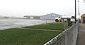
Airport tarmac & hangars


References[]
- ^ a b c FAA Airport Form 5010 for OZW PDF, effective 2007-12-20
- ^ "List of NPIAS Airports" (PDF). FAA.gov. Federal Aviation Administration. 21 October 2016. Retrieved 25 November 2016.
- ^ Great Circle Mapper: KOZW - Howell, Michigan (Livingston County Spencer J. Hardy Airport)
External links[]
- Livingston County Airport, official site
- "Michigan Airport Directory - OZW" (PDF). (42.5 KiB)
- Resources for this airport:
- FAA airport information for OZW
- AirNav airport information for KOZW
- FlightAware airport information and live flight tracker
- NOAA/NWS weather observations: current, past three days
- SkyVector aeronautical chart, Terminal Procedures
This article about a Michigan airport is a stub. You can help Wikipedia by . |
- Airports in Michigan
- Buildings and structures in Livingston County, Michigan
- Transportation in Livingston County, Michigan
- Michigan airport stubs