Loch Tarsan
| Loch Tarsan | |
|---|---|
 Loch Tarsan. | |
 Loch Tarsan | |
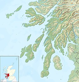
| Location | Glen Lean, Cowal, Argyll and Bute, Scotland. |
| Coordinates | 56°00′39″N 5°05′11″W / 56.010914°N 5.0863659°WCoordinates: 56°00′39″N 5°05′11″W / 56.010914°N 5.0863659°W, National grid reference NS 07692 84075 |
| Type | Reservoir. |
| Primary inflows | Corrachaive Glen |
| Primary outflows | Glentarsan Burn |
| Basin countries | Scotland, United Kingdom. |
| Surface area | 1,100,000 m2 (12,000,000 sq ft) |
| Surface elevation | 121 m (397 ft) |

Loch Tarsan; is a freshwater loch and impounding reservoir located 13 kilometres Northwest of Dunoon, on the Cowal peninsula in Argyll and Bute, Scotland. This three-armed Reservoir extends into both and Glen Lean. It supplies water to the Striven Hydro-Electric Scheme (also known as the Cowal Hydro-Electric Power Scheme). The larger of the two dams is 17.6 metres high and was completed in 1953. The water that is collected in the loch, are piped to the hydro-electric generating station, located at Ardtaraig, at the head of Loch Striven.[1]
The lochs angling is managed by Dunoon and District Angling Club.[2]
The B836 road passes the loch.[3]
See also[]
- List of reservoirs and dams in the United Kingdom
References[]
- ^ "Cowal Hydro-Electric Power Scheme from The Gazetteer for Scotland". www.scottish-places.info.
- ^ "…Loch Tarsan". March 19, 2015.
- ^ "B836 - Roader's Digest: The SABRE Wiki". www.sabre-roads.org.uk.
Sources[]
- "Argyll and Bute Council Reservoirs Act 1975 Public Register"
- Scottish Places - Cowal Hydro-Electric Power Scheme
External links[]
- Map sources for Loch Tarsan
| Wikimedia Commons has media related to Loch Tarsan. |
This Scotland-related article is a stub. You can help Wikipedia by . |
Categories:
- Reservoirs in Argyll and Bute
- Cowal
- Scotland stubs