Lochloosa Creek
This article needs additional citations for verification. (May 2014) |
| Lochloosa Creek | |
|---|---|
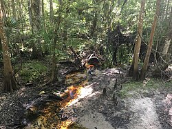
 Lochloosa Creek, April 2019 | |
| Location | |
| Country | United States |
| State | Florida |
| County | Alachua County |
| Physical characteristics | |
| Source | |
| • location | Saluda Swamp |
| • coordinates | 29°39′56″N 82°09′35″W / 29.66556°N 82.15972°W |
| Mouth | |
• location | Lochloosa Lake |
• coordinates | 29°32′54″N 82°08′16″W / 29.54833°N 82.13778°WCoordinates: 29°32′54″N 82°08′16″W / 29.54833°N 82.13778°W |
• elevation | 56 ft (17 m) |
| Basin size | 42.7 sq mi (111 km2) |
| Basin features | |
| GNIS | 285900 |
Lochloosa Creek is a stream that flows from north to south through eastern Alachua County, Florida.[1] Its watershed composed of 42.7 square miles (111 km2) through natural and Silvicultural land use. It is the largest tributary to Lochloosa Lake. Lochloosa Creek is longest creek in Alachua County.
Headwaters[]
Forming from the Saluda Swamp, Lochloosa Creek begins as a small trickle of a stream that flows south. It flows through agricultural lands.
References[]
- ^ "Lochloosa Creek". Geographic Names Information System. United States Geological Survey. Retrieved May 8, 2014.
Categories:
- Rivers of Alachua County, Florida
- Rivers of Florida
- North Central Florida geography stubs
- Florida river stubs
