Longperrier
Longperrier | |
|---|---|
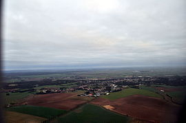 Aerial view of Longperrier | |
 | |
show Location of Longperrier | |
 Longperrier | |
| Coordinates: 49°03′08″N 2°39′49″E / 49.0523°N 2.6635°ECoordinates: 49°03′08″N 2°39′49″E / 49.0523°N 2.6635°E | |
| Country | France |
| Region | Île-de-France |
| Department | Seine-et-Marne |
| Arrondissement | Meaux |
| Canton | Mitry-Mory |
| Intercommunality | CA Roissy Pays de France |
| Government | |
| • Mayor (2020–2026) | Michel Mouton[1] |
| Area 1 | 4.63 km2 (1.79 sq mi) |
| Population (Jan. 2018)[2] | 2,344 |
| • Density | 510/km2 (1,300/sq mi) |
| Time zone | UTC+01:00 (CET) |
| • Summer (DST) | UTC+02:00 (CEST) |
| INSEE/Postal code | 77259 /77230 |
| Elevation | 89–172 m (292–564 ft) |
| 1 French Land Register data, which excludes lakes, ponds, glaciers > 1 km2 (0.386 sq mi or 247 acres) and river estuaries. | |


Longperrier is a commune in the Seine-et-Marne department in the Île-de-France region in north-central France.
Demographics[]
Inhabitants are called Longperrois.
See also[]
- Communes of the Seine-et-Marne department
References[]
- ^ "Répertoire national des élus: les maires". data.gouv.fr, Plateforme ouverte des données publiques françaises (in French). 2 December 2020.
- ^ "Populations légales 2018". INSEE. 28 December 2020.
External links[]
| Wikimedia Commons has media related to Longperrier. |
- 1999 Land Use, from IAURIF (Institute for Urban Planning and Development of the Paris-Île-de-France région) (in English)
| show Communes of the Seine-et-Marne department |
|---|
This article related to a Seine-et-Marne location is a stub. You can help Wikipedia by . |
Categories:
- Communes of Seine-et-Marne
- Seine-et-Marne geography stubs