Lonnig
Lonnig | |
|---|---|
 Coat of arms | |
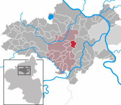
show Location of Lonnig within Mayen-Koblenz district | |
 Lonnig | |
| Coordinates: 50°18′42″N 7°24′30″E / 50.31167°N 7.40833°ECoordinates: 50°18′42″N 7°24′30″E / 50.31167°N 7.40833°E | |
| Country | Germany |
| State | Rhineland-Palatinate |
| District | Mayen-Koblenz |
| Municipal assoc. | Maifeld |
| Government | |
| • Mayor (2019–24) | Stefan Dörr[1] |
| Area | |
| • Total | 5.50 km2 (2.12 sq mi) |
| Elevation | 260 m (850 ft) |
| Population (2020-12-31)[2] | |
| • Total | 1,248 |
| • Density | 230/km2 (590/sq mi) |
| Time zone | UTC+01:00 (CET) |
| • Summer (DST) | UTC+02:00 (CEST) |
| Postal codes | 56295 |
| Dialling codes | 02625 |
| Vehicle registration | MYK |
| Website | www.lonnig.de |


Lonnig is a municipality in the district of Mayen-Koblenz in Rhineland-Palatinate, western Germany.
References[]
- ^ Direktwahlen 2019, Landkreis Mayen-Koblenz, Landeswahlleiter Rheinland-Pfalz, accessed 5 August 2021.
- ^ "Bevölkerungsstand 2020, Kreise, Gemeinden, Verbandsgemeinden". Statistisches Landesamt Rheinland-Pfalz (in German). 2021.
| show Towns and municipalities in Mayen-Koblenz |
|---|
| Authority control |
|---|
This Mayen-Koblenz location article is a stub. You can help Wikipedia by . |
Categories:
- Municipalities in Rhineland-Palatinate
- Mayen-Koblenz
- Mayen-Koblenz geography stubs