Lookout Summit
| Lookout Summit | |
|---|---|
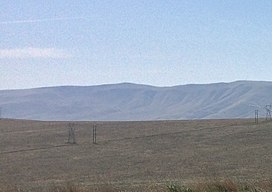 The summit of Lookout Summit | |
| Highest point | |
| Elevation | 3,629 ft (1,106 m)[1][2] |
| Prominence | 1,829 ft (557 m)[1] |
| Isolation | 12.94 mi (20.82 km)[1] |
| Listing |
|
| Coordinates | 46°26′51″N 119°50′24″W / 46.4476327°N 119.8400381°WCoordinates: 46°26′51″N 119°50′24″W / 46.4476327°N 119.8400381°W[3] |
| Geography | |
| Location | Benton County, Washington |
| Parent range | Rattlesnake Hills |
| Topo map | USGS Maiden Spring[2] |
Lookout Summit—officially listed as "Lookout" in the Geographic Names Information System[3]—is the highest point in Benton County,[4] in the U.S. state of Washington. The mountain is also the highest point in the Rattlesnake Hills,[5] with an elevation 98 ft (30 m) higher than the neighboring, more-well-known Rattlesnake Mountain—which is the second highest peak in the range (as well as the county).[5]

References[]
- ^ a b c "Rattlesnake Hills Lookout". Peakbagger.com. Retrieved May 3, 2018.
- ^ a b "Maiden Spring Topographic Map". United States Geological Survey. Retrieved May 3, 2018.
- ^ a b "Lookout". Geographic Names Information System. Retrieved May 3, 2018.
- ^ "Washington County High Points". Peakbagger.com. Retrieved May 3, 2018.
- ^ a b "Rattlesnake Hills". Peakbagger.com. Retrieved May 3, 2018.
This article related to a mountain, mountain range, or peak in the United States is a stub. You can help Wikipedia by . |
Categories:
- Landforms of Benton County, Washington
- Ridges of Washington (state)
- Mountains of Washington (state)
- United States geography stubs
- North America mountain stubs