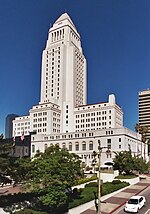
Los Angeles City Council District 1
Los Angeles City Council District 1 is one of the 15 districts of the Los Angeles City Council, representing sections of Northeast Los Angeles and Northwest Los Angeles. Councilmember Gil Cedillo is the current representative for CD 1; he took office on July 1, 2013 and was reelected in 2017. A 2015 referendum approved a realignment of city elections to match statewide elections, beginning in 2020 and extending the terms of sitting officeholders; the next election for District 1 will be in 2022.[1]
Between 1923 and 1987 District 1 represented all, then parts, of the San Fernando Valley. It was redistricted in 1987 to cover an area northwest and north of Downtown Los Angeles, to provide another majority-Hispanic council district in the city.
Geography[]
Present day boundaries[]
According to the district's website, the 1st Council District includes all or parts of the following 22 neighborhoods: [2]
- Glassell Park
- Cypress Park
- Highland Park
- Mount Washington
- Sycamore Grove
- Solano Canyon
- Elysian Park
- Echo Park
- Westlake
- Angelino Heights
- Temple Beaudry
- Chinatown
- Forgotten Edge
- Lincoln Heights
- Montecito Heights
- Pico Union
- Adams-Normandie
- University Park
- Victory Heights
- Koreatown
- Mid Cities
- MacArthur Park
The 1st District is separated from Downtown by the 110 freeway, and the boundary continues northeast until it reaches York Boulevard in Highland Park. For additional reference, see the official City of Los Angeles map of District 1.
The district is approximately 13.5 square miles in area, making it the city's third-smallest council district.[3]
Historic District 1 locations[]
A new city charter effective in 1925 replaced the former plurality "at large" voting system for a nine-member council with a district system, having a 15-member council. Each district was to be approximately equal in population, based upon the voting in the previous gubernatorial election; thus redistricting was done every four years. (At present, redistricting is done every ten years, based upon the preceding U.S. census results.)[4] The numbering system established in 1925 for City Council districts began with No. 1 in the north of the city, the San Fernando Valley, and ended with No. 15 in the south, the Harbor area.
The rough boundaries or descriptions are:
1925: All of the San Fernando Valley, some of the Santa Monica Mountains reaching south to the Sherman district, the Cahuenga Pass, the Hollywood Hills, Griffith Park, Atwater and the eastern part of the Los Feliz District south to approximately Santa Monica Boulevard.[5][6]
1926: The San Fernando Valley, with a district office in the Roscoe neighborhood (now Sun Valley).[7]
1928: "The eastern section of the south boundary . . . is changed from Sunset Boulevard to Fountain Avenue. . . . The westerly portion of the south boundary . . . is a prolongation of the crest of the Santa Monica Mountains. . . . The east boundary is Allesandro Street and the east city limits and the west and north boundaries [in the San Fernando Valley] are the city limits."[8]
1932-33: All of the San Fernando Valley, the Atwater section, and the territory east of Griffith Park, east of Vermont Avenue and north of Fountain Avenue.[9][10]
1937: The San Fernando Valley, the Los Feliz section east of Griffith Park Drive and north of Franklin Avenue, the section between Vermont and Talmadge avenues south to Santa Monica Boulevard, and the Riverside Drive area west of Glendale Boulevard.[11]
1940: With the rise of the Valley population, the 1st District gave up the Los Feliz and Atwater areas, with its southeast boundary retreating to a point near Cahuenga Boulevard and Mulholland Highway. It was still the only Valley district.[12]
1971: The 1st District was the largest geographic area in the city, about 76 square miles, which was a sixth the total area of Los Angeles. It included Arleta, Lake View Terrace, Mission Hills, Pacoima, Shadow Hills, Sunland-Tujunga, Sun Valley and Sylmar.[13]
1987: After the death of incumbent Howard Finn, the district was transferred to Northeast Los Angeles and Northwest Los Angeles, in order to provide an additional seat for representing the increased Hispanic population in L.A.
Population[]
As of the 2000 Census,[3] there were 222,165 people residing in the district. The population density was 16,456.67/mi2. The racial and ethnic makeup of the district was 75.5% Latino, 5.4% white, 2.6% African American, 0.3% Native American, 15.1% Asian, 0.1% from other races, and 1.0% from two or more races.
There were 19,252 households, out of which 44.8% had children under the age of 18 living with them, 72.3% were married couples living together, 8.3% had a female householder with no husband present, and 16.4% were non-families. 12.4% of all households were made up of individuals, and 4.7% had someone living alone who was 65 years of age or older. The average household size was 3.05 and the average family size was 3.35.
In the district, 70%, 154,927 people, were over the age of 18 while the remaining thirty percent, 67,238 people, were under the age of 18.
Officeholders[]
San Fernando Valley[]
- Charles Randall, 1925–1933
- Jim Wilson, 1933-1941
- Delamere Francis McCloskey, 1941–1945
- Leland S. Warburton, 1945–1952
- Everett G. Burkhalter, 1953–1962
- Louis R. Nowell, 1963–1977
- Bob Ronka, 1977–1981
- Howard Finn, 1981–1986
Northeast-Northwest Los Angeles[]
- Gloria Molina, 1987–1991
- Mike Hernandez, 1991–2001
- Ed Reyes, 2001– 2013
- Gil Cedillo, 2013–
See also[]
- Los Angeles City Council
- Los Angeles City Council districts
- List of Los Angeles municipal election returns
- Sunland-Tujunga: Los Angeles City Council redistricting — how District 1 was moved from the Valley in 1986.
References[]
- ^ https://clerk.lacity.org/elections/candidates
- ^ "MAKING THE FIRST DISTRICT #1". gilcedillo.com.
- ^ Jump up to: a b Los Angeles City Council website Archived 2010-02-23 at the Wayback Machine
- ^ Tina Daunt and Seema Mehta, "Council Districts Drawn to Benefit Valley, Latinos," Los Angeles Times, June 12, 2002
- ^ "First Map Showing City Council's Districts," Los Angeles Times, January 16, 1925, page 1 The map shows all 15 council districts. The official boundaries of all 15 as limned by the city clerk are at "Councilmanic Districts Are Traced by Clerk Dominguez," Los Angeles Times, February 12, 1925, page A-2
- ^ "Here Are the Hundred and Twelve Aspirants for the City's Fifteen Councilmanic Seats," Los Angeles Times, May 3, 1925, page 7
- ^ "To the Citizens of Los Angeles," Los Angeles Times, February 14, 1926, page B-5
- ^ "Council Areas' Lines Changed," Los Angeles Times, December 29, 1928, page A-1
- ^ "District Lines Get Approval," Los Angeles Times, December 24, 1932, page 2
- ^ "City Reapportionment Measure Gets Approval," Los Angeles Times, January 19, 1933 With map of all districts.
- ^ "New Council Zones Defined," Los Angeles Times, January 7, 1937, page A-18
- ^ "Proposed New Alignment for City Voting Precincts" (with map), Los Angeles Times, November 30, 1940, page A-3
- ^ "Louis B. Nowell," Los Angeles Public Library reference file
- Note: Access to the Los Angeles Times links requires the use of a library card.
External links[]
| show Members of the Los Angeles City Council |
|---|

| show |
|---|

- Los Angeles City Council districts
- Northeast Los Angeles
- Northwest Los Angeles
- Chinatown, Los Angeles
- Cypress Park, Los Angeles
- Echo Park, Los Angeles
- Elysian Park, Los Angeles
- Glassell Park, Los Angeles
- Highland Park, Los Angeles
- Lincoln Heights, Los Angeles
- Mount Washington, Los Angeles
- Montecito Heights, Los Angeles
- Pico-Union, Los Angeles
- Westlake, Los Angeles