Los Ríos Province
Los Rios | |
|---|---|
Province | |
| Provincia de Los Rios | |
 Flag | |
 Location of Los Rios Province in Ecuador. | |
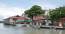
 Cantons of Los Ríos Province | |
| Country | Ecuador |
| Created | October 6, 1860. |
| Founded by | Legislative decree. |
| Named for | High number of existing rivers. |
| Capital | Babahoyo |
| Cantons | List of Cantons |
| Government | |
| • Type | Provincial |
| Area | |
| • Total | 7,205.27 km2 (2,781.97 sq mi) |
| Population (2010)[1] | |
| • Total | 778,115 |
| • Density | 110/km2 (280/sq mi) |
| • Urban | 326,122 |
| • Population 2001 | 668,309 |
| Time zone | UTC-5 (ECT) |
| Vehicle registration | R |
| HDI (2017) | 0.705[2] high · 22nd |
| Website | www |
Los Ríos (Spanish pronunciation: [loz ˈri.os]) is a province in Ecuador. The capital is Babahoyo. The province was founded on October 6, 1860. Under legislative decree. Babahoyo was made its capital on September 30, 1948.
Demographics[]
Ethnic groups as of the Ecuadorian census of 2010:[3]
- Mestizo 52.9%
- Montubio 35.1%
- Afro-Ecuadorian 6.2%
- White 5.0%
- Indigenous 0.6%
- Other 0.3%
Economy[]
The province's economy is largely based on its agriculture: coffee, cacao, bananas, rice, tobacco, etc. Its small industrial sector produces paper, sugar, and wood crafts. Recently developed tourist attractions include fishing and native rituals.
Cantons[]
The province is divided into 13 cantons. The following table lists each with its population at the time of the 2001 census, its area in square kilometres (km²), and the name of the canton seat or capital.[4]
| Canton | Pop. (2010) | Area (km²) | Seat/Capital |
|---|---|---|---|
| Baba | 39,681 | 516 | |
| Babahoyo | 153,773 | 1,076 | Babahoyo |
| Buena Fé | 63,148 | 569 | |
| Mocache | 38,392 | 562 | |
| Montalvo | 24,164 | 362 | |
| Palenque | 22,320 | 570 | |
| Pueblo Viejo | 36,477 | 338 | |
| Quevedo | 173,575 | 303 | Quevedo |
| Quinsaloma | 16,476 | 280 | |
| Urdaneta | 29,263 | 377 | Catarama |
| Valencia | 42,556 | 980 | Valencia |
| Ventanas | 71,093 | 288 | Ventanas |
| Vinces | 71,736 | 693 | Vinces |
See also[]
| Wikimedia Commons has media related to Los Ríos Province. |
- Provinces of Ecuador
- Cantons of Ecuador
References[]
- ^ "Archived copy". Archived from the original on 2011-02-01. Retrieved 2011-01-29.CS1 maint: archived copy as title (link)
- ^ Villalba, Juan. "Human Development Index in Ecuador". Scribd (in Spanish). Retrieved 2019-02-05.
- ^ Censos, Instituto Nacional de Estadística y. "Resultados -". www.ecuadorencifras.gob.ec. Retrieved 17 April 2018.
- ^ Cantons of Ecuador. Statoids.com. Retrieved 4 November 2009.
| hide | |
|---|---|
Coordinates: 1°46′00″S 79°27′00″W / 1.76667°S 79.45°W

| Authority control |
|---|
- Los Ríos Province
- Provinces of Ecuador