Ludewa District
Ludewa District | |
|---|---|
| Ludewa District | |
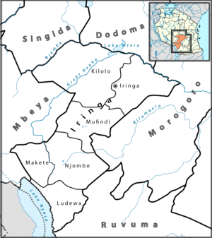 A map of the Ludewa district. | |
 Ludewa District Location of Ludewa District | |
| Coordinates: 10°00′S 34°45′E / 10.000°S 34.750°ECoordinates: 10°00′S 34°45′E / 10.000°S 34.750°E | |
| Country | Tanzania |
| Area | |
| • Water | 0 km2 (0 sq mi) |
| Population (2012) | |
| • Total | 128,155 |
| Time zone | UTC+3 (EAT) |
| Area code(s) | 026 |
| Website | www |


Ludewa District[1] is one of six districts in the Njombe Region in Tanzania, East Africa. Prior to 2012, the district was one of the seven districts of Iringa Region.[2] The town of Ludewa is the administrative seat of the district. A hospital is located in the city. The district is bordered to the north by the Njombe Rural District and Makete District, to the southeast by the Ruvuma Region and to the southwest by the country of Malawi across Lake Malawi/Lake Nyasa.

According to the 2002 Tanzania National Census, the Ludewa District had a population of 128,155.[4]
Geography[]
The district has a wide shore of Lake Nyasa with attractive beaches in Lupingu and Manda and the mouth of Ruhuhu River.
Economy[]
Farming[]
The primary occupation is subsistence farming and livestock rearing.[5]
Fishing[]
Along the coast of Lake Nyasa there is traditional fishing.[5]
Mining[]
There is a small amount of artisanal mining of gold and gem quality green tourmaline.[6]


Administrative subdivisions[]
Constituencies[]
For parliamentary elections, Tanzania is divided into constituencies. As of the 2010 elections Ludewa District had one constituency:[7]
- Ludewa Constituency
Divisions[]
Ludewa District is administratively divided into divisions.
Wards[]
As of 2002, Ludewa District was administratively divided into twenty-two wards:[4] After the reorganization where Ludewa was moved to Njombe Region in 2012, there were twenty-six wards.[8]
2002 Wards[]
Below are the 22 wards as follows:
|
|
|
2012 Wards[]
Below are the 26 wards as follows:
|
|
|
Notes[]
- ^ Ludewa District (Approved) at GEOnet Names Server, United States National Geospatial-Intelligence Agency
- ^ Staff (9 March 2012). "Tanzania: State Gazettes New Regions, Districts". Daily News. Dar es Salaam, Tanzania. Archived from the original on 23 August 2012.
- ^ http://www.mwtc.go.tz/
- ^ Jump up to: a b "2002 Population and Housing General Report: Iringa: Ludewa". Archived from the original on 18 March 2004.
- ^ Jump up to: a b http:// www.mifugouvuvi.go.tz /
- ^ "Socio-Economic Profile of Iringa Region" (PDF) (second ed.). The Planning Commission, Dar es Salaam, and The Regional Commissioner's Office, Iringa. May 2007. Archived from the original (PDF) on 13 November 2010. Retrieved 7 September 2012. (missing front cover)
- ^ "Organisations located in Ludewa District - Tanzania". African Development Information.
- ^ "Postcodes Njombe Region 59000" (PDF). Tanzania Communications Regulatory Authority (TCRA). 2012.[permanent dead link]
| show Authority control |
|---|
- Districts of Njombe Region