Lunning
| Lunning | |
|---|---|
 | |
 Lunning Location within Shetland | |
| Area | 0.18 km2 (0.069 sq mi) |
| Council area |
|
| Country | Scotland |
| Sovereign state | United Kingdom |
| Police | Scotland |
| Fire | Scottish |
| Ambulance | Scottish |


Cliffs near Lunning
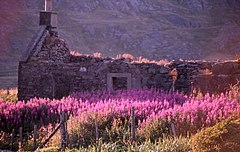
Lunning is a coastal hamlet in Mainland, Shetland Islands, Scotland, United Kingdom; the nearest settlement is Vidlin, and it is within the parish of Nesting. There is a standing stone near the settlement.[1][2][3]
References[]
- ^ "Google Earth". earth.google.com. Retrieved 2020-10-09.
- ^ "OS Maps: online mapping and walking, running and cycling routes". osmaps.ordnancesurvey.co.uk. Retrieved 2020-10-09.
- ^ "Lunning, Shetland Islands - area information, map, walks and more". Ordnance Survey Get Outside. Retrieved 2020-10-09.
This Shetland location article is a stub. You can help Wikipedia by . |
Categories:
- Hamlets in Scotland
- Villages in Mainland, Shetland
- Shetland geography stubs