Lyall Glacier
| Lyall Glacier | |
|---|---|
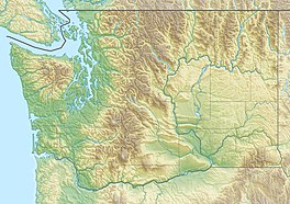 Lyall Glacier Location of the Lyall Glacier within the State of Washington | |
| Type | Mountain glacier |
| Location | Chelan County, Washington United States |
| Coordinates | 48°29′16″N 120°44′50″W / 48.48778°N 120.74722°WCoordinates: 48°29′16″N 120°44′50″W / 48.48778°N 120.74722°W[1] |
| Length | 0.20 miles (0.32 km) |
| Terminus | Talus |
| Status | Retreating |

Lyall Glacier is within the Wenatchee National Forest in Chelan County, Washington, United States, and is just southeast of Frisco Mountain.[1][2][3] It occupies the north cirque on Rainy Peak. Melt from Lyall Glacier contributes to waterfalls which tumble 1,000 ft (300 m) into Rainy Lake.
See also[]
References[]
- ^ a b "Lyall Glacier". Geographic Names Information System. United States Geological Survey.
- ^ "MyTopo Maps - Lyall Glacier, Washington, USA" (Map). mytopo.com. Trimble Navigation, Ltd. Retrieved 17 Feb 2018.
- ^ McAlester Mountain, WA (Map). TopoQwest (United States Geological Survey Maps). Retrieved May 4, 2013.
This article about a glacier in Washington is a stub. You can help Wikipedia by . |
Categories:
- Glaciers of the North Cascades
- Glaciers of Skagit County, Washington
- Glaciers of Washington (state)
- Washington (state) glacier stubs