Lyngseidet
Lyngseidet
Ivgomuotki / Yykeänmuotka | |
|---|---|
Village | |
 View of the village | |
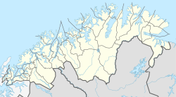
 Lyngseidet Location of the village | |
| Coordinates: 69°34′35″N 20°13′08″E / 69.5763°N 20.2188°ECoordinates: 69°34′35″N 20°13′08″E / 69.5763°N 20.2188°E | |
| Country | Norway |
| Region | Northern Norway |
| County | Troms og Finnmark |
| District | Nord-Troms |
| Municipality | Lyngen Municipality |
| Area | |
| • Total | 0.87 km2 (0.34 sq mi) |
| Elevation | 5 m (16 ft) |
| Population (2017)[1] | |
| • Total | 819 |
| • Density | 941/km2 (2,440/sq mi) |
| Time zone | UTC+01:00 (CET) |
| • Summer (DST) | UTC+02:00 (CEST) |
| Post Code | 9060 Lyngseidet |
Lyngseidet (also Northern Sami: Ivgumuotki or Kven: Yykeänmuotka) is the administrative centre of Lyngen Municipality in Troms og Finnmark county, Norway. The village is located on an isthmus that is about 3 km (1.9 mi) wide between an arm of the Ullsfjorden and the Lyngenfjorden.
The village is home to two grocery stores, Lyngen Church, nursing home, schools, daycare, pharmacy and library. A nine meter tall plastic figure Santa Claus named Gollis is also located here.[3] Lyngseidet is located 15 km (9.3 mi) north of the village of Furuflaten and 12 km (7.5 mi) by ferry from Olderdalen, in the neighboring Kåfjord Municipality. The 0.87-square-kilometre (210-acre) village has a population (2017) of 819 which gives the village a population density of 941 inhabitants per square kilometre (2,440/sq mi).[1]
References[]
- ^ Jump up to: a b c Statistisk sentralbyrå (1 January 2017). "Urban settlements. Population and area, by municipality".
- ^ "Lyngseidet, Lyngen (Troms)". yr.no. Retrieved 2018-08-07.
- ^ "Norges styggeste turistattraksjon Gollis formerer seg". 18 December 2020.
External links[]
- Villages in Troms
- Populated places of Arctic Norway
- Lyngen

