Mékambo Airport
Mékambo Airport | |||||||||||
|---|---|---|---|---|---|---|---|---|---|---|---|
| Summary | |||||||||||
| Serves | Mékambo | ||||||||||
| Elevation AMSL | 1,686 ft / 514 m | ||||||||||
| Coordinates | 0°58′40″N 13°58′05″E / 0.97778°N 13.96806°ECoordinates: 0°58′40″N 13°58′05″E / 0.97778°N 13.96806°E | ||||||||||
| Map | |||||||||||
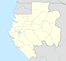 MKB Location in Gabon | |||||||||||
| Runways | |||||||||||
| |||||||||||

Mékambo Airport (IATA: FOOE, ICAO: MKB) is an airport serving the village of Mékambo in the Ogooué-Ivindo Province of Gabon.
The runway forms part of the N4 road 4 kilometres (2.5 mi) south of the village.[1]
See also[]
 Aviation portal
- List of airports in Gabon
- Transport in Gabon
References[]
- ^ a b Google Maps - Mékambo
- ^ Airport information for MKB at Great Circle Mapper.
External links[]
This article about an airport in Gabon is a stub. You can help Wikipedia by . |
Categories:
- Airports in Gabon
- Central Africa airport stubs
- Gabonese building and structure stubs