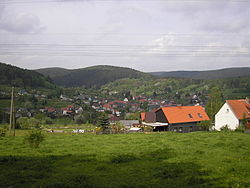
Möhrenbach
This article does not cite any sources. (July 2020) |
Möhrenbach | |
|---|---|
Ortsteil of Gehren | |
 Möhrenbach | |
 Coat of arms | |
show Location of Möhrenbach | |
 Möhrenbach | |
| Coordinates: 50°37′24″N 10°59′41″E / 50.62333°N 10.99472°ECoordinates: 50°37′24″N 10°59′41″E / 50.62333°N 10.99472°E | |
| Country | Germany |
| State | Thuringia |
| District | Ilm-Kreis |
| Municipality | Gehren |
| Area | |
| • Total | 13.86 km2 (5.35 sq mi) |
| Elevation | 540 m (1,770 ft) |
| Population (2012-12-31) | |
| • Total | 654 |
| • Density | 47/km2 (120/sq mi) |
| Time zone | UTC+01:00 (CET) |
| • Summer (DST) | UTC+02:00 (CEST) |
| Postal codes | 98708 |
| Dialling codes | 036783 |
| Vehicle registration | IK |
| Website | Möhrenbach |


Möhrenbach is a village and a former municipality in the district Ilm-Kreis, in Thuringia, Germany. Since 31 December 2013, it is part of the municipality Gehren.
References[]
| Authority control |
|---|
This Ilm-Kreis location article is a stub. You can help Wikipedia by . |
Categories:
- Former municipalities in Thuringia
- Bezirk Suhl
- Thuringia geography stubs