Maarat al-Numan District
(Redirected from )
Maarat al-Numan District
منطقة معرة النعمان | |
|---|---|
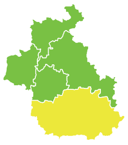 Map of Maarat al-Numan District within Idlib Governorate | |
| Coordinates (Maarat al-Numan): 35°38′N 36°40′E / 35.63°N 36.67°ECoordinates: 35°38′N 36°40′E / 35.63°N 36.67°E | |
| Country | |
| Governorate | Idlib |
| Seat | Maarat al-Numan |
| Subdistricts | 4 nawāḥī |
| Area | |
| • Total | 2,028.88 km2 (783.35 sq mi) |
| Population (2004)[1] | |
| • Total | 371,829 |
| • Density | 180/km2 (470/sq mi) |
| Geocode | SY0702 |

Maarat al-Numaan District (Arabic: منطقة معرة النعمان, romanized: manṭiqat Maʿarrat al-Nuʿmān) is a district of the Idlib Governorate in northwestern Syria. The administrative centre is the city of Maarat al-Numan. At the 2004 census, the district had a population of 371,829.[1]
Sub-districts[]
The district of Maarat al-Numaan is divided into six sub-districts or nawāḥī (population as of 2004[1]):
- Ma'arrat al-Nu'man Subdistrict (ناحية معرة النعمان): population 149,834.[2]
- Khan Shaykhun Subdistrict (ناحية خان شيخون): population 34,371.[3]
- Sinjar Subdistrict (ناحية سنجار): population 33,721.[4]
- Kafr Nabl Subdistrict (ناحية كفر نبل): population 67,460.[5]
- Al-Tamanah Subdistrict (ناحية التمانعة): population 29,114.[6]
- Hish Subdistrict (ناحية حيش): population 41,231.[7]
References[]
- ^ a b c "2004 Census Data". UN OCHA. Retrieved 15 October 2015.
- ^ "Maarrat al-Nu'man nahiyah population". Cbssyr.org. Archived from the original on 2013-02-06. Retrieved 2012-06-20.
- ^ "Khan Shaykhun nahiyah population". Cbssyr.org. Archived from the original on 2013-02-06. Retrieved 2012-06-20.
- ^ "Sinjar nahiyah population". Cbssyr.org. Archived from the original on 2013-02-06. Retrieved 2012-06-20.
- ^ "Kafr Nabl nahiyah population". Cbssyr.org. Archived from the original on 2013-02-06. Retrieved 2012-06-20.
- ^ "Taman'a nahiyah population". Cbssyr.org. Archived from the original on 2013-02-06. Retrieved 2012-06-20.
- ^ "Hish nahiyah population". Cbssyr.org. Archived from the original on 2013-02-06. Retrieved 2012-06-20.
External links[]
 Media related to Maarrat al-Nu'man District at Wikimedia Commons
This article about a location in Idlib Governorate, Syria is a stub. You can help Wikipedia by . |
Categories:
- Maarat al-Numan District
- Districts of Idlib Governorate
- Syria geography stubs