Mañagaha
Mañagaha Island Historic District | |
 Mañagaha | |
| Nearest city | Garapan, Saipan |
|---|---|
| Area | 100 acres (40 ha) |
| NRHP reference No. | 84000425[1] |
| Added to NRHP | November 5, 1984 |
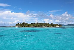
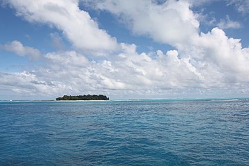
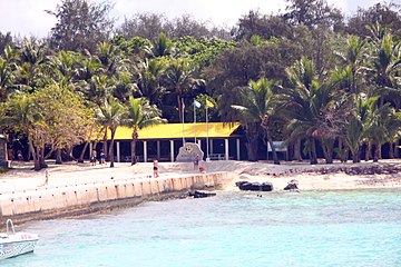
Mañagaha is a small islet which lies off the west coast of Saipan within its lagoon in the Northern Mariana Islands. Although it has no permanent residents, Mañagaha is popular among Saipan's tourists as a day-trip destination due to its wide sandy beaches and a number of marine activities including snorkeling, parasailing and jet skiing.
Mañagaha hosts a colony of breeding Wedge-tailed Shearwaters. This seabird nests in burrows principally on the east side of the island.
The island is historically significant for several reasons. It is the burial ground of the famous Carolinian Chief Aghurubw, who is said to have established the first Carolinian settlement in Saipan in 1815. A statue of the chief commemorates his achievements in leading his people from Satawal after a devastating typhoon to Saipan.[2] The island also has remnants of Japanese fortifications from World War II.[3] The entire island is listed on the United States National Register of Historic Places as a historic district.
Gallery[]


See also[]
References[]
- ^ "National Register Information System". National Register of Historic Places. National Park Service. July 9, 2010.
- ^ Flood, Bo (January 2001). Marianas Island Legends: Myth and Magic. Bess Press. pp. viii, 90–92. ISBN 978-1-57306-101-8.
- ^ "NRHP nomination for Managaha Island Historic District". National Park Service. Retrieved April 16, 2015.
| Wikimedia Commons has media related to Mañagaha Island. |
Coordinates: 15°14′29″N 145°42′46″E / 15.2414°N 145.7127°E

Saipan (capital) | |||||||
| Topics | |||||||
| Geography |
| ||||||
| Municipalities | |||||||
| Settlements |
| ||||||
| Education |
| ||||||
| Transportation | |||||||
| Landmarks | |||||||
| Media |
| ||||||
| Museums and History | |||||||
| Topics |  | ||||||||
|---|---|---|---|---|---|---|---|---|---|
| Lists by municipality |
| ||||||||
| Other lists |
| ||||||||
| |||||||||
This Northern Marianas location article is a stub. You can help Wikipedia by . |
- Uninhabited islands of the Northern Mariana Islands
- Saipan
- National Register of Historic Places in the Northern Mariana Islands
- Islands of the Northern Mariana Islands
- Northern Mariana Islands stubs
- Oceania geography stubs