Mała Słońca
Mała Słońca | |
|---|---|
Village | |
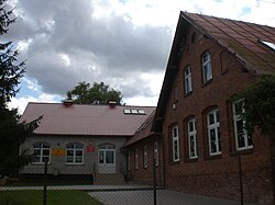 School in Mała Słońca | |
 Mała Słońca | |
| Coordinates: 54°0′14″N 18°49′44″E / 54.00389°N 18.82889°E | |
| Country | |
| Voivodeship | Pomeranian |
| County | Tczew |
| Gmina | Subkowy |
| Population | 274 |
| Time zone | UTC+1 (CET) |
| • Summer (DST) | UTC+2 (CEST) |


Mała Słońca [ˈmawa ˈswɔɲt͡sa] (German: Klein Schlanz) is a village in the administrative district of Gmina Subkowy, within Tczew County, Pomeranian Voivodeship, in northern Poland.[1] It lies approximately 4 kilometres (2 mi) east of Subkowy, 13 km (8 mi) south-east of Tczew, and 43 km (27 mi) south of the regional capital Gdańsk. It is located within the ethnocultural region of Kociewie in the historic region of Pomerania.
The village has a population of 274.
Mała Słońca was a royal village of the Polish Crown, administratively located in the Tczew County in the Pomeranian Voivodeship.[2]
References[]
- ^ "Central Statistical Office (GUS) - TERYT (National Register of Territorial Land Apportionment Journal)" (in Polish). 2008-06-01.
- ^ Marian Biskup, Andrzej Tomczak, Mapy województwa pomorskiego w drugiej połowie XVI w., Toruń, 1955, p. 113 (in Polish)
| hide | ||
|---|---|---|
| Seat |  | |
| Other villages | ||
Coordinates: 54°0′14″N 18°49′44″E / 54.00389°N 18.82889°E
This Tczew County location article is a stub. You can help Wikipedia by . |
Categories:
- Villages in Tczew County
- Tczew County geography stubs